Table of Contents
Introduction
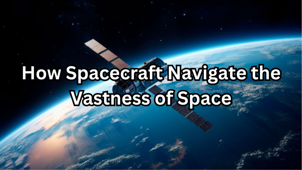
Spacecraft Navigate the Vastness of Space, space exploration represents one of humanity’s most ambitious and complex endeavors. As we venture into the vast and uncharted realms beyond our planet, precise navigation becomes crucial for the success and safety of missions. Unlike travel on Earth, where familiar landmarks and terrestrial coordinates guide us, space navigation requires sophisticated techniques and technologies to chart courses through an environment that is both expansive and dynamic. This article delves into the fascinating world of spacecraft navigation, exploring the methods and technologies that enable spacecraft to traverse the boundless reaches of space with remarkable accuracy.
Overview of Space Navigation
Space navigation involves determining the position and trajectory of spacecraft as they travel through space. Unlike navigation on Earth, where the surface is relatively fixed and predictable, space navigation must account for the movement of celestial bodies, gravitational forces, and other dynamic factors. The core elements of space navigation include trajectory planning, position determination, course correction, and the use of various navigation systems, such as inertial navigation systems, star trackers, and radio signals. These components work together to ensure that spacecraft can travel through the spacecraft navigate the vastness of space with precision.
Importance of Accurate Spacecraft Navigate the Vastness of Space
Accurate navigation is fundamental to the success of space missions for several reasons. It ensures mission success by enabling spacecraft to reach their intended destinations, even when traveling vast distances. Safety is another critical aspect, as precise navigation minimizes the risk of collisions with space debris, other spacecraft, or celestial bodies. Additionally, accurate navigation optimizes resource usage, such as fuel and time, which are often limited in space missions. For scientific missions, it allows for the precise collection of data and reliable experimentation. Furthermore, maintaining accurate navigation ensures stable communication with ground stations, which is essential for command reception and data transmission. Overall, accurate space navigation is essential for achieving mission objectives, ensuring safety, and maximizing resource efficiency.
Fundamentals of Space Navigation
Understanding Space
Space, the seemingly infinite expanse that exists beyond Earth’s atmosphere, presents a unique and challenging environment for exploration. Unlike the familiar and bounded terrestrial world, space is characterized by its boundlessness, extreme conditions, and the absence of a solid reference frame. This vast expanse is not empty but is filled with a variety of celestial objects, including stars, planets, moons, asteroids, and comets. Understanding space requires grasping how these celestial bodies interact with each other and how their positions and movements can be predicted and navigated. The study of space involves exploring its physical properties, the behavior of objects within it, and the fundamental forces that govern their interactions.
The Spacecraft Navigate the Vastness of Space
The sheer scale of space is almost beyond human comprehension. Our solar system alone spans billions of kilometers, with planets orbiting the Sun at distances ranging from the relatively close proximity of Mercury to the vast distance of Neptune. Beyond our solar system, space stretches even further, containing billions of galaxies, each with countless stars and planetary systems. This vastness presents both opportunities and challenges for space exploration. The distances involved mean that travel and communication require precise planning and advanced technology. The enormity of space also implies that missions must be meticulously calculated to ensure that spacecraft reach their destinations efficiently and accurately.
Key Concepts: Orbits, Trajectories, and Gravity
Understanding space navigation relies on grasping key concepts such as orbits, trajectories, and gravity. Orbits refer to the curved paths that objects follow around a more massive body, like the Earth orbiting the Sun or a satellite orbiting Earth. These paths are determined by gravitational forces and the initial velocity of the orbiting object. Trajectories describe the path that a spacecraft follows through space, which can be influenced by gravitational pulls from various celestial bodies. Gravity, the force of attraction between masses, is fundamental to these concepts. It governs the motion of celestial bodies and affects the trajectories of spacecraft, requiring careful calculations to ensure successful navigation.
Basics of Celestial Mechanics
Celestial mechanics is the branch of astronomy that deals with the motions of celestial objects and the forces that influence their movement. It provides the mathematical framework for understanding how objects such as planets, moons, and asteroids move and interact in space. Celestial mechanics applies Newtonian physics to model and predict the positions and trajectories of these objects. It encompasses concepts such as orbital mechanics, which studies how bodies orbit each other, and perturbation theory, which deals with the deviations from ideal orbital paths caused by gravitational influences of other bodies.
Newton’s Laws of Motion
Newton’s laws of motion form the foundation of classical mechanics and are crucial for understanding the motion of objects in space. The first law, also known as the law of inertia, states that an object will remain at rest or continue moving in a straight line at constant speed unless acted upon by an external force. The second law quantifies this relationship with the equation F=maF = maF=ma, where force equals mass times acceleration, highlighting how forces cause changes in motion. The third law states that for every action, there is an equal and opposite reaction, which explains how propulsion systems in spacecraft work. These laws are essential for predicting and controlling the movement of spacecraft as they navigate through space.
Kepler’s Laws of Planetary Motion
Kepler’s laws of planetary motion describe the orbits of planets around the Sun and are fundamental to celestial mechanics. The first law, or the law of ellipses, states that planets orbit the Sun in elliptical paths, with the Sun at one focus of the ellipse. The second law, known as the law of equal areas, indicates that a line segment joining a planet and the Sun sweeps out equal areas during equal intervals of time, meaning that a planet moves faster when it is closer to the Sun and slower when it is farther away. The third law, or the law of harmonies, states that the square of a planet’s orbital period is directly proportional to the cube of its average distance from the Sun. These laws provide a precise description of planetary motion and are integral to understanding and predicting orbital paths.
Historical Development of Space Navigation
Early Methods of Navigation
Early methods of navigation laid the groundwork for the sophisticated techniques used in modern space exploration. Ancient navigators relied on observable celestial bodies and landmarks to determine their positions and chart their courses. Techniques varied by culture but generally included the use of the stars, the sun, and natural features on Earth. Mariners and explorers developed methods for celestial navigation, which involved measuring the angles between celestial objects and the horizon to determine latitude and longitude. These early navigational techniques, while rudimentary by today’s standards, were crucial for successful exploration and trade long before the advent of modern technology.
Ancient Techniques
Ancient techniques of navigation were fundamentally based on the observation of the natural environment. Early seafarers, such as those from ancient civilizations like the Greeks, Egyptians, and Polynesians, used the stars to guide their journeys. The Greeks, for example, used the position of constellations and the North Star to determine direction. Polynesians mastered the art of navigating the vast Pacific Ocean by observing star patterns, ocean swells, and bird migrations. Similarly, ancient sailors in the Mediterranean used the sun’s position and the stars to plot their courses across the sea. These techniques required keen observational skills and an understanding of celestial patterns, which were crucial for long-distance travel and exploration.
Evolution to Modern Space Navigation
The evolution from ancient navigation methods to modern space navigation represents a significant leap in technology and complexity. With the advent of the space age, the principles of celestial navigation were adapted to account for the unique challenges of space travel. Early space missions relied on basic inertial navigation systems and ground-based tracking to determine spacecraft positions and trajectories. As technology advanced, more sophisticated systems such as radar, star trackers, and onboard computers were developed. These innovations allowed for precise control of spacecraft trajectories, real-time adjustments, and enhanced mission planning, marking a profound shift from the observational techniques of the past to the high-tech methods used in contemporary space exploration.
Key Milestones in Space Navigation History
Key milestones in space navigation history highlight the rapid progress from the early days of space exploration to the sophisticated systems used today. One of the first significant milestones was the launch of Sputnik 1 in 1957, which marked the beginning of the space age and introduced the concept of satellite-based tracking. The 1960s saw further advancements with the launch of the first communication satellites and the development of ground-based tracking stations. The Apollo missions of the 1960s and 1970s demonstrated the capabilities of advanced navigation systems through successful lunar landings and complex maneuvers. More recent milestones include the deployment of GPS satellites and the use of autonomous navigation systems for deep space missions, reflecting ongoing innovations in the field.
Sputnik and Early Satellites
The launch of Sputnik 1 by the Soviet Union in 1957 was a groundbreaking achievement in space navigation and marked the beginning of the space age. Sputnik 1 was the first artificial satellite to orbit the Earth, and its successful launch demonstrated the feasibility of space-based technology for tracking and communication. The early satellites, including Sputnik 2, which carried the first living creature into space, paved the way for future space missions and the development of satellite-based navigation systems. These early satellites provided crucial data for understanding orbital mechanics and led to the establishment of global tracking networks that would become integral to modern space navigation.
Apollo Missions and Lunar Navigation
The Apollo missions of the 1960s and 1970s were a major leap forward in space navigation, showcasing advanced techniques and technologies for lunar exploration. Apollo 11, the first mission to land humans on the Moon, relied on a combination of ground-based tracking, onboard inertial navigation systems, and precise trajectory calculations. The mission’s success depended on accurate navigation to ensure the spacecraft’s safe travel from Earth to lunar orbit and the subsequent landing on the lunar surface. The Apollo program also introduced innovative technologies such as the Lunar Module’s guidance systems, which allowed for precise lunar landings and provided valuable experience for future space missions. These milestones in lunar navigation not only demonstrated the capabilities of contemporary navigation systems but also set the stage for future exploration and technological advancements in space technology.
Modern Space Navigation Techniques
Inertial Navigation Systems (INS)
Inertial Navigation Systems (INS) are essential technologies used for determining the position and velocity of a spacecraft by measuring its acceleration and rotational rates. INS operates based on the principles of inertia and does not rely on external references, making it crucial for navigation in environments where GPS signals are unavailable, such as deep space. The system uses accelerometers to measure linear acceleration and gyroscopes to measure angular rotation. By integrating these measurements over time, INS can calculate the spacecraft’s current position and velocity with high accuracy.
Principles of INS
The core principle of an Inertial Navigation System is to measure the changes in velocity and orientation of a spacecraft. Accelerometers detect linear acceleration along the spacecraft’s axes, while gyroscopes measure rotational rates. These measurements are then processed using mathematical algorithms to compute the spacecraft’s trajectory. The INS operates based on Newton’s laws of motion, where the integration of acceleration data provides velocity, and further integration yields position. This method allows INS to track movement in three-dimensional space accurately, despite the lack of external reference points.
Applications in Spacecraft
Inertial Navigation Systems are widely used in spacecraft for various applications. They are integral to trajectory planning and control, ensuring that spacecraft follow the intended path throughout their mission. INS is crucial during the initial phases of spaceflight, where it helps establish the spacecraft’s position relative to Earth and other celestial bodies. During interplanetary missions, INS provides continuous navigation updates, allowing for precise course corrections and adjustments. Its ability to function independently of external signals makes INS especially valuable for deep-space exploration, where traditional navigation aids are not available.
Star Trackers and Celestial Navigation
Star trackers are advanced devices used in space navigation to determine a spacecraft’s orientation and position by observing the positions of stars. These devices play a critical role in celestial navigation, enabling spacecraft to achieve high-precision tracking and control. By comparing the observed positions of stars with a preloaded star catalog, star trackers can provide accurate data on the spacecraft’s attitude and alignment. This method of navigation leverages the stability and predictability of star positions to maintain precise orientation and course throughout space missions.
Functionality of Star Trackers
Star trackers function by capturing images of the night sky and identifying the positions of stars using optical sensors. The system compares these observations with an onboard star catalog, which contains data about star positions and characteristics. By matching observed star positions to those in the catalog, star trackers can determine the spacecraft’s orientation with high accuracy. This information is used to correct and maintain the spacecraft’s attitude, ensuring proper alignment for scientific observations, communication, and maneuvering. Star trackers are essential for spacecraft operating far from Earth, where traditional navigation aids are not available.
Using Stars for Accurate Positioning
Stars have been used for navigation for centuries due to their fixed positions and predictable movements. In modern space navigation, this principle is applied through star trackers, which utilize the stable positions of stars to provide precise orientation data. By analyzing the angular positions of stars relative to the spacecraft, star trackers can determine its attitude with exceptional accuracy. This method is particularly valuable for spacecraft in deep space, where other navigation aids are not accessible. Accurate positioning using stars ensures that spacecraft can maintain correct alignment for scientific experiments, communication, and course corrections.
Radio Navigation
Radio navigation involves using radio signals to determine the position and trajectory of spacecraft. This method relies on transmitting and receiving radio waves to measure distances and velocities accurately. Radio navigation is crucial for space missions, providing continuous tracking and communication capabilities across vast distances. It encompasses various techniques, including Doppler radar and the Deep Space Network (DSN), which are integral to managing and controlling spacecraft operations.
Doppler Radar
Doppler radar is a radio navigation technique used to measure the speed and direction of a spacecraft relative to Earth. By analyzing the frequency shift of radio signals transmitted from a spacecraft and received by ground stations, Doppler radar can determine the spacecraft’s velocity along the line of sight. This method is based on the Doppler effect, where the frequency of the signal changes depending on the relative motion between the spacecraft and the receiver. Doppler radar provides critical data for tracking spacecraft trajectories, enabling precise adjustments and course corrections during missions.
Deep Space Network (DSN)
The Deep Space Network (DSN) is a global network of ground-based radio antennas used for tracking and communicating with spacecraft beyond Earth’s orbit. Managed by NASA, the DSN consists of three major complexes located in California, Spain, and Australia, positioned approximately 120 degrees apart around the globe. This strategic placement ensures continuous communication with spacecraft regardless of their location in space. The DSN provides essential support for tracking spacecraft, receiving scientific data, and sending commands, making it a vital component of modern space exploration and navigation.
Advanced Navigation Technologies
Global Navigation Satellite Systems (GNSS)
Global Navigation Satellite Systems (GNSS) are satellite-based systems used to provide precise location and timing information anywhere on Earth. GNSS relies on a constellation of satellites orbiting the planet, which transmit signals that are received by GNSS receivers on the ground or in space. By calculating the time it takes for the signals to travel from the satellites to the receiver, GNSS can determine the exact position of the receiver. These systems play a crucial role in various applications, including navigation, mapping, and timing, and are integral to both terrestrial and space-based operations.
Overview of GNSS
Global Navigation Satellite Systems (GNSS) consist of multiple satellite constellations designed to provide accurate and reliable positioning data worldwide. The key GNSS systems include the United States’ Global Positioning System (GPS), Russia’s GLONASS, the European Union’s Galileo, and China’s BeiDou. Each system operates independently but can complement one another to enhance accuracy and reliability. GNSS receivers use signals from multiple satellites to calculate precise location data, making these systems essential for navigation, surveying, and timing applications. The combination of these systems offers global coverage and improves the accuracy and robustness of navigation solutions.
Role of GPS, GLONASS, and Galileo in Space Navigation
GPS, GLONASS, and Galileo each contribute significantly to space navigation by providing accurate positioning and timing data. GPS, operated by the United States, is the most widely used GNSS and provides global coverage with a high level of accuracy. GLONASS, managed by Russia, complements GPS and offers additional coverage, particularly in high-latitude regions. Galileo, developed by the European Union, provides enhanced accuracy and reliability with its advanced technology and additional features. Together, these systems offer robust and redundant navigation capabilities, essential for spacecraft operations, satellite tracking, and mission planning. Their integration allows for improved precision and reliability in space navigation, ensuring accurate trajectory and positioning for spacecraft.
Autonomous Navigation Systems
Autonomous Navigation Systems use advanced technologies to enable spacecraft to navigate independently without constant input from ground control. These systems rely on a combination of sensors, algorithms, and artificial intelligence (AI) to make real-time navigation decisions. Autonomous systems can analyze data from various sources, such as star trackers, inertial sensors, and onboard cameras, to determine the spacecraft’s position and orientation. They can perform tasks such as trajectory adjustments, obstacle avoidance, and mission planning autonomously, making them essential for deep space exploration where communication delays with Earth are significant.
AI and Machine Learning in Spacecraft Navigation
Artificial Intelligence (AI) and Machine Learning (ML) are increasingly used in spacecraft navigation to enhance autonomous capabilities and decision-making processes. AI algorithms can analyze vast amounts of data from onboard sensors and external sources to make real-time navigation decisions. Machine Learning models can be trained to predict spacecraft behavior, optimize trajectories, and adapt to changing conditions. These technologies enable spacecraft to perform complex tasks such as autonomous docking, collision avoidance, and adaptive navigation strategies, significantly improving mission efficiency and success. AI and ML are particularly valuable for deep space missions where human oversight is limited and communication delays are substantial.
Autonomous Systems for Deep Space Missions
Autonomous systems are crucial for deep space missions due to the long communication delays between spacecraft and Earth. These systems allow spacecraft to operate independently, make real-time decisions, and adapt to unforeseen circumstances without waiting for instructions from ground control. Autonomous navigation involves using onboard sensors and AI algorithms to monitor the spacecraft’s environment, calculate its position, and execute maneuvers. This capability is essential for missions to distant planets, asteroids, or other celestial bodies where timely responses and adjustments are critical. Autonomous systems enable spacecraft to conduct complex operations, such as landing on other planets or navigating through asteroid belts, with minimal intervention from Earth-based teams.
Optical Navigation
Optical Navigation involves using visual data from cameras or other imaging devices to determine the position and orientation of a spacecraft. This method leverages images of celestial bodies, such as stars or planets, to provide accurate navigation information. Optical navigation systems capture high-resolution images and analyze the positions and movements of these celestial objects relative to the spacecraft. By comparing this data with preloaded star catalogs or models, the system can calculate the spacecraft’s orientation and trajectory with high precision. Optical navigation is particularly valuable for deep space missions, where traditional navigation methods may be less effective.
Visual-Based Systems
Visual-Based Systems in space navigation use cameras and imaging technology to provide real-time data on the spacecraft’s surroundings. These systems capture images of celestial objects or surface features and process them to determine the spacecraft’s position and orientation. Visual-based systems can include star trackers, spaceborne cameras, and imaging sensors. They are used for various applications, including attitude determination, landing site selection, and navigation through asteroid belts. By analyzing visual data, these systems enable precise navigation and maneuvering, enhancing the spacecraft’s ability to operate autonomously and perform complex tasks.
Advantages and Challenges
Visual-based navigation systems offer several advantages, including high precision, the ability to operate in various lighting conditions, and the capability to detect and avoid obstacles. They provide valuable data for accurate positioning and orientation, essential for complex space missions. However, these systems also face challenges, such as sensitivity to light conditions and the need for high-resolution imaging to achieve accurate results. Additionally, processing large amounts of visual data in real-time can be computationally intensive, requiring advanced algorithms and processing power. Despite these challenges, visual-based systems are a powerful tool in modern space navigation, providing critical support for autonomous operations and precise maneuvering.
Spacecraft Guidance and Control Systems
Attitude Control Systems
Attitude Control Systems are essential for maintaining and adjusting the orientation of a spacecraft in space. These systems ensure that a spacecraft’s instruments and sensors are correctly aligned for scientific observations, communications, and navigation. Attitude control involves adjusting the spacecraft’s orientation relative to a reference frame, which can be Earth, the Sun, or distant celestial objects. Accurate attitude control is crucial for mission success, as it affects data collection, communication links, and the overall trajectory of the spacecraft.
Importance of Attitude Control
Attitude control is vital for several reasons. First, it ensures that scientific instruments and sensors are correctly oriented to collect accurate data. For communication, precise attitude control aligns antennas with ground stations or other spacecraft, maintaining strong and reliable communication links. Additionally, accurate attitude control is essential for navigating and maneuvering spacecraft, as it influences the trajectory and stability of the spacecraft. Without effective attitude control, a spacecraft could suffer from misalignment issues, leading to mission failures or compromised data quality.
Reaction Wheels and Control Moment Gyroscopes
Reaction wheels and Control Moment Gyroscopes (CMGs) are key components used in spacecraft attitude control systems. Reaction wheels are spinning wheels mounted on the spacecraft that create torques to change its orientation. By adjusting the speed and direction of these wheels, the spacecraft can be rotated along different axes. Control Moment Gyroscopes operate on similar principles but use spinning masses to generate torques. CMGs provide higher control authority and are often used for more precise attitude adjustments. Both systems allow for fine control over spacecraft orientation, enabling stable and accurate positioning.
Thrusters and Propulsion Systems
Thrusters and propulsion systems play a crucial role in spacecraft maneuvering and course correction. Thrusters use the expulsion of propellant to generate thrust, which can be used to change the spacecraft’s velocity and direction. They are essential for adjusting the spacecraft’s trajectory, performing orbital insertion, and executing complex maneuvers. Propulsion systems can vary widely, from chemical rockets to electric propulsion, each offering different advantages depending on the mission requirements. Effective propulsion is critical for achieving mission objectives, whether for orbit insertion, deep space travel, or precise landings.
Types of Propulsion Systems
There are several types of propulsion systems used in space missions, each suited to different mission profiles. Chemical propulsion systems use the combustion of chemical propellants to produce thrust, offering high thrust-to-weight ratios and quick maneuvering capabilities. Electric propulsion systems, such as ion thrusters, use electric fields to accelerate ions, providing high efficiency and prolonged thrust but at lower thrust levels. Hybrid systems combine elements of both chemical and electric propulsion to balance thrust and efficiency. Each type of propulsion system has its specific applications, advantages, and limitations, influencing its selection based on mission goals and requirements.
Role in Maneuvering and Course Correction
Propulsion systems are fundamental for spacecraft maneuvering and course correction. They allow spacecraft to adjust their orbits, perform orbital transfers, and make trajectory changes necessary for mission success. Thrusters provide the necessary force to execute these maneuvers, whether for fine adjustments or significant course changes. Propulsion systems also enable spacecraft to maintain their correct trajectories during extended missions, including deep space travel and planetary exploration. By providing the means to control velocity and direction, propulsion systems ensure that spacecraft can reach their intended destinations, avoid obstacles, and perform mission-critical tasks effectively.
Mission Planning and Execution
Pre-Launch Navigation Planning
Pre-launch navigation planning is a critical phase in the preparation of a space mission, involving detailed analysis and strategy to ensure successful navigation and mission execution. This process begins with defining mission objectives and designing the spacecraft’s trajectory to achieve those goals. Mission planners use sophisticated modeling and simulation tools to calculate the spacecraft’s path, taking into account factors such as gravitational forces, orbital mechanics, and mission constraints. This phase includes determining the optimal launch window, trajectory adjustments, and required propulsion maneuvers. Accurate pre-launch planning is essential to minimize risks, optimize mission outcomes, and ensure that the spacecraft reaches its intended destination efficiently.
Mission Design and Navigation Strategy
Mission design and navigation strategy encompass the comprehensive planning and execution required to achieve the objectives of a space mission. This involves creating a detailed mission plan that includes spacecraft design, trajectory planning, and navigation tactics. Designers and engineers develop navigation strategies to handle the complexities of space travel, such as orbital insertions, transfers between celestial bodies, and rendezvous operations. The strategy includes selecting appropriate propulsion systems, designing attitude control systems, and planning for contingencies. A well-defined navigation strategy ensures that the spacecraft can maintain its intended path, perform necessary adjustments, and achieve mission success.
Simulation and Testing
Simulation and testing are essential components of mission preparation, allowing engineers to validate navigation strategies and systems before launch. Through simulations, mission planners can model spacecraft behavior under various conditions and test the effectiveness of different navigation strategies. These simulations help identify potential issues, optimize system performance, and refine mission plans. Testing involves both hardware-in-the-loop (HIL) and software-in-the-loop (SIL) approaches to ensure that all systems perform as expected. By rigorously simulating and testing navigation systems, engineers can reduce the risk of mission failure and enhance the reliability and accuracy of spacecraft operations.
Real-Time Navigation and Adjustments
Real-time navigation and adjustments are crucial for maintaining spacecraft trajectory and orientation during the mission. Once in space, spacecraft rely on onboard navigation systems to continuously monitor their position and velocity. These systems use data from sensors, such as star trackers and inertial measurement units, to make real-time adjustments as needed. Any deviations from the planned trajectory are detected and corrected through automatic or manual adjustments. Real-time navigation ensures that the spacecraft remains on course, performs required maneuvers, and achieves mission objectives despite any unforeseen changes in space conditions or mission parameters.
Mid-Course Corrections
Mid-course corrections are adjustments made to a spacecraft’s trajectory during the mission to ensure it remains on the correct path. These corrections are typically performed at predetermined points or in response to observed deviations from the planned trajectory. Mid-course corrections involve firing thrusters or adjusting propulsion systems to alter the spacecraft’s velocity and direction. These maneuvers are crucial for ensuring that the spacecraft reaches its intended destination, whether it is a specific orbit, planetary surface, or rendezvous point. Accurate mid-course corrections are essential for mission success, particularly for complex missions involving long-duration space travel or precise landing operations.
Monitoring and Control from Ground Stations
Monitoring and control from ground stations involve overseeing and managing spacecraft operations from Earth-based facilities. Ground stations are equipped with advanced tracking and communication systems that provide continuous monitoring of spacecraft status, including its position, velocity, and system health. Ground controllers use this data to make real-time decisions, issue commands, and perform remote adjustments. They also monitor for any anomalies or issues that may arise during the mission. Effective monitoring and control are critical for ensuring the spacecraft’s success, as ground stations provide the necessary support for navigation, maneuvering, and overall mission management.
Challenges in Space Navigation
Dealing with Gravitational Forces
Dealing with gravitational forces is a fundamental aspect of spacecraft navigation, as gravity significantly influences a spacecraft’s trajectory and motion in space. Spacecraft must account for the gravitational pull of celestial bodies, including planets, moons, and stars, which can alter their paths. This requires precise calculations and adjustments to maintain or achieve the desired trajectory. Navigational systems use models of gravitational forces to predict and counteract their effects. By carefully planning maneuvers and utilizing gravitational forces to their advantage, such as through gravity assists, spacecraft can optimize their trajectories and conserve fuel, enhancing mission efficiency and success.
Gravity Assists and Slingshot Maneuvers
Gravity assists, or slingshot maneuvers, are techniques used to increase a spacecraft’s speed and alter its trajectory by passing close to a celestial body. This maneuver leverages the gravitational pull of the body to accelerate the spacecraft, effectively “slingshotting” it onto a new path with higher velocity. By carefully timing and positioning these maneuvers, mission planners can achieve significant changes in velocity and direction without expending additional propellant. Gravity assists are especially useful for interplanetary missions, allowing spacecraft to reach distant targets more efficiently. They require precise calculations and timing to ensure that the spacecraft benefits from the gravitational interaction while avoiding potential collisions or orbital instabilities.
Managing Gravitational Perturbations
Managing gravitational perturbations involves addressing the small but significant variations in a spacecraft’s trajectory caused by the gravitational influence of nearby celestial bodies. These perturbations can result from factors such as the presence of multiple gravitational sources, orbital resonances, or variations in the mass distribution of a planet or moon. To manage these perturbations, spacecraft navigation systems continuously monitor and adjust the spacecraft’s trajectory. Predictive models and real-time data help mission controllers anticipate and compensate for these effects, ensuring that the spacecraft remains on its intended path. Effective management of gravitational perturbations is essential for maintaining accurate navigation and achieving mission objectives.
Navigating Through Space Debris
Navigating through space debris presents significant challenges due to the increasing density of debris in Earth’s orbit. Space debris, including defunct satellites, spent rocket stages, and fragments from collisions, poses a risk of collision with operational spacecraft. To navigate safely, spacecraft employ strategies to detect, track, and avoid debris. This involves using onboard sensors and ground-based tracking systems to monitor debris trajectories and predict potential collisions. Spacecraft may perform avoidance maneuvers to change their orbits and avoid debris, ensuring mission safety and continuity. Effective navigation through space debris is crucial for preventing damage and maintaining the integrity of spacecraft and their missions.
Risks Posed by Space Debris
Space debris poses significant risks to spacecraft due to its high velocity and potential for causing severe damage upon impact. Debris can range from small fragments to large defunct satellites, all of which travel at speeds that can exceed 10 kilometers per second. Even tiny particles can cause substantial damage due to their high kinetic energy. Collisions with space debris can compromise spacecraft integrity, damage critical systems, and jeopardize mission success. The increasing accumulation of debris exacerbates these risks, making it essential for spacecraft to employ effective strategies for detecting and avoiding potential collisions.
Strategies for Safe Navigation
Strategies for safe navigation through space debris involve a combination of detection, tracking, and avoidance measures. Spacecraft are equipped with sensors and systems to detect and track debris in real-time, allowing for early warning and timely response. Ground-based tracking systems, such as radar and optical telescopes, provide additional data on debris trajectories. When a potential collision is detected, spacecraft can execute avoidance maneuvers to alter their orbits and steer clear of debris. These maneuvers are planned based on predictive models and real-time data to ensure they are effective and minimize mission disruption. Implementing robust strategies for space debris management is critical for maintaining spacecraft safety and mission success.
Communication Delays and Signal Accuracy
Communication delays and signal accuracy are important considerations in space missions, particularly for spacecraft operating far from Earth. Signal latency, or the time it takes for a signal to travel between the spacecraft and ground stations, can vary depending on the distance between them. This delay can impact real-time command and control, data transmission, and the ability to respond quickly to changes or anomalies. Ensuring accurate data transmission despite these delays requires careful planning and the use of advanced communication protocols. Redundant systems and error-correction techniques help maintain data integrity and reliability, even in the presence of significant communication delays.
Impact of Signal Latency
Signal latency affects the ability to communicate and control spacecraft, especially for deep space missions where distances are vast. The time it takes for signals to travel between Earth and the spacecraft can lead to delays in command execution and data receipt. This latency can impact real-time operations, such as maneuvering, scientific observations, and system diagnostics. Mission planners must account for signal latency when designing communication protocols and scheduling command sequences. By understanding and mitigating the effects of latency, mission teams can ensure more reliable operations and maintain effective control over spacecraft activities.
Ensuring Accurate Data Transmission
Ensuring accurate data transmission involves implementing robust communication protocols and technologies to maintain data integrity despite potential challenges such as signal degradation and interference. Techniques such as error correction codes, data redundancy, and signal encryption are used to verify and protect transmitted data. Communication systems are designed to handle various conditions, including signal loss and interference, by using redundant channels and error-checking mechanisms. By employing these strategies, spacecraft and ground stations can ensure that critical data is transmitted accurately and reliably, supporting mission success and operational efficiency.
Future of Space Navigation
Emerging Technologies
Future of Spacecraft, Emerging technologies are continually advancing the field of spacecraft navigation, introducing new methods and systems to enhance precision, efficiency, and autonomy. These innovations aim to address the challenges of deep space exploration and improve mission capabilities. Technologies such as quantum navigation, hybrid systems, and next-generation sensors are at the forefront of this evolution, offering promising solutions for more accurate and reliable navigation. As these technologies develop, they have the potential to transform how spacecraft navigate and operate in space, enabling more complex missions and extending the boundaries of space exploration.
Quantum Navigation
Quantum navigation is an emerging technology that leverages the principles of quantum mechanics to achieve highly precise measurements of position and velocity. Unlike classical navigation systems, which rely on traditional sensors and algorithms, quantum navigation uses quantum entanglement and superposition to measure gravitational fields and accelerations with unprecedented accuracy. Quantum sensors, such as atom interferometers, can detect minute changes in gravitational forces and velocity, providing highly accurate navigation data. This technology holds promise for improving navigation in deep space, where traditional methods may be less effective due to the vast distances and complex gravitational environments.
Hybrid Navigation Systems
Hybrid navigation systems combine multiple navigation technologies to enhance overall performance and reliability. By integrating different methods, such as optical, inertial, and radio-based navigation, hybrid systems can provide more accurate and robust solutions for spacecraft navigation. For example, combining star trackers with inertial measurement units (IMUs) can improve orientation accuracy and reduce the effects of sensor drift. Hybrid systems also allow for redundancy, as different navigation methods can complement each other and provide backup in case one system fails. This approach enhances the spacecraft’s ability to navigate effectively across various mission scenarios and environments.
Innovations on the Horizon
Innovations on the horizon for spacecraft navigation include advancements in sensor technologies, artificial intelligence, and integration of new data sources. Next-generation sensors, such as high-resolution star trackers and advanced optical systems, promise improved accuracy and reliability. Additionally, advancements in AI algorithms are enabling more sophisticated autonomous navigation systems capable of real-time decision-making and adaptive responses to dynamic space environments. Innovations in quantum technologies and hybrid systems are also expected to contribute to more precise and efficient navigation solutions. These emerging technologies will play a crucial role in addressing the challenges of future space missions and expanding exploration capabilities.
Next-Generation Star Trackers
Next-generation star trackers represent a significant advancement in optical navigation systems. These trackers use high-resolution cameras and advanced algorithms to precisely measure the positions of stars and other celestial objects. The increased sensitivity and accuracy of next-generation star trackers allow for improved determination of spacecraft orientation and position. Enhanced features may include better performance in varying light conditions, higher data processing speeds, and integration with other navigation systems. These advancements will support more accurate and reliable spacecraft orientation, crucial for complex missions such as deep space exploration and precision landing operations.
Advanced AI Algorithms for Autonomous Navigation
Advanced AI algorithms are revolutionizing autonomous spacecraft navigation by enabling sophisticated real-time decision-making and adaptive control. Machine learning and artificial intelligence techniques are used to analyze data from various sensors, predict spacecraft behavior, and optimize navigation strategies. These algorithms can adapt to changing conditions, learn from past experiences, and improve over time. By integrating AI with navigation systems, spacecraft can perform complex maneuvers, handle unexpected situations, and execute autonomous tasks with greater efficiency. The development of advanced AI algorithms will enhance the capabilities of spacecraft, making them more autonomous and capable of handling intricate missions in challenging environments.
Conclusion
Spacecraft navigation is a complex and evolving field that combines various technologies and techniques to ensure successful space missions. From the fundamentals of gravitational forces and celestial mechanics to advanced navigation systems and emerging technologies, each aspect plays a crucial role in guiding spacecraft through the vastness of space. Understanding the principles behind navigation, managing challenges like space debris, and leveraging innovations such as quantum navigation and AI are essential for achieving mission objectives and exploring new frontiers.
Recap of Key Points
Throughout the exploration of spacecraft navigation, several key points have emerged. Early methods of navigation, including ancient techniques and milestones such as Sputnik and Apollo missions, laid the groundwork for modern practices. Today, spacecraft utilize sophisticated systems like inertial navigation, star trackers, and radio navigation to maintain their trajectories and orientation. The integration of global navigation satellite systems (GNSS), autonomous navigation, and advanced propulsion technologies further enhances mission capabilities. Addressing challenges such as gravitational perturbations, space debris, and communication delays is critical for mission success. As we look to the future, emerging technologies such as quantum navigation and AI-driven systems promise to transform the field, offering new solutions and opportunities for space exploration.
The Ever-Evolving Field of Space Navigation
The field of space navigation is continuously evolving as new technologies and methodologies are developed. With each advancement, spacecraft navigation becomes more precise, efficient, and capable of handling the complexities of deep space missions. Innovations such as hybrid navigation systems, next-generation sensors, and quantum technologies are pushing the boundaries of what is possible, enabling more ambitious missions and expanding our understanding of the universe. As space exploration progresses, the integration of these emerging technologies will play a pivotal role in shaping the future of navigation, ensuring that we can continue to explore and discover new frontiers with greater confidence and capability.
FAQs
What is the primary method used for spacecraft navigation?
The primary method used for spacecraft navigation involves a combination of inertial navigation systems (INS), star trackers, and radio-based tracking. Inertial navigation systems measure changes in velocity and orientation using accelerometers and gyroscopes. Star trackers capture the positions of stars to determine the spacecraft’s orientation relative to celestial objects. Radio-based tracking includes methods such as Doppler radar and communication with ground stations to monitor the spacecraft’s position and velocity. These systems work together to provide accurate navigation and maintain the spacecraft’s trajectory throughout its mission.
How do spacecraft correct their course during a mission?
Spacecraft correct their course during a mission through mid-course corrections, which are maneuvers executed to adjust the spacecraft’s trajectory. These corrections are typically performed using thrusters or propulsion systems to change the spacecraft’s velocity and direction. Mid-course corrections are planned based on real-time data and predictive models that account for deviations from the intended path. By adjusting their trajectory as needed, spacecraft can ensure they remain on course and reach their destination or perform specific mission objectives effectively.
What role does AI play in modern space navigation?
AI plays a significant role in modern space navigation by enhancing autonomous decision-making and optimizing navigation strategies. Advanced AI algorithms analyze data from various sensors and systems to improve trajectory planning, maneuver execution, and real-time adjustments. AI can adapt to changing conditions, predict potential issues, and autonomously perform complex tasks, reducing the need for constant human intervention. This capability is particularly valuable for deep space missions, where communication delays make real-time control challenging. AI-driven systems enhance the spacecraft’s ability to navigate accurately and efficiently, even in dynamic and unpredictable environments.
How do spacecraft navigate in the absence of GPS signals in deep space?
In the absence of GPS signals in deep space, spacecraft rely on alternative navigation methods. These include inertial navigation systems, which use onboard accelerometers and gyroscopes to track changes in velocity and orientation. Star trackers measure the positions of stars to determine the spacecraft’s orientation relative to celestial objects. Additionally, spacecraft use radio-based tracking systems, such as the Deep Space Network (DSN), which employs ground-based antennas to communicate with and track spacecraft. These methods provide the necessary data to navigate and adjust trajectories accurately even when GPS signals are not available.
What are the major challenges faced in space navigation?
Major challenges faced in space navigation include dealing with gravitational forces, managing space debris, and overcoming communication delays. Gravitational forces from celestial bodies can alter a spacecraft’s trajectory, requiring precise calculations and adjustments. Space debris poses a risk of collision, necessitating effective detection and avoidance strategies. Communication delays, especially for deep space missions, impact real-time control and data transmission, making accurate navigation more challenging. Additionally, the vast distances and dynamic conditions of space require advanced technologies and robust systems to ensure successful navigation and mission execution.