Table of Contents
Introduction
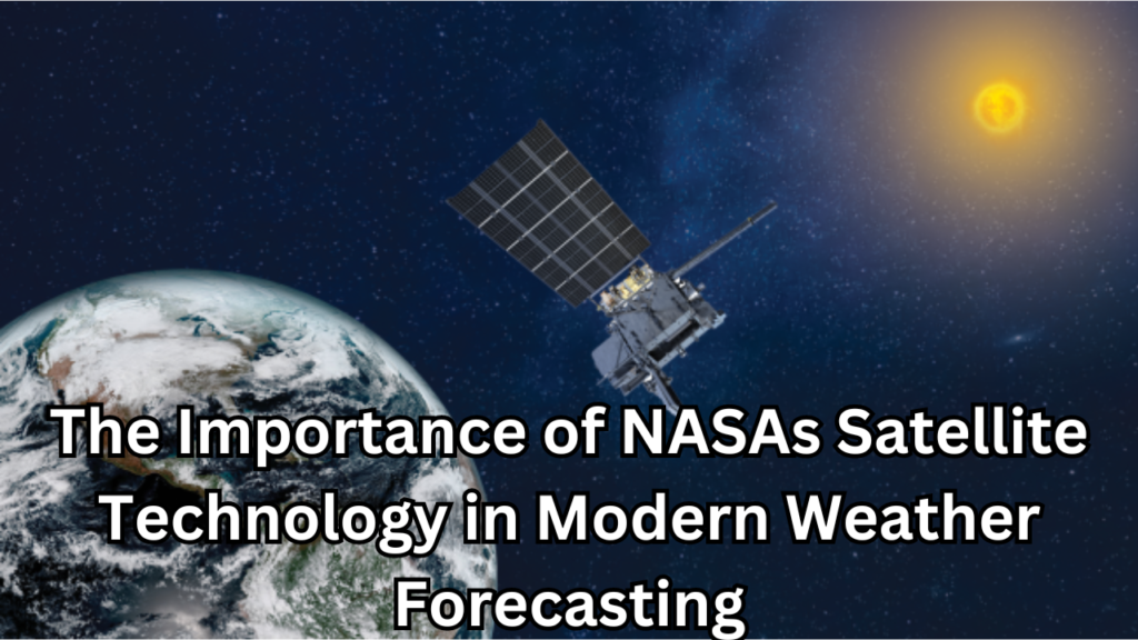
Weather forecasting has evolved significantly over the years, transitioning from rudimentary methods to sophisticated, satellite-driven models that provide accurate and timely predictions. At the forefront of this revolution is NASA, whose advancements in satellite technology have transformed our ability to understand and predict weather patterns. This article delves into the critical role that Importance of NASAs Satellite Technology plays in modern weather forecasting, exploring its history, technological innovations, applications, and future prospects.
Overview of Modern Weather Forecasting
Modern weather forecasting is a complex process that integrates data from various sources, including ground-based observations, radar, and satellites. It involves the collection, analysis, and interpretation of meteorological data to predict atmospheric conditions. Key components of modern weather forecasting include data collection, satellite observations, numerical weather prediction models, computational power, and communication systems. Data collection involves gathering information on temperature, humidity, wind speed, atmospheric pressure, and precipitation from a global network of observation stations. Satellite observations utilize geostationary and polar-orbiting satellites to monitor weather patterns from space, providing a comprehensive view of the Earth’s atmosphere. Numerical weather prediction models employ mathematical models that simulate the atmosphere’s behavior based on collected data to generate forecasts. The use of supercomputers enables the rapid processing of vast amounts of data, enhancing the accuracy and timeliness of predictions. Finally, communication systems disseminate forecasts to the public, government agencies, and businesses through various media channels, ensuring that critical weather information reaches those who need it most. The integration of these components allows meteorologists to provide forecasts that are essential for daily activities, emergency planning, and climate research.
NASA’s Role in Weather Prediction
NASA has been instrumental in advancing weather prediction through its development and deployment of cutting-edge satellite technology. NASA has launched numerous weather satellites, such as the Geostationary Operational Environmental Satellites (GOES) and the Joint Polar Satellite System (JPSS), which provide critical data for weather prediction. These satellites are equipped with advanced sensors and instruments, including radiometers, spectrometers, and LIDAR, that enhance the accuracy and scope of weather data collection. NASA employs sophisticated data processing techniques and machine learning algorithms to analyze satellite data, improving the accuracy of weather forecasts. Additionally, NASA collaborates with international space agencies and meteorological organizations, sharing data and expertise to enhance global weather forecasting capabilities. Beyond short-term weather prediction, NASA’s satellites contribute to long-term climate monitoring, helping scientists understand climate change and its impacts. Through these efforts, NASA plays a crucial role in providing reliable weather forecasts, which are vital for public safety, economic stability, and environmental protection.
Historical Context
Early Weather Forecasting Methods
Before the advent of modern technology, weather forecasting was a rudimentary science based largely on observation and folklore. Ancient civilizations relied on patterns observed in the sky, animal behavior, and seasonal cycles to make predictions. For instance, farmers would look to the phases of the moon and the behavior of birds to predict rainfall or drought. In the 17th century, the invention of instruments such as the barometer, thermometer, and hygrometer marked a significant leap in weather observation, allowing for more precise measurements of atmospheric pressure, temperature, and humidity. By the 19th century, the establishment of weather stations and the development of the telegraph enabled the collection and sharing of weather data over large distances. Meteorologists could now track weather patterns and develop rudimentary forecasting models. Despite these advancements, early weather forecasting remained limited in scope and accuracy, constrained by the lack of comprehensive observational data and understanding of atmospheric processes.
The Advent of Satellite Technology
The launch of the first weather satellite, TIROS-1 (Television Infrared Observation Satellite), in 1960 revolutionized weather forecasting. For the first time, scientists could observe weather systems from space, providing a global perspective on atmospheric conditions. TIROS-1 captured images of cloud cover and transmitted them back to Earth, offering unprecedented insights into weather patterns. This breakthrough led to the development of more advanced satellites equipped with a variety of sensors capable of measuring temperature, humidity, wind speed, and other critical atmospheric parameters. Satellites such as the Geostationary Operational Environmental Satellites (GOES) and the Joint Polar Satellite System (JPSS) provided continuous monitoring of the Earth’s weather systems, enabling meteorologists to track storms, monitor climate trends, and improve the accuracy of weather forecasts. The advent of satellite technology marked a significant milestone in meteorology, transforming weather forecasting into a precise and reliable science.
NASA’s Pioneering Efforts in Satellite Development
NASA has played a pivotal role in the development and advancement of satellite technology for weather forecasting. In collaboration with other agencies, NASA has launched numerous weather satellites that provide critical data for monitoring and predicting atmospheric conditions. The Geostationary Operational Environmental Satellites (GOES) series, developed by NASA and operated by NOAA, offers real-time monitoring of weather systems, severe storms, and environmental hazards. The Joint Polar Satellite System (JPSS), another collaborative effort, provides detailed observations of the Earth’s atmosphere, oceans, and land, contributing to long-term climate monitoring and short-term weather prediction. NASA’s Aqua and Terra satellites, part of the Earth Observing System (EOS), carry a suite of instruments that measure key atmospheric parameters, enhancing our understanding of climate dynamics and weather patterns. NASA has also been at the forefront of technological innovation, developing advanced sensors such as radiometers, spectrometers, and LIDAR, which improve the accuracy and resolution of weather data. Through its pioneering efforts in satellite development, NASA has significantly enhanced our ability to forecast weather, monitor climate change, and respond to natural disasters.
Satellite Technology Fundamentals
What Are Weather Satellites?
Weather satellites are specialized spacecraft designed to monitor and collect data about the Earth’s atmosphere and surface. These satellites are equipped with various instruments and sensors that measure a wide range of atmospheric parameters, including temperature, humidity, wind speed, and cloud cover. By providing a continuous stream of data, weather satellites play a crucial role in meteorology, allowing scientists to track weather patterns, predict severe weather events, and study long-term climate trends. The data collected by weather satellites is essential for creating accurate weather forecasts, improving our understanding of atmospheric processes, and enhancing our ability to respond to natural disasters.
Types of Weather Satellites
There are two primary types of weather satellites: geostationary satellites and polar-orbiting satellites. Each type serves a unique purpose and provides different perspectives and data on the Earth’s atmosphere.
Geostationary Satellites
Geostationary satellites orbit the Earth at an altitude of approximately 35,786 kilometers (22,236 miles) above the equator. They move in sync with the Earth’s rotation, allowing them to remain fixed over a specific geographic location. This stationary position enables continuous monitoring of a particular area, making geostationary satellites ideal for observing and tracking weather systems, such as hurricanes and severe storms, in real time. These satellites provide frequent updates, often every 15 minutes or less, which is crucial for monitoring rapidly changing weather conditions. Examples of geostationary satellites include the Geostationary Operational Environmental Satellites (GOES) series operated by NOAA and NASA. These satellites are equipped with advanced sensors that capture high-resolution images and data, providing meteorologists with valuable information for short-term weather forecasting and emergency response.
Polar-Orbiting Satellites
Polar-orbiting satellites operate at lower altitudes, typically between 700 and 800 kilometers (435 to 500 miles) above the Earth’s surface. Unlike geostationary satellites, they follow a near-polar orbit, passing over the Earth’s poles multiple times a day. As the Earth rotates beneath them, these satellites can scan the entire surface of the planet, providing global coverage. Polar-orbiting satellites are particularly useful for collecting detailed data on atmospheric conditions, such as temperature, humidity, and cloud cover, across the entire globe. They play a vital role in long-term climate monitoring and environmental research. The Joint Polar Satellite System (JPSS), a collaboration between NOAA and NASA, is an example of polar-orbiting satellites that provide critical data for weather forecasting and climate studies. By offering a comprehensive view of the Earth’s atmosphere, polar-orbiting satellites complement the data collected by geostationary satellites, contributing to more accurate and reliable weather predictions.
Key NASA Weather Satellites
GOES (Geostationary Operational Environmental Satellites)
The Geostationary Operational Environmental Satellites (GOES) series is a key component of the United States’ weather observation and forecasting infrastructure. Operated by NOAA in collaboration with NASA, GOES satellites are positioned in geostationary orbit approximately 35,786 kilometers (22,236 miles) above the equator. This orbit allows them to continuously monitor the same geographic area, providing real-time data on weather conditions. GOES satellites are equipped with advanced instruments such as the Advanced Baseline Imager (ABI) and the Geostationary Lightning Mapper (GLM), which capture high-resolution images of the Earth’s atmosphere and surface, and detect lightning activity, respectively. The continuous stream of data from GOES satellites is crucial for tracking severe weather events, such as hurricanes, thunderstorms, and tornadoes, enabling timely warnings and forecasts that help protect lives and property. Additionally, GOES data supports long-term climate monitoring and environmental research, making it an invaluable tool for meteorologists and scientists.
JPSS (Joint Polar Satellite System)
The Joint Polar Satellite System (JPSS) is a collaborative program between NOAA and NASA that provides critical data for weather forecasting, climate monitoring, and environmental research. JPSS satellites are polar-orbiting, meaning they circle the Earth from pole to pole at an altitude of approximately 824 kilometers (512 miles), allowing them to observe the entire planet twice a day. This global coverage is essential for gathering detailed information on atmospheric conditions, such as temperature, humidity, and cloud cover, as well as monitoring ocean and land surfaces. Key instruments on JPSS satellites include the Visible Infrared Imaging Radiometer Suite (VIIRS), which provides high-resolution imagery, and the Cross-track Infrared Sounder (CrIS), which measures atmospheric temperature and moisture profiles. The data collected by JPSS is integrated into numerical weather prediction models, significantly improving the accuracy of weather forecasts. Moreover, JPSS supports environmental monitoring by tracking changes in the Earth’s climate, sea ice, vegetation, and natural disasters, contributing to a better understanding of global environmental changes.
Aqua and Terra Satellites
Aqua and Terra are twin satellites launched by NASA as part of the Earth Observing System (EOS) to monitor the Earth’s atmosphere, oceans, and land. Terra, launched in 1999, and Aqua, launched in 2002, carry a suite of scientific instruments that provide comprehensive data on various environmental parameters. Terra’s instruments, such as the Moderate Resolution Imaging Spectroradiometer (MODIS) and the Multi-angle Imaging SpectroRadiometer (MISR), capture detailed images of the Earth’s surface and atmosphere, helping scientists study climate change, deforestation, and urbanization. Aqua, named after the Latin word for water, focuses on the water cycle, with instruments like the Advanced Microwave Scanning Radiometer for EOS (AMSR-E) and the Atmospheric Infrared Sounder (AIRS) that measure sea surface temperatures, water vapor, and precipitation. The data from Aqua and Terra is crucial for understanding global climate dynamics, tracking natural disasters like wildfires and hurricanes, and conducting environmental research. By providing a continuous and detailed record of the Earth’s systems, these satellites play a vital role in advancing climate science and improving environmental management.
TRMM (Tropical Rainfall Measuring Mission)
The Tropical Rainfall Measuring Mission (TRMM) was a joint mission between NASA and the Japan Aero space Exploration Agency (JAXA) launched in 1997 to study tropical rainfall and its impact on global climate. TRMM was the first satellite dedicated to measuring tropical and subtropical precipitation, providing valuable data on rainfall distribution, intensity, and associated latent heat release. The satellite’s key instrument, the Precipitation Radar (PR), allowed scientists to obtain three-dimensional profiles of rainfall, while the TRMM Microwave Imager (TMI) and Visible and Infrared Scanner (VIRS) provided complementary data on precipitation and cloud properties. TRMM’s observations significantly improved the understanding of tropical weather systems, such as hurricanes and monsoons, and their role in the global water cycle. The data from TRMM has been instrumental in enhancing weather prediction models, disaster response, and climate research. Although the mission officially ended in 2015, TRMM’s legacy continues through the data it provided, which remains a valuable resource for scientists and meteorologists.
GPM (Global Precipitation Measurement)
The Global Precipitation Measurement (GPM) mission, a successor to TRMM, is an international satellite mission led by NASA and JAXA to provide advanced measurements of global precipitation. Launched in 2014, the GPM Core Observatory carries the Dual-frequency Precipitation Radar (DPR) and the GPM Microwave Imager (GMI), which together capture detailed data on precipitation intensity, distribution, and type (rain, snow, sleet). GPM extends the capabilities of TRMM by covering a broader range of latitudes and providing more accurate and frequent precipitation measurements. The mission includes a constellation of partner satellites from various international space agencies, enhancing global coverage and data availability. GPM data is crucial for improving weather forecasts, monitoring extreme weather events, and understanding the global water cycle. It supports various applications, including flood prediction, drought monitoring, and climate research. By offering a comprehensive view of precipitation patterns worldwide, GPM helps scientists and meteorologists better understand and respond to weather and climate-related challenges.
Technological Innovations
Advanced Sensors and Instruments
Advanced sensors and instruments are the backbone of modern weather satellites, enabling the collection of precise and comprehensive data on atmospheric conditions. These technologies have revolutionized meteorology by providing detailed observations of weather patterns, climate dynamics, and environmental changes. The instruments aboard weather satellites can measure a wide array of atmospheric parameters, such as temperature, humidity, wind speed, cloud cover, and precipitation. They include radiometers, spectrometers, and Light Detection and Ranging (LIDAR) systems, each serving a specific function in data collection. The integration of these advanced sensors and instruments allows for continuous monitoring and real-time data transmission, enhancing the accuracy and reliability of weather forecasts and climate models.
Radiometers
Radiometers are critical instruments used in weather satellites to measure the intensity of electromagnetic radiation emitted or reflected by the Earth’s surface and atmosphere. They operate across various wavelengths, including visible, infrared, and microwave bands, to capture a comprehensive picture of atmospheric conditions. Radiometers can detect temperature variations, monitor cloud cover, and measure water vapor and ozone concentrations. One prominent example is the Advanced Microwave Sounding Unit (AMSU), which provides temperature profiles of the atmosphere. Another is the Visible Infrared Imaging Radiometer Suite (VIIRS) on the Joint Polar Satellite System (JPSS), which captures high-resolution images and data on land, ocean, and atmospheric properties. By providing critical information on weather and climate variables, radiometers play a vital role in enhancing weather prediction accuracy and environmental monitoring.
Spectrometers
Spectrometers are sophisticated instruments that analyze the spectral composition of light to identify and quantify various atmospheric components. By measuring the absorption and emission of light at different wavelengths, spectrometers can detect gases such as carbon dioxide, methane, and ozone, as well as aerosols and other particulates. These measurements are crucial for monitoring air quality, studying atmospheric chemistry, and tracking greenhouse gas concentrations. An example is the Atmospheric Infrared Sounder (AIRS) on NASA’s Aqua satellite, which provides detailed temperature and humidity profiles of the atmosphere. Spectrometers are essential tools for understanding the chemical composition of the atmosphere and its impact on weather patterns and climate change.
LIDAR
Light Detection and Ranging (LIDAR) is a remote sensing technology that uses laser pulses to measure distances and create detailed three-dimensional maps of the Earth’s surface and atmosphere. In weather satellites, LIDAR is used to measure cloud heights, aerosol concentrations, and wind speeds. It works by emitting laser pulses and measuring the time it takes for the light to return after hitting an object or particle. The data collected by LIDAR systems provide valuable insights into cloud dynamics, air quality, and atmospheric circulation. For example, NASA’s CALIPSO (Cloud-Aerosol Lidar and Infrared Pathfinder Satellite Observations) mission uses LIDAR to study the distribution and properties of clouds and aerosols, contributing to a better understanding of their effects on climate and weather. LIDAR technology enhances the accuracy of weather and climate models by providing high-resolution vertical profiles of the atmosphere.
Data Collection and Transmission
The process of data collection and transmission is crucial for the effective use of weather satellite observations. Advanced sensors and instruments onboard the satellites continuously gather data on various atmospheric and environmental parameters. This data is then transmitted to ground stations using sophisticated communication systems. Once received, the data undergoes processing and analysis to extract valuable information and generate accurate weather forecasts and climate models. High-speed data links and advanced computing technologies ensure that the data is processed in real-time, allowing meteorologists to respond quickly to changing weather conditions. The integration of data from multiple satellites and sensors enhances the overall accuracy and reliability of weather predictions. Additionally, data sharing agreements between international space agencies and meteorological organizations facilitate the global exchange of satellite observations, contributing to improved weather forecasting and climate monitoring on a worldwide scale.
Data Analysis and Interpretation
Data Processing Techniques
Data processing techniques are essential for transforming raw satellite data into actionable information that can be used for weather forecasting and climate analysis. These techniques involve several steps, including data acquisition, calibration, validation, and interpretation. Once the data is transmitted from the satellite to ground stations, it undergoes preprocessing to remove noise and correct for any distortions caused by the atmosphere or satellite instruments. Calibration ensures that the measurements are accurate and consistent over time.
After preprocessing, the data is validated by comparing it with ground-based observations and other satellite data to ensure its reliability. Advanced algorithms are then applied to interpret the data and extract meaningful insights. For example, numerical weather prediction (NWP) models use mathematical equations to simulate the behavior of the atmosphere based on the processed data. These models integrate data from multiple sources, including satellites, weather stations, and radar, to generate weather forecasts.
Data assimilation techniques are also used to combine observational data with model outputs, improving the accuracy of the forecasts. Ensemble forecasting, which runs multiple simulations with slightly varying initial conditions, helps quantify the uncertainty in the predictions. Visualization tools are then employed to present the processed data in an easily interpretable format, such as weather maps and charts. These data processing techniques enable meteorologists to deliver accurate and timely weather forecasts, contributing to public safety and preparedness.
Role of AI and Machine Learning in Forecasting
Artificial intelligence (AI) and machine learning (ML) have become increasingly important in the field of weather forecasting, offering powerful tools to enhance prediction accuracy and efficiency. AI and ML algorithms can analyze vast amounts of data from satellites, weather stations, and other sources more quickly and accurately than traditional methods. These technologies are capable of identifying complex patterns and relationships within the data that might be missed by human analysts or conventional models.
One of the primary applications of AI in weather forecasting is in improving numerical weather prediction (NWP) models. Machine learning algorithms can optimize these models by identifying the most relevant variables and refining the equations used to simulate atmospheric processes. Additionally, AI can be used for data assimilation, integrating observations from various sources to produce a more accurate representation of the current state of the atmosphere.
Machine learning techniques such as deep learning are particularly effective in processing and interpreting satellite imagery. Convolutional neural networks (CNNs), a type of deep learning algorithm, can analyze images to detect and track weather phenomena like hurricanes, storms, and cloud formations with high precision. AI can also enhance ensemble forecasting by generating a large number of simulations with different initial conditions, providing a better understanding of forecast uncertainties.
Furthermore, AI-driven predictive analytics can improve the forecasting of extreme weather events, such as tornadoes, floods, and heatwaves. By analyzing historical weather data and current observations, machine learning models can predict the likelihood and potential impact of these events, enabling better preparation and response.
Applications of Satellite Data
Short-Term Weather Predictions
Short-term weather predictions focus on forecasting atmospheric conditions over a period ranging from a few hours to several days. These predictions are crucial for daily planning and emergency preparedness. The process involves the integration of data from various sources, including satellites, weather stations, radar, and balloons, into numerical weather prediction (NWP) models. These models use mathematical equations to simulate atmospheric dynamics and provide forecasts for temperature, precipitation, wind speed, and other weather parameters. Advances in satellite technology, such as the high-resolution imagery provided by the Geostationary Operational Environmental Satellites (GOES), have significantly improved the accuracy and timeliness of short-term weather predictions. These forecasts are essential for a wide range of activities, from aviation and agriculture to outdoor events and public safety.
Long-Term Climate Monitoring
Long-term climate monitoring involves the continuous observation and analysis of atmospheric and environmental data over extended periods, typically decades, to detect and understand trends and changes in the Earth’s climate. Satellites play a pivotal role in this process by providing consistent and comprehensive data on temperature, precipitation, sea level, ice cover, and greenhouse gas concentrations. Instruments like those on the Aqua and Terra satellites offer valuable insights into the global water cycle and energy balance. Long-term climate monitoring helps scientists understand the effects of natural and human-induced changes on the climate system, guiding policy decisions and mitigation strategies to address global warming, climate change, and their impacts on ecosystems and human societies.
Natural Disaster Management
Natural disaster management relies heavily on accurate and timely weather and climate data to prepare for, respond to, and mitigate the impacts of events such as hurricanes, floods, droughts, and wildfires. Satellites provide critical real-time data and imagery that help predict the onset and severity of natural disasters, allowing authorities to issue early warnings and coordinate emergency responses. For example, the Joint Polar Satellite System (JPSS) offers detailed observations of atmospheric conditions, which are vital for tracking and forecasting the development of severe weather events. Advanced data processing techniques and predictive models enable the identification of vulnerable areas and the efficient allocation of resources for disaster relief and recovery efforts.
Hurricanes and Cyclones
Hurricanes and cyclones are among the most devastating natural disasters, causing widespread destruction and loss of life. Accurate tracking and prediction of these storms are essential for minimizing their impact. Satellites, such as those in the GOES series, provide continuous monitoring of storm formation and movement, capturing high-resolution images and data on wind speeds, precipitation, and cloud structures. This information is fed into predictive models that forecast the path and intensity of hurricanes and cyclones, allowing for timely evacuation orders and disaster preparedness measures. The integration of data from multiple satellites and ground-based observations enhances the accuracy of these forecasts, providing vital information to safeguard communities in the storm’s path.
Flood Monitoring
Flood monitoring involves the use of satellite data to detect, analyze, and predict the occurrence and impact of floods. Satellites equipped with synthetic aperture radar (SAR), such as the Sentinel-1 series, can penetrate cloud cover and provide detailed images of flood-affected areas, even during heavy rainfall. These images help identify inundated regions, assess the extent of flooding, and monitor changes over time. Additionally, satellites like the Global Precipitation Measurement (GPM) mission provide data on precipitation rates and patterns, which are crucial for predicting and managing flood risks. Real-time flood monitoring supports emergency response efforts by providing accurate information for evacuations, resource deployment, and post-disaster recovery planning.
Drought Prediction
Drought prediction relies on the continuous monitoring of various environmental parameters, including soil moisture, vegetation health, precipitation, and temperature. Satellites such as NASA’s Soil Moisture Active Passive (SMAP) mission provide detailed measurements of soil moisture levels, which are critical for assessing drought conditions. By analyzing long-term data trends, scientists can identify regions at risk of drought and predict its onset and severity. This information helps in planning water resource management, agricultural practices, and disaster preparedness. Early warning systems based on satellite data allow governments and communities to implement mitigation strategies, such as water conservation measures and crop diversification, to reduce the impact of drought on food security and livelihoods.
Global Collaboration
International Partnerships
International partnerships are essential for advancing weather forecasting, climate monitoring, and environmental research. Collaborative efforts among space agencies, meteorological organizations, and scientific institutions around the world enhance our collective ability to monitor and predict atmospheric and environmental conditions. For example, the Global Precipitation Measurement (GPM) mission is a collaborative effort led by NASA and the Japan Aerospace Exploration Agency (JAXA), involving contributions from various international partners. These partnerships enable the sharing of satellite data, expertise, and resources, leading to more comprehensive and accurate weather and climate models. International collaborations also facilitate the development of new satellite missions and technologies, ensuring continuous improvements in our ability to observe and understand the Earth’s climate system. By working together, countries can address global challenges such as climate change, natural disasters, and environmental degradation more effectively.
Data Sharing and Integration
Data sharing and integration are crucial for maximizing the utility of satellite observations and improving weather forecasting and climate monitoring. The exchange of data between different satellites, ground-based observations, and numerical weather prediction models enhances the accuracy and reliability of forecasts. Organizations such as the World Meteorological Organization (WMO) play a key role in facilitating global data sharing by establishing standards and protocols for data exchange. Integrated data systems combine observations from various sources, including geostationary and polar-orbiting satellites, weather stations, radars, and buoys, to provide a comprehensive and detailed picture of atmospheric conditions.
One example of successful data integration is the European Organisation for the Exploitation of Meteorological Satellites (EUMETSAT), which collaborates with NOAA, NASA, and other agencies to share satellite data and support global weather prediction efforts. The assimilation of diverse data sets into numerical weather prediction models improves the accuracy of short-term forecasts and long-term climate projections. Additionally, open data policies and initiatives, such as the Copernicus program, provide free and open access to satellite data, enabling researchers, policymakers, and the public to benefit from these valuable resources. Effective data sharing and integration enhance our ability to monitor and respond to weather and climate-related challenges, contributing to better decision-making and a more resilient global society.
Benefits of NASA’s Satellite Technology
Accuracy in Weather Forecasting
Accuracy in weather forecasting is paramount for ensuring public safety, economic stability, and efficient resource management. Advances in satellite technology, data processing techniques, and numerical weather prediction (NWP) models have significantly improved the precision of weather forecasts. Satellites provide continuous, high-resolution data on atmospheric conditions, such as temperature, humidity, wind speed, and cloud cover. This data is integrated into sophisticated NWP models that simulate atmospheric dynamics and predict future weather patterns. The accuracy of these forecasts is further enhanced by data assimilation techniques, which combine observations from multiple sources to create a comprehensive picture of current conditions. Accurate weather forecasting allows for better planning and decision-making across various sectors, from agriculture and transportation to disaster management and public health.
Economic Impacts
Accurate weather forecasting has profound economic impacts, helping industries and businesses make informed decisions that mitigate risks and optimize operations. In agriculture, precise weather forecasts enable farmers to plan planting and harvesting schedules, manage irrigation, and protect crops from adverse weather conditions, thereby increasing productivity and reducing losses. The transportation sector, including aviation, shipping, and logistics, relies on accurate forecasts to ensure safe and efficient operations, minimizing delays and accidents caused by severe weather. Energy companies use weather predictions to manage power generation and distribution, balancing supply and demand while incorporating renewable energy sources like solar and wind. Additionally, accurate weather forecasts help the insurance industry assess risks and set premiums, ultimately reducing the financial impact of natural disasters. By supporting these and other economic activities, reliable weather forecasting contributes to economic stability and growth.
Environmental and Public Safety
Accurate weather forecasting is critical for environmental protection and public safety. Timely predictions of severe weather events, such as hurricanes, tornadoes, floods, and heatwaves, enable authorities to issue warnings and coordinate emergency responses, protecting lives and property. Early warning systems based on precise weather forecasts allow communities to prepare for and mitigate the impacts of natural disasters, reducing casualties and economic damage. Furthermore, accurate forecasts help monitor and manage environmental phenomena, such as air quality, water resources, and wildfire risks. For example, predictions of high pollution levels can trigger public health advisories, encouraging vulnerable populations to take protective measures. Accurate weather forecasting also supports climate monitoring and research, helping scientists track changes in the Earth’s climate and develop strategies to address global challenges such as climate change and environmental degradation. By enhancing environmental management and safeguarding public health and safety, accurate weather forecasting plays a vital role in building resilient communities and protecting ecosystems.
Challenges and Limitations
Technological Challenges
Technological challenges in weather satellite operations encompass a range of issues related to satellite design, data collection, and processing. One major challenge is ensuring the reliability and longevity of satellite instruments in the harsh environment of space. Satellites must withstand extreme temperatures, radiation, and micrometeoroid impacts while maintaining precision and accuracy in their measurements. Another challenge is the development and maintenance of advanced sensors that can provide high-resolution, multi-spectral data. As technology evolves, satellites need to incorporate more sophisticated instruments that can capture detailed atmospheric and environmental parameters across various wavelengths.
Additionally, ensuring consistent communication between satellites and ground stations is crucial for uninterrupted data transmission. Issues such as signal degradation, data loss, and communication delays can impact the timeliness and accuracy of weather forecasts. Moreover, the integration of data from multiple satellites and sources into cohesive models requires advanced algorithms and computational resources. Addressing these technological challenges is essential for maintaining the effectiveness and reliability of weather satellite systems.
Data Overload
Data overload refers to the challenge of managing and processing the vast amounts of data generated by modern weather satellites. Each satellite continuously collects high-resolution images and measurements across multiple wavelengths, resulting in an enormous volume of data. Efficiently storing, transmitting, and processing this data is a significant challenge for meteorological organizations and research institutions.
To address data overload, advanced data management systems and high-performance computing resources are necessary. Data assimilation techniques are employed to integrate observations from various satellites and ground-based sources into numerical weather prediction models. These models must process and analyze large datasets quickly to provide accurate forecasts in real-time. Additionally, machine learning and artificial intelligence are increasingly used to automate data processing and enhance the ability to extract meaningful information from complex datasets. Balancing the need for detailed observations with the capacity to manage and analyze data effectively is crucial for optimizing the benefits of satellite technology.
Future Challenges in Satellite Technology
The future of satellite technology presents several challenges as scientists and engineers work to advance the capabilities of weather and environmental observation systems. One major challenge is the development of next-generation satellites with improved resolution, sensitivity, and longevity. Innovations in sensor technology and miniaturization must keep pace with the growing demands for higher-resolution data and more frequent observations.
Another challenge is the need for enhanced data processing and analysis capabilities. As satellite missions continue to produce increasing volumes of data, there is a growing need for advanced algorithms and computing power to manage and interpret this information effectively. This includes addressing issues related to data integration, real-time processing, and automated decision-making.
Additionally, addressing the increasing congestion of space with more satellites and debris poses a significant challenge. Ensuring the safe operation of satellites and avoiding collisions requires effective space traffic management and debris mitigation strategies. Finally, there is a need for international collaboration and standardization to ensure interoperability between different satellite systems and data-sharing protocols.
Future of Satellite Weather Forecasting
Upcoming NASA Missions
NASA’s upcoming missions are poised to enhance our understanding of the Earth’s atmosphere, weather patterns, and climate dynamics. Among these missions is the Earth Science Decadal Survey, which outlines a series of planned satellite missions to address critical scientific questions and advance weather and climate observation capabilities. For example, the PACE (Plankton, Aerosol, Cloud, ocean Ecosystem) mission, scheduled for launch in the mid-2020s, aims to provide comprehensive data on ocean ecosystems, aerosols, and clouds, offering valuable insights into the interactions between the atmosphere and oceans.
Another notable mission is the NISAR (NASA-ISRO Synthetic Aperture Radar), developed in collaboration with the Indian Space Research Organisation (ISRO). NISAR will utilize advanced radar technology to monitor changes in the Earth’s surface, including land deformation, ice dynamics, and natural hazards. This mission is expected to contribute significantly to our understanding of earthquake processes, volcanic activity, and sea-level rise.
Additionally, the TEMPO (Tropospheric Emissions: Monitoring of Pollution) mission will focus on air quality monitoring by measuring pollutants such as ozone, nitrogen dioxide, and sulfur dioxide. TEMPO will provide high-resolution, real-time data on air quality, which is crucial for public health and environmental management.
These upcoming missions are part of NASA’s broader strategy to enhance Earth observation capabilities, improve weather forecasting, and address critical environmental challenges.
Technological Advancements on the Horizon
Several technological advancements are on the horizon that promise to revolutionize weather forecasting and climate monitoring. One significant advancement is the development of hyperspectral imaging technology, which will enable satellites to capture data across an extensive range of wavelengths, providing detailed information on atmospheric composition, cloud properties, and surface conditions. This technology will improve the accuracy of weather forecasts and climate models by offering more granular data on various environmental parameters.
Small satellite (CubeSat) technology is another emerging trend, offering cost-effective and flexible solutions for Earth observation. CubeSats can be deployed in constellations to provide high-resolution, real-time data on weather and climate. Their small size and lower cost make them ideal for rapid deployment and frequent updates, complementing traditional, larger satellite missions.
Advancements in artificial intelligence (AI) and machine learning are also transforming satellite data processing. AI algorithms are increasingly being used to automate data analysis, identify patterns, and improve the accuracy of predictive models. This includes the development of advanced neural networks that can process and interpret complex satellite imagery, enhancing the ability to predict weather events and track environmental changes.
Finally, the integration of quantum computing holds the potential to revolutionize data processing capabilities. Quantum computers could significantly accelerate the analysis of large datasets and improve the performance of numerical weather prediction models, leading to more accurate and timely forecasts.
Potential Impacts on Weather Forecasting
The technological advancements and upcoming missions have the potential to greatly impact weather forecasting in several ways. Enhanced hyperspectral imaging will provide more detailed and accurate observations of atmospheric composition and cloud properties, leading to improvements in forecast precision. This will enable meteorologists to better understand and predict complex weather phenomena, such as rapidly intensifying storms and subtle changes in atmospheric conditions.
The deployment of small satellites and CubeSats will increase the frequency and resolution of observational data, offering near-real-time updates on weather conditions and improving the ability to monitor and respond to emerging weather events. This increased observational capacity will enhance the accuracy of short-term forecasts and provide more timely information for emergency response and public safety.
Advancements in AI and machine learning will streamline data processing and analysis, allowing for more sophisticated and efficient weather prediction models. By automating the identification of weather patterns and integrating diverse data sources, AI will improve the accuracy of forecasts and enhance the ability to predict extreme weather events.
Finally, the potential of quantum computing to accelerate data processing could lead to significant improvements in numerical weather prediction models, enabling more precise and timely forecasts. This could have broad implications for various sectors, including agriculture, transportation, and disaster management, by providing more reliable information for planning and decision-making.
Summary
Recap of Key Points
Weather forecasting and climate monitoring have significantly advanced due to technological innovations, particularly in satellite technology. Early weather forecasting methods relied on observational data from ground-based instruments, but the advent of satellite technology marked a transformative shift in how meteorologists monitor and predict weather. NASA has played a pioneering role in this evolution, developing and deploying satellites that provide critical data on atmospheric conditions, weather patterns, and environmental changes.
The various types of weather satellites, including geostationary and polar-orbiting satellites, offer complementary capabilities. Geostationary satellites provide continuous coverage of specific regions, while polar-orbiting satellites offer global observations. Notable missions such as GOES, JPSS, Aqua, Terra, TRMM, and GPM have contributed valuable data that enhance short-term weather predictions, long-term climate monitoring, and natural disaster management.
Advanced sensors and instruments aboard these satellites, such as radiometers, spectrometers, and LIDAR, enable precise measurement of atmospheric parameters. Data processing techniques, including data assimilation and ensemble forecasting, are crucial for accurate predictions. The integration of AI and machine learning further refines forecast accuracy and efficiency, addressing the challenges of data overload.
Future advancements in satellite technology, such as hyperspectral imaging, small satellites, and quantum computing, promise to further enhance weather forecasting capabilities. International partnerships and data-sharing initiatives play a vital role in maximizing the benefits of satellite observations and improving global weather and climate monitoring.
The Continued Importance of NASA’s Contributions
NASA’s contributions to weather forecasting and climate monitoring remain critical as technology continues to evolve and environmental challenges intensify. NASA’s innovative satellite missions and technological advancements have consistently pushed the boundaries of what is possible in Earth observation. By developing and deploying cutting-edge satellites and instruments, NASA has provided invaluable data that enhances our understanding of the atmosphere, weather patterns, and climate dynamics.
The continued importance of NASA’s contributions is evident in several key areas. Accurate weather forecasting relies on the high-resolution, real-time data provided by NASA’s satellites, which are crucial for public safety, economic stability, and environmental management. NASA’s ongoing missions and future projects are expected to further advance our ability to monitor and predict weather and climate phenomena, supporting better decision-making and disaster preparedness.
Furthermore, NASA’s international partnerships and data-sharing efforts foster global collaboration and ensure that satellite data is accessible to researchers, policymakers, and the public. These efforts enhance the effectiveness of weather forecasts and climate monitoring on a worldwide scale.
FAQs
How Do Weather Satellites Work?
Weather satellites operate by orbiting the Earth and collecting data on atmospheric conditions and environmental changes. Equipped with sophisticated sensors and instruments, these satellites measure various parameters such as temperature, humidity, cloud cover, and wind patterns. The sensors detect different types of electromagnetic radiation, including visible light, infrared, and microwave signals. This data is then used to create detailed images and measurements of weather conditions. Satellites can be positioned in two main types of orbits: geostationary, where they remain fixed relative to a specific area on Earth, and polar-orbiting, where they travel from pole to pole, covering the entire globe as the Earth rotates. The data collected is transmitted to ground stations, processed, and integrated into weather prediction models, providing crucial information for accurate forecasting and climate monitoring.
What Is the Difference Between Geostationary and Polar-Orbiting Satellites?
Geostationary and polar-orbiting satellites serve distinct roles in weather observation and have different operational characteristics. Geostationary satellites orbit the Earth at an altitude of about 35,786 kilometers (22,236 miles) above the equator. They move at the same rotational speed as the Earth, allowing them to remain fixed relative to a specific geographic location. This constant positioning provides continuous, real-time monitoring of the same area, making these satellites ideal for tracking rapidly evolving weather events and providing consistent updates. On the other hand, polar-orbiting satellites orbit at lower altitudes, typically between 700 and 1,000 kilometers (430 to 620 miles), traveling from pole to pole. This orbit allows them to cover the entire Earth’s surface over time, providing global observations and valuable data for climate monitoring and long-term environmental studies. While geostationary satellites offer detailed insights into localized weather patterns, polar-orbiting satellites provide a broader, global perspective.
How Accurate Are Satellite-Based Weather Forecasts?
Satellite-based weather forecasts have become highly accurate due to advancements in satellite technology, data processing, and numerical weather prediction models. Satellites provide high-resolution, real-time data on various atmospheric conditions, which is integrated into sophisticated forecasting models to generate detailed weather predictions. The accuracy of these forecasts depends on the quality of the satellite observations, the capabilities of the forecasting models, and the methods used for data assimilation. Modern satellites equipped with advanced sensors offer precise measurements of temperature, humidity, and cloud cover, contributing to more reliable forecasts. Despite these advancements, challenges remain, particularly in predicting the precise intensity and path of severe weather events. Nevertheless, continuous improvements in satellite technology, data analysis techniques, and machine learning are enhancing forecast accuracy and providing more timely and reliable weather information for various sectors.
What Are the Future Prospects for Satellite Technology in Weather Forecasting?
The future prospects for satellite technology in weather forecasting are bright, with several emerging trends set to advance our ability to monitor and predict atmospheric conditions. Hyperspectral imaging is expected to become more prevalent, offering detailed observations across a wide range of wavelengths and improving data on atmospheric composition and cloud properties. The use of small satellites and CubeSats is also likely to expand, providing cost-effective, high-resolution, and real-time data through satellite constellations. Artificial intelligence and machine learning will play an increasingly important role in processing and analyzing satellite data, automating data interpretation and enhancing forecast models. Additionally, advancements in quantum computing could revolutionize data processing capabilities, leading to more accurate simulations of atmospheric processes. These technological advancements will contribute to more precise and timely weather forecasts, supporting better decision-making and response strategies for weather-related challenges.
How Can the Public Access Weather Data from NASA Satellites?
The public can access weather data from NASA satellites through several platforms and resources provided by NASA and its partners. The Earth Data website offers access to a vast array of satellite data, including imagery and measurements from various Earth observation missions. Users can search for and download data related to weather, climate, and environmental conditions. The Worldview tool, available on the Earthdata website, provides an interactive map for exploring and visualizing satellite imagery from NASA’s missions. The Earth Observing System Data and Information System (EOSDIS) also provides comprehensive access to NASA’s Earth science data, including weather and climate observations, with capabilities for data search, visualization, and download. Additionally, NASA shares satellite imagery and weather data through its social media channels and public outreach programs, offering updates and visualizations of significant weather events and current conditions.