Table of Contents
Introduction
Overview of Earth Observation
ESAs Earth Observation Programs involves the collection and analysis of data about our planet using satellite and airborne technologies. This process employs various methods to monitor and measure the Earth’s surface, atmosphere, and oceans. Remote sensing techniques, including satellite imaging and radar systems, are pivotal in capturing high-resolution data from a distance. These observations provide crucial insights into environmental conditions, natural phenomena, and human activities, enabling a deeper understanding of complex processes such as climate change, natural disasters, and resource management.
Importance of Earth Observation for Environmental Protection
Earth observation is vital for environmental protection as it offers critical data that supports decision-making and policy development. Monitoring climate change through satellite data helps track variations in temperature, ice cover, and greenhouse gas levels, aiding in climate predictions and mitigation strategies. In disaster management, real-time data from Earth observation systems helps respond to and manage the impacts of natural events like hurricanes and wildfires. Additionally, the management of natural resources such as water, forests, and agriculture benefits from accurate data, optimizing usage and monitoring environmental changes. Earth observation also plays a key role in biodiversity conservation by tracking habitat loss and species distribution, thus supporting efforts to protect endangered species and preserve ecosystems.
Introduction to the European Space Agency (ESA)
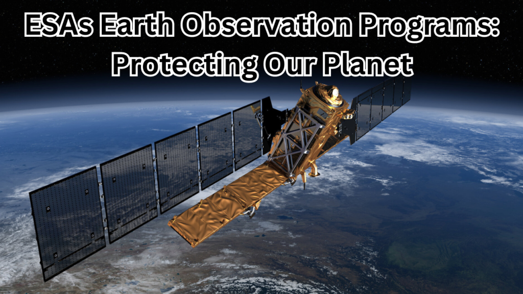
The European Space Agency (ESA) is a prominent intergovernmental organization founded in 1975, dedicated to space exploration and research. ESA’s mission encompasses advancing space science, developing technological innovations, and fostering international cooperation in space activities. Through its key programs, such as the Copernicus Program and Earth Explorer Missions, ESA plays a significant role in Earth observation. The Copernicus Program focuses on providing comprehensive environmental monitoring data, while Earth Explorer Missions address specific scientific challenges related to Earth observation. ESA collaborates with various international partners and private entities, enhancing its capabilities and contributing to global efforts in space and environmental science.
Historical Context
Early Earth Observation Missions
The history of Earth observation began in the mid-20th century with the launch of pioneering satellites that set the stage for modern space-based environmental monitoring. One of the earliest mission was the launch of Sputnik 1 by the Soviet Union in 1957, which, while not specifically designed for Earth observation, demonstrated the potential of satellites for space-based research. Following this, the NASA’s Landsat program started in 1972 with Landsat 1, marking a significant milestone by providing the first comprehensive, continuous imagery of the Earth’s surface. This mission enabled the systematic study of land use, vegetation, and urban growth, laying the groundwork for future Earth observation technologies and methodologies.
Evolution of ESA’s Earth Observation Programs
The European Space Agency (ESA) has significantly contributed to the evolution of Earth observation since its establishment in 1975. In the 1980s, ESA began to develop its Earth observation capabilities with missions like EROS-A (Earth Resources Observation Satellite), focusing on remote sensing and environmental monitoring. The launch of the ERS-1 satellite in 1991 marked a key advancement, introducing synthetic-aperture radar for detailed observations of the Earth’s surface, including ice, ocean waves, and land topography. Over the years, ESAs Earth observation programs have evolved to include more sophisticated satellites and missions, such as the Envisat mission in 2002, which was one of the largest Earth observation satellites ever launched and provided comprehensive data on atmospheric composition, land use, and oceanography. The launch of the Copernicus Program in the 2010s represents a major milestone, establishing a robust framework for continuous environmental monitoring with a constellation of satellites designed to provide detailed, real-time data on various Earth systems.
Milestones and Achievements
ESA has achieved numerous milestones in Earth observation that have significantly advanced our understanding of the planet. One of the most notable achievements is the Copernicus Sentinel-1 satellites, launched in 2014, which provide all-weather, day-and-night radar imagery for monitoring land subsidence, deforestation, and agricultural practices. The Sentinel-2 satellites, launched in 2015, offer high-resolution optical imagery, greatly enhancing our ability to monitor land cover changes and assess vegetation health. Another significant milestone is the successful launch and operation of the SMOS (Soil Moisture and Ocean Salinity) satellite in 2009, which has provided crucial data for understanding soil moisture and salinity levels in oceans, contributing to improved weather forecasting and climate modeling. The ADM-Aeolus mission, launched in 2018, represents a breakthrough in atmospheric observation by providing vertical profiles of wind, contributing to more accurate weather predictions and climate research. These milestones underscore ESA’s ongoing commitment to advancing Earth observation technologies and contributing valuable data for environmental protection and scientific research.
Core ESA Earth Observation Programs
Copernicus Program
The Copernicus Program, initiated by the European Union with significant collaboration from the European Space Agency (ESA), is one of the largest and most comprehensive Earth observation programs globally. Launched in 2014, the program aims to provide detailed, high-quality data to support environmental monitoring, disaster response, and policy-making. By utilizing a fleet of satellites and ground-based systems, Copernicus offers a broad range of services designed to enhance our understanding of Earth’s systems, track environmental changes, and improve decision-making across various sectors.
Objectives and Goals
The Copernicus Program is driven by several key objectives and goals centered around environmental monitoring and policy support. Its primary aim is to deliver accurate, timely data on the state of the environment to support sustainable management practices. This includes tracking land use changes, vegetation health, and water resources to aid in resource management. The program also seeks to enhance climate change assessments by providing data on atmospheric composition, sea-level rise, and ice cover. Additionally, Copernicus aims to improve disaster response by offering real-time information on natural disasters, thereby aiding in emergency management and recovery efforts. Another crucial goal is to support policymakers with reliable data to develop and implement effective environmental and climate policies.
Key Satellites and Instruments
The Copernicus Program relies on a sophisticated constellation of satellites, each equipped with advanced instruments to capture and analyze environmental data. Sentinel-1 satellites use synthetic-aperture radar to provide all-weather, day-and-night imagery of the Earth’s surface, crucial for monitoring land subsidence and infrastructure changes. Sentinel-2 satellites are equipped with optical imaging sensors that deliver high-resolution imagery for tracking land cover changes, vegetation health, and agricultural practices. Sentinel-3 focuses on both ocean and land surface monitoring, utilizing instruments to measure sea surface temperature, sea level, and land surface temperature. The upcoming Sentinel-4 and Sentinel-5 satellites are dedicated to atmospheric monitoring, providing valuable data on air quality, greenhouse gases, and ozone levels.
Data Processing and Accessibility
The Copernicus Program ensures that the extensive data collected by its satellites is processed, analyzed, and made accessible through a robust data management system. Data is processed at specialized centers such as the Copernicus Space Component (CSC) and the European Centre for Medium-Range Weather Forecasts (ECMWF), which handle calibration, validation, and production of high-quality data products. In line with its open-access policy, Copernicus provides free and unrestricted access to its data and products, allowing researchers, policymakers, and the public to benefit from the information without financial or technical barriers. The Copernicus Open Access Hub serves as the primary platform for accessing data, offering a user-friendly interface for searching, downloading, and visualizing satellite data. Additionally, thematic services such as the Copernicus Climate Change Service (C3S) and the Copernicus Emergency Management Service (CEMS) provide specialized data products and analyses for various applications.
Earth Explorer Missions
The Earth Explorer Missions, part of the European Space Agency’s (ESA) Earth Observation program, are designed to address specific scientific and technological challenges related to Earth observation. These missions aim to advance our understanding of Earth systems by providing detailed, targeted observations that are not covered by the broader Copernicus Program. Each mission is focused on investigating particular aspects of the Earth’s atmosphere, oceans, or land surfaces, using innovative technologies and methodologies. Through these missions, ESA seeks to enhance scientific knowledge, improve environmental monitoring, and develop new applications for Earth observation data.
Mission Objectives
The primary objectives of the Earth Explorer Missions are to tackle key scientific questions and technological challenges that contribute to a better understanding of Earth’s environment. Each mission is developed with specific goals in mind, such as improving measurements of atmospheric composition, understanding ocean dynamics, or monitoring soil moisture. These objectives are addressed through the deployment of advanced satellite instruments designed to collect high-precision data. By focusing on particular aspects of Earth systems, the missions aim to provide critical insights that can enhance climate models, support environmental management, and inform policy decisions.
Notable Missions (e.g., SMOS, ADM-Aeolus)
Several Earth Explorer Missions have made significant contributions to Earth observation science. The Soil Moisture and Ocean Salinity (SMOS) mission, launched in 2009, was designed to measure soil moisture and ocean salinity with unprecedented accuracy. This data has been crucial for improving weather forecasts, understanding droughts, and studying ocean circulation. Another notable mission is ADM-Aeolus, launched in 2018, which focuses on atmospheric wind profiling. Using a laser Doppler instrument, ADM-Aeolus provides vertical profiles of wind speeds and directions, offering valuable data for weather prediction and climate research. These missions represent significant advancements in satellite technology and have provided essential data for scientific research and environmental monitoring.
Scientific Contributions
The Earth Explorer Missions have made substantial contributions to our understanding of various Earth processes. The data from the SMOS mission has enhanced climate models by providing accurate measurements of soil moisture and ocean salinity, which are critical for understanding water cycles and climate variability. ADM-Aeolus has advanced atmospheric science by offering detailed wind profile measurements, improving weather forecasting accuracy and contributing to climate studies. The insights gained from these missions have supported a wide range of applications, from enhancing environmental management practices to advancing scientific research in atmospheric and ocean sciences. By addressing specific scientific questions and challenges, the Earth Explorer Missions have played a crucial role in expanding our knowledge of Earth’s systems and processes.
Technological Innovations
Advanced Satellite Technologies
Advanced satellite technologies have revolutionized Earth observation by enabling more precise, comprehensive, and timely data collection. Modern satellites are equipped with sophisticated systems and innovations that enhance their observational capabilities. Key advancements include the development of high-resolution imaging sensors that provide detailed surface and atmospheric data, and synthetic-aperture radar (SAR) systems that allow for all-weather, day-and-night observations. The integration of multi-spectral and hyperspectral imaging capabilities enables detailed analysis of various surface types and atmospheric components. Additionally, improvements in satellite propulsion and communication technologies have increased the longevity and operational efficiency of satellites, allowing for continuous monitoring and data transmission. These technological advancements have significantly expanded the scope and accuracy of Earth observation missions.
Remote Sensing Instruments
Remote sensing instruments are essential tools in Earth observation, designed to capture and analyze data from a distance. These instruments can be broadly categorized into passive and active sensors. Passive sensors detect natural radiation emitted or reflected by objects on the Earth’s surface, such as optical and thermal infrared sensors. These are used in imaging systems to gather data on land cover, vegetation, and surface temperatures. Active sensors, such as synthetic-aperture radar (SAR) and Lidar, emit their own signals and measure the reflected or scattered signals to analyze surface properties and atmospheric conditions. These instruments are crucial for providing high-resolution, accurate data across various applications, from environmental monitoring to disaster management.
Data Acquisition and Analysis Techniques
Data acquisition and analysis techniques in Earth observation involve the collection, processing, and interpretation of satellite data to extract meaningful information. Data acquisition techniques include satellite imaging, where data is captured through optical, infrared, or radar sensors, and data is collected in various formats, such as images, spectra, or time-series measurements. The processing of this data involves steps like calibration, correction, and integration to ensure accuracy and consistency. Advanced algorithms and software are employed to analyze the processed data, including techniques like image classification, change detection, and statistical modeling. Machine learning and artificial intelligence are increasingly used to enhance data analysis, enabling more sophisticated pattern recognition, predictive modeling, and anomaly detection. These techniques are essential for converting raw satellite data into actionable insights for environmental monitoring, climate research, and various other applications.
Major Components of Earth Observation
Satellites and Spacecraft
Satellites and spacecraft are the cornerstone of Earth observation, equipped with advanced technology to gather data about our planet from space. Satellites are specifically designed to orbit Earth and carry a variety of sensors and instruments to monitor different aspects of the environment. They can be categorized into several types, including observation satellites that focus on imaging and measuring the Earth’s surface, weather satellites that monitor atmospheric conditions, and communication satellites that facilitate data transmission. Modern satellites often include features such as high-resolution cameras, synthetic-aperture radar (SAR), and spectrometers to capture detailed information on land cover, sea surface temperatures, and atmospheric composition. Spacecraft, including both satellites and probes, are equipped with propulsion systems to maintain their orbits and can be designed for specific missions, such as planetary exploration or deep-space observation. Together, these technologies provide critical data for scientific research, environmental monitoring, and global communication.
Ground Stations and Data Centers
Ground stations and data centers play a crucial role in the Earth observation infrastructure, handling the reception, processing, and management of satellite data. Ground stations are equipped with large antennas and tracking systems that receive data transmissions from orbiting satellites. These stations are strategically located around the world to ensure continuous coverage and data acquisition. Once data is received, it is sent to data centers where it is processed, analyzed, and stored. Data centers are equipped with high-performance computing systems and advanced software to handle the large volumes of data generated by satellites. They perform tasks such as data calibration, validation, and transformation to ensure the accuracy and usability of the information. Additionally, data centers facilitate the archiving and dissemination of data, making it available to researchers, policymakers, and the public through various platforms and services.
Data Distribution Networks
Data distribution networks are essential for managing and delivering satellite data to users around the globe. These networks include various systems and technologies that ensure the efficient and reliable transfer of data from ground stations and data centers to end users. Key components of data distribution networks include satellite data hubs, cloud storage services, and content delivery networks (CDNs). Satellite data hubs aggregate and manage data from multiple sources, providing centralized access points for users. Cloud storage services offer scalable and flexible storage solutions, allowing for the efficient handling of large datasets and facilitating easy access and sharing. CDNs enhance the distribution of data by caching and delivering content from geographically dispersed servers, improving access speed and reducing latency. These networks enable seamless access to Earth observation data, supporting a wide range of applications from scientific research to emergency response and policy-making.
Applications and Impact
Climate Change Monitoring
Climate change monitoring involves the systematic collection and analysis of data to track alterations in Earth’s climate systems. This encompasses a wide range of parameters including temperature fluctuations, greenhouse gas concentrations, ice cover, and sea level rise. Satellite-based observations provide critical insights into these changes by offering comprehensive, long-term data that is essential for understanding global climate patterns. Advanced sensors on satellites measure atmospheric composition and temperature variations, while other instruments track changes in ice sheets and glaciers. By integrating this data into climate models, scientists can better predict future climate scenarios, assess the impacts of climate change on different regions, and guide mitigation and adaptation strategies. Effective climate change monitoring is crucial for addressing the challenges posed by global warming and for informing policies aimed at reducing carbon emissions and enhancing climate resilience.
Natural Disaster Management
Natural disaster management relies heavily on timely and accurate information to mitigate the impacts of events such as hurricanes, earthquakes, floods, and wildfires. Earth observation satellites play a vital role in this process by providing real-time data on disaster conditions and their aftermath. For example, satellite imagery can be used to monitor the development and movement of hurricanes, assess the extent of floodwaters, and track the spread of wildfires. By delivering high-resolution images and measurements, satellites help emergency responders and decision-makers to coordinate timely interventions, manage resources, and assess damage. Additionally, satellite data supports early warning systems by identifying potential hazards and predicting their impacts, which is essential for improving preparedness and reducing the overall risk of disasters.
Agriculture and Forestry
In agriculture and forestry, satellite technology is used to enhance the management and monitoring of land resources. Satellites provide valuable data on crop health, soil moisture, and land use changes, which is crucial for optimizing agricultural practices and ensuring food security. High-resolution imagery helps farmers and land managers monitor crop growth, detect pests and diseases, and manage irrigation systems more effectively. In forestry, satellite observations are used to monitor deforestation, track forest cover changes, and assess the health of forest ecosystems. By integrating satellite data with other information sources, stakeholders can make informed decisions regarding land management, conservation efforts, and sustainable resource use, contributing to the overall health and productivity of agricultural and forested areas.
Urban Planning and Development
Urban planning and development benefit significantly from satellite-based Earth observation data, which provides a comprehensive view of urban environments and their changes over time. Satellite imagery is used to monitor urban expansion, assess infrastructure development, and analyze land use patterns. This information supports city planners and developers in designing efficient transportation networks, optimizing land use, and managing urban growth. Additionally, satellite data helps in assessing environmental impacts associated with urbanization, such as changes in vegetation cover and increased pollution levels. By leveraging satellite observations, urban areas can be developed in a more sustainable and informed manner, ensuring that growth is managed effectively and that infrastructure meets the needs of expanding populations.
Marine and Coastal Observations
Marine and coastal observations are crucial for monitoring and managing oceanographic conditions and coastal environments. Satellites equipped with specialized sensors provide data on sea surface temperatures, ocean color, wave heights, and coastal erosion. This information is essential for understanding marine ecosystems, tracking changes in sea levels, and monitoring the health of coral reefs and other marine habitats. Satellite data also supports the management of coastal resources, including monitoring fishing activities, detecting oil spills, and assessing the impacts of coastal development. By providing detailed and timely information, satellite observations help to protect marine environments, support sustainable fisheries, and manage the effects of climate change on coastal areas.
Public and Private Partnerships
Collaboration with International Space Agencies
Collaboration with international space agencies is a cornerstone of successful Earth observation missions and space exploration. By partnering with agencies such as NASA, the Russian space agency Roscosmos, and the Indian Space Research Organisation (ISRO), organizations like the European Space Agency (ESA) leverage global expertise and resources to advance space technology and scientific research. These collaborations often involve joint missions, shared satellite data, and coordinated research efforts. For instance, the Copernicus Program benefits from international partnerships by integrating data from various space agencies’ satellites, enhancing the scope and accuracy of environmental monitoring. Collaborative projects enable the pooling of resources, technology, and knowledge, leading to more comprehensive and cost-effective solutions for addressing global challenges such as climate change, natural disasters, and resource management.
Engagement with Research Institutions
Engagement with research institutions is vital for advancing Earth observation science and technology. Institutions such as the European Space Agency’s Earth Observation Science Advisory Committee and various academic research centers play a crucial role in developing new methodologies, analyzing satellite data, and driving scientific innovation. These collaborations involve joint research projects, data-sharing agreements, and the development of advanced analytical tools. Research institutions contribute to the refinement of satellite instruments, the creation of new data products, and the interpretation of complex datasets. By working closely with these institutions, space agencies and organizations can ensure that Earth observation missions are scientifically robust and that the data generated is used to its fullest potential for understanding and addressing environmental and climatic issues.
Partnerships with Private Sector Companies
Partnerships with private sector companies are increasingly important in the field of Earth observation, as they drive innovation and expand the capabilities of space missions. Private companies contribute by developing advanced satellite technologies, providing launch services, and offering data analytics solutions. Collaborations with companies such as SpaceX, which provides cost-effective launch services, or data analytics firms that specialize in processing and interpreting satellite data, enhance the overall effectiveness of Earth observation programs. Additionally, these partnerships facilitate the commercialization of space technology and services, making high-quality data more accessible to a broader range of users. By leveraging private sector expertise and resources, space agencies and organizations can accelerate technological advancements, reduce costs, and improve the delivery of Earth observation data and services.
Challenges and Limitations
Technical and Operational Challenges
Technical and operational challenges are inherent in the field of Earth observation, often arising from the complexity of satellite systems and the harsh environment of space. One major challenge is the development and maintenance of satellite instruments that can withstand the extreme conditions of space while delivering precise measurements. These instruments must be designed to handle factors such as radiation, temperature fluctuations, and micrometeoroid impacts. Additionally, operational challenges include ensuring reliable data transmission from orbiting satellites to ground stations, as well as managing the coordination and scheduling of satellite operations. The integration of multiple satellite systems and the need for precise synchronization also add to the complexity. Addressing these challenges requires ongoing technological innovation, rigorous testing, and robust mission planning to ensure the success and longevity of Earth observation missions.
Data Quality and Accuracy Issues
Data quality and accuracy are critical for the effectiveness of Earth observation systems, but they can be compromised by various factors. Issues such as sensor calibration errors, data noise, and atmospheric interference can affect the reliability of satellite measurements. Calibration and validation of satellite instruments are necessary to correct for these errors and ensure data accuracy. Additionally, the interpretation of satellite data can be challenged by the presence of artifacts or inconsistencies, which require sophisticated algorithms and analytical methods to address. Ensuring data quality involves rigorous quality control processes, cross-validation with ground-based observations, and continuous improvements in sensor technology and data processing techniques. Reliable and accurate data is essential for making informed decisions in environmental monitoring, climate research, and disaster management.
Funding and Budget Constraints
Funding and budget constraints are significant factors influencing the scope and capabilities of Earth observation programs. Developing, launching, and operating satellites require substantial financial resources, and limited budgets can impact the scale and number of missions. Budget constraints may affect various aspects, including the development of advanced technologies, the frequency of satellite launches, and the maintenance of existing systems. In addition, the cost of data processing and analysis can strain resources, limiting the extent of data availability and dissemination. To address these challenges, space agencies often seek international collaborations, public-private partnerships, and alternative funding sources. Effective financial planning and resource management are crucial to maximizing the impact of Earth observation programs and ensuring that they continue to provide valuable data for scientific research and policy-making.
Future Directions
Upcoming Missions and Projects
Upcoming missions and projects in Earth observation promise to enhance our capabilities for monitoring and understanding Earth systems. Notable future missions include the Copernicus Sentinel-1C and Sentinel-2C satellites, which will augment the existing Sentinel constellations, providing additional data for land and ocean monitoring. Another significant project is the ESA’s EarthCARE mission, set to launch in the mid-2020s, which aims to improve our understanding of cloud and aerosol interactions and their impact on climate. The Harmony mission, planned for the next decade, will use radar and optical observations to study Earth’s surface and subsurface, offering new insights into natural resources and environmental changes. Additionally, international collaborations such as the Lunar Gateway project involve multi-agency efforts to establish a lunar outpost that will support Earth observation and deep-space exploration.
Technological Advancements on the Horizon
Technological advancements are poised to revolutionize Earth observation capabilities in the coming years. Innovations include the development of next-generation synthetic-aperture radar (SAR) systems that promise higher resolution and more detailed imaging of Earth’s surface. Advances in hyperspectral imaging will enable more precise analysis of land, water, and atmospheric composition by capturing a broader range of wavelengths. The integration of artificial intelligence (AI) and machine learning in data processing is expected to enhance the accuracy and efficiency of data analysis, enabling more sophisticated pattern recognition and predictive modeling. Furthermore, the deployment of miniaturized satellites or CubeSats will allow for more frequent and cost-effective observations, expanding the ability to monitor dynamic environmental changes on a global scale.
Long-Term Goals and Vision
The long-term goals and vision for Earth observation focus on advancing our ability to understand and manage Earth’s complex systems in a rapidly changing environment. Key objectives include the enhancement of global climate monitoring to improve predictions and responses to climate change impacts, such as extreme weather events and sea-level rise. Aiming for more comprehensive environmental sustainability, future efforts will emphasize the integration of Earth observation data into decision-making processes to support conservation, resource management, and urban planning. The vision also includes fostering international collaboration to create a unified, global Earth observation system that provides continuous, high-resolution data across various domains. Ultimately, the goal is to leverage these advancements to ensure a sustainable future by informing policies, enhancing scientific research, and improving the resilience of communities worldwide.
Summary
Recap of Key Points
The field of Earth observation encompasses a range of activities and technologies dedicated to monitoring and understanding our planet’s systems. Key aspects include the Copernicus Program, which provides comprehensive environmental monitoring through a constellation of satellites designed to observe land, sea, and atmospheric conditions. Earth Explorer Missions focus on specific scientific and technological challenges, contributing valuable data for climate research, natural disaster management, and other applications. Advances in satellite technologies, remote sensing instruments, and data analysis techniques are crucial for improving the accuracy and scope of observations. Additionally, international collaborations, partnerships with research institutions and the private sector play a significant role in advancing the capabilities of Earth observation programs. Challenges such as technical and operational difficulties, data quality issues, and funding constraints must be addressed to maximize the effectiveness of these programs. Looking ahead, upcoming missions and technological advancements promise to further enhance our ability to monitor and protect the Earth, with long-term goals aimed at supporting global sustainability and resilience.
The Role of ESA in Earth Protection
The European Space Agency (ESA) plays a pivotal role in Earth protection through its extensive Earth observation programs and missions. ESA’s initiatives, such as the Copernicus Program, provide critical data for monitoring environmental changes, assessing climate impacts, and managing natural disasters. By developing and deploying advanced satellites and remote sensing technologies, ESA contributes to a deeper understanding of Earth’s systems and supports global efforts to address climate change and environmental degradation. The agency’s collaborations with international space organizations, research institutions, and private sector companies enhance the scope and effectiveness of its missions, ensuring that the data generated is both comprehensive and actionable. ESA’s commitment to open data policies and the development of innovative Earth observation tools positions it as a key player in global efforts to protect and sustain the environment, ultimately supporting informed decision-making and promoting a more resilient and sustainable future.
Frequently Asked Questions (FAQs)
What is the Copernicus Program and How Does It Work?
The Copernicus Program, a flagship initiative of the European Union in collaboration with the European Space Agency (ESA), is designed to provide comprehensive and timely environmental monitoring. It operates through a constellation of Sentinel satellites, each equipped with advanced sensors that collect detailed data on various aspects of Earth’s environment. These satellites are tasked with observing land, sea, and atmospheric conditions, providing crucial information for managing natural resources, responding to emergencies, and understanding climate change. The program includes thematic services that process and analyze the data to deliver actionable insights. By making this data openly accessible, the Copernicus Program supports a wide range of applications and facilitates informed decision-making at both the regional and global levels.
How Does ESA’s Earth Observation Data Contribute to Climate Change Research?
ESA’s Earth observation data is vital for advancing climate change research by offering detailed and accurate measurements of climate-related variables. Through its fleet of satellites, ESA monitors key indicators such as atmospheric greenhouse gas concentrations, sea level rise, and changes in ice cover. This data provides a comprehensive view of long-term climate trends and helps scientists validate and refine climate models. By delivering high-resolution and consistent observations, ESA contributes to a deeper understanding of how climate change is affecting different regions and ecosystems. This information supports the development of effective climate policies and strategies, aiding in global efforts to mitigate and adapt to the impacts of climate change.
What Are the Main Challenges Faced by ESA in Its Earth Observation Missions?
ESA faces several significant challenges in its Earth observation missions, including technical, operational, and financial issues. Developing and maintaining complex satellite systems presents technical hurdles such as ensuring durability in space and managing sophisticated instruments. Operational challenges include the coordination of multiple missions and ensuring reliable data transmission from orbiting satellites. Data quality and accuracy are also critical concerns, as calibration errors and atmospheric interference can affect measurements. Additionally, funding and budget constraints can limit the scope and frequency of missions. Addressing these challenges requires continuous technological innovation, careful planning, and effective resource management to enhance the success and sustainability of ESA’s Earth observation programs.
How Can Individuals Access ESA’s Earth Observation Data?
Individuals can access ESA’s Earth observation data through several user-friendly platforms provided by the agency. The Copernicus Open Access Hub offers free and open access to data from the Sentinel satellites, allowing users to search, download, and view satellite imagery. The Copernicus Data and Information Access Services (DIAS) provide cloud-based solutions for accessing and processing large datasets, facilitating advanced data analyses. Additionally, ESA’s Earth Online website provides comprehensive information about ESA’s Earth observation missions, data products, and access tools. These resources are designed to make satellite data easily accessible for researchers, policymakers, and the general public, promoting widespread use and application of Earth observation information.
What Are the Future Plans for ESA’s Earth Observation Programs?
ESA’s future plans for Earth observation programs focus on expanding capabilities and addressing emerging environmental challenges. The agency aims to enhance the Sentinel satellite constellations with new missions and upgraded technologies to provide even more detailed environmental monitoring. Upcoming advancements include the development of next-generation radar systems, hyperspectral imaging, and the integration of artificial intelligence for improved data analysis. ESA also plans to strengthen international collaborations to leverage global expertise and resources, further enhancing the effectiveness of its Earth observation efforts. Additionally, future missions will continue to prioritize monitoring climate change impacts and supporting global sustainability initiatives, reflecting ESA’s commitment to advancing environmental research and management.