Table of Contents
Introduction
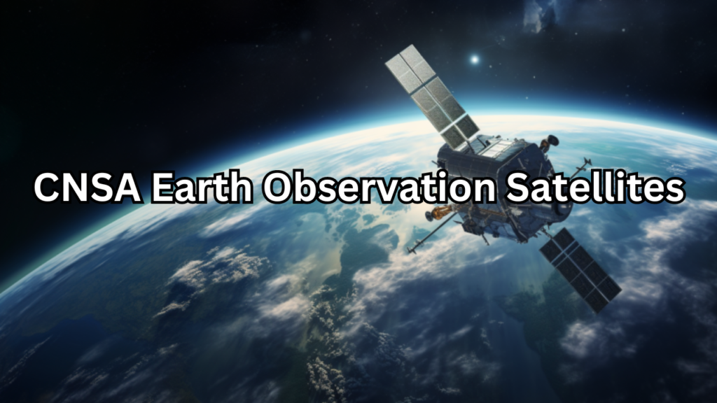
The China National Space Administration (CNSA) is China’s central authority for space exploration and satellite operations, tasked with advancing the CNSA Earth Observation Satellites capabilities and scientific endeavors. Established in 1993, CNSA oversees the planning, development, and management of space missions, including satellite launches, crewed spaceflights, and deep-space exploration. With a mission to enhance China’s presence in space and contribute to global space science, CNSA has made significant strides in satellite technology, particularly in Earth observation.
Brief Overview of the China National Space Administration (CNSA)
The China National Space Administration (CNSA) is the national space agency of China, responsible for the planning and development of space activities and programs. Established in 1993, CNSA coordinates China’s space exploration efforts, including satellite launches, manned space missions, and deep space exploration. Over the years, CNSA has achieved significant milestones, such as the successful launch of the Tiangong space station and the Chang’e lunar missions. Its mission is to advance space science and technology, foster international cooperation, and contribute to the peaceful use of outer space. CNSA’s expanding capabilities reflect China’s growing prominence in the global space arena.
Importance of Earth Observation Satellites for Environmental Monitoring, Disaster Management, and Scientific Research
Earth observation satellites play a crucial role in monitoring and understanding our planet’s dynamic systems. For environmental monitoring, these satellites provide invaluable data on climate change, deforestation, and pollution levels, allowing for more informed decision-making and effective conservation strategies. In disaster management, Earth observation satellites enable real-time tracking of natural disasters such as hurricanes, earthquakes, and floods, facilitating timely responses and resource allocation. Additionally, they support scientific research by offering insights into geological processes, atmospheric phenomena, and ecological patterns, contributing to a deeper understanding of Earth’s systems and aiding in the development of sustainable solutions.
History and Development
The history of CNSA’s Earth observation satellite program is marked by significant milestones and rapid advancements. China’s journey into Earth observation began with the launch of its first satellite, Dong Fang Hong 1, in 1970, which was primarily intended for broadcasting purposes. However, the real focus on Earth observation came later, with the establishment of a more dedicated satellite program in the early 2000s. Early efforts included the launch of the first-generation satellites in the HJ (Huabei Jinghua) series, which laid the groundwork for more sophisticated observational capabilities.
Early Efforts and Milestones in CNSA’s Earth Observation Satellite Program
One of the key early milestones was the deployment of the Gaofen series, which began with the launch of Gaofen-1 in 2013. Gaofen-1 was equipped with advanced optical and synthetic aperture radar (SAR) sensors, providing high-resolution imagery for a range of applications from environmental monitoring to urban planning. The successful launch of Gaofen-1 marked a significant step forward, setting the stage for subsequent satellites in the series. Another notable early achievement was the launch of the HJ-1A and HJ-1B satellites in 2008, which focused on environmental and disaster monitoring. These early missions established a foundation for China’s Earth observation capabilities and demonstrated its commitment to advancing space-based monitoring technology.
Key Missions and Advancements Over the Years
Since these early missions, CNSA has continued to expand and enhance its Earth observation satellite program. The Gaofen series has seen several upgrades, with Gaofen-2, launched in 2014, featuring improved resolution and broader coverage. Gaofen-3, introduced in 2016, incorporated synthetic aperture radar technology, enabling all-weather and nighttime imaging. In addition, the Tianwen-1 mission, launched in 2020, marked a significant leap by integrating Earth observation capabilities with deep space exploration. Recent advancements include the development of high-resolution and multi-spectral sensors, which enhance the accuracy and scope of observational data. These ongoing improvements reflect CNSA’s commitment to leveraging satellite technology for comprehensive Earth monitoring and scientific research.
Major Earth Observation Satellites
Gaofen Series
The Gaofen series is a cornerstone of China’s Earth observation capabilities, designed to provide high-resolution imagery and extensive coverage for various applications. The series began with the launch of Gaofen-1 in 2013, which featured a dual payload consisting of an optical high-resolution camera and a multi-spectral scanner. Gaofen-1 was tasked with monitoring land resources, urban development, and disaster response. Subsequent satellites in the series, such as Gaofen-2 (2014) and Gaofen-3 (2016), built upon these capabilities with enhanced resolution and additional features. Gaofen-2 introduced advanced optical imaging with a resolution of up to 1 meter, while Gaofen-3 incorporated synthetic aperture radar (SAR) technology, allowing for all-weather, day-and-night observations. The series aims to support applications in resource management, environmental monitoring, and urban planning, providing crucial data for sustainable development and emergency response.
Tianwen Series
The Tianwen series, although primarily known for its deep space exploration missions, also includes satellites with significant Earth observation capabilities. The most prominent member of this series is Tianwen-1, launched in 2020, which marked China’s first mission to Mars but also includes instruments for Earth observation. The Earth observation capabilities of Tianwen-1 are centered on its high-resolution imaging systems, which are designed to monitor terrestrial features and provide valuable data on climate and environmental changes. This dual-purpose approach demonstrates CNSA’s commitment to leveraging its spacecraft for comprehensive observation tasks, enhancing both Earth and planetary science.
HJ Series
The HJ series focuses on environmental and agricultural monitoring, with a specific emphasis on providing data to support sustainable practices. The series began with the HJ-1A and HJ-1B satellites, launched in 2008, which were equipped with multi-spectral and multi-angle imaging capabilities. These satellites are instrumental in tracking environmental changes such as deforestation, land degradation, and water resource management. The HJ satellites also support agricultural applications by monitoring crop health, assessing land use patterns, and managing agricultural resources. The data provided by the HJ series is crucial for informing policy decisions and implementing effective management strategies in both environmental conservation and agricultural productivity.
Technological Innovations
Sensors and Imaging Technologies Used in CNSA’s Satellites
CNSA Earth observation satellites are equipped with cutting-edge sensors and imaging technologies that enable high-resolution and precise observations of Earth. One of the most notable advancements is the use of synthetic aperture radar (SAR) technology, as seen in the Gaofen-3 satellite. SAR systems provide all-weather, day-and-night imaging capabilities, which are crucial for monitoring environments and assessing natural disasters irrespective of weather conditions. Additionally, the optical imaging sensors in the Gaofen series offer high-resolution images, with some satellites achieving resolutions as fine as 1 meter. These optical sensors capture detailed visual data, which is essential for urban planning, resource management, and environmental monitoring. The HJ series utilizes multi-spectral sensors that capture data across various wavelengths, enabling comprehensive analysis of vegetation health, land cover, and water quality. Together, these technologies enhance the ability to gather diverse and accurate data from space.
Advances in Data Processing and Analysis
Advancements in data processing and analysis have significantly improved the utility and accuracy of the data obtained from CNSA Earth observation satellites. Modern satellites are equipped with onboard processing systems that handle initial data compression and preprocessing, which reduces the volume of data transmitted back to Earth and speeds up the analysis. Ground-based data processing centers employ sophisticated algorithms and artificial intelligence (AI) to interpret satellite data more effectively. These advancements include machine learning techniques for automating feature recognition and change detection, which allow for real-time analysis of environmental and urban changes. Enhanced data fusion techniques integrate information from multiple sensors and satellites, providing more comprehensive and accurate insights. Additionally, the development of advanced data visualization tools enables users to interpret complex datasets more intuitively, facilitating better decision-making for applications ranging from disaster response to resource management.
Applications and Impact
Environmental Monitoring: Tracking Deforestation, Climate Change, and Pollution
CNSA Earth observation satellites play a pivotal role in environmental monitoring by providing critical data on deforestation, climate change, and pollution. Through high-resolution imaging and advanced sensors, these satellites can track changes in forest cover, helping to detect and analyze deforestation trends. This data is essential for managing conservation efforts and enforcing environmental regulations. Climate change monitoring is another key application, with satellites offering insights into temperature variations, ice melt, and greenhouse gas emissions. This information supports scientific research and helps policymakers develop strategies to mitigate the impacts of climate change. Additionally, satellites are instrumental in monitoring pollution levels, including air and water quality. By capturing data on pollutants and tracking their sources, CNSA’s satellites help in assessing environmental health and guiding efforts to reduce pollution.
Disaster Management: Earthquake, Flood, and Storm Monitoring and Response
In disaster management, CNSA Earth observation satellites provide invaluable support for monitoring and responding to natural disasters. During earthquakes, satellites can capture pre- and post-event imagery to assess damage and identify affected areas, aiding in the coordination of relief efforts. For floods, satellite data helps in tracking floodwaters, predicting flood extents, and evaluating the impact on infrastructure and communities. This information is crucial for emergency response teams to deploy resources effectively and plan evacuation strategies. In the case of storms, satellites provide real-time monitoring of storm systems, including their development, movement, and intensity. This data enhances early warning systems and helps in preparing and executing disaster response plans, ultimately reducing the impact of such events on human life and property.
Urban Planning and Resource Management
CNSA’s satellites are also vital tools for urban planning and resource management. In urban planning, high-resolution imagery assists in analyzing land use patterns, planning infrastructure projects, and monitoring urban growth. This data supports the development of sustainable cities by providing insights into land availability, infrastructure needs, and environmental impacts. For resource management, satellites offer critical information on natural resources such as water, minerals, and agricultural lands. They help in monitoring resource usage, managing supply chains, and ensuring sustainable practices. By providing a comprehensive view of both urban and rural areas, CNSA Earth observation satellites facilitate informed decision-making and efficient management of resources, contributing to overall societal development and environmental sustainability.
International Collaboration and Competition
Partnerships with Other Space Agencies and Organizations
CNSA actively engages in international collaboration to enhance the capabilities and reach of its Earth observation satellite programs. China has established partnerships with various space agencies and organizations worldwide, fostering a spirit of cooperation in space exploration and Earth monitoring. For example, CNSA collaborates with the European Space Agency (ESA) on joint missions and data sharing initiatives, such as the cooperation on the China-France Oceanography Satellite (CFOSat), which focuses on ocean surface winds and wave heights. Additionally, CNSA has worked with Russia on several satellite missions, exchanging data and expertise to improve Earth observation capabilities. These partnerships enable the sharing of valuable data, enhance scientific research, and promote joint development of advanced technologies. International collaboration not only broadens the scope of applications for Earth observation data but also strengthens global efforts in monitoring environmental changes and managing natural resources.
Competitive Landscape with Other Nations’ Earth Observation Programs
The competitive landscape in Earth observation is characterized by a race among nations to develop advanced satellite technologies and secure strategic advantages in space-based monitoring. CNSA faces competition from other major spacefaring nations, such as the United States, Europe, and India, each with their own robust Earth observation programs. For instance, NASA’s Landsat program and the European Space Agency’s Copernicus program are well-established and provide extensive global coverage and high-resolution data. Similarly, India’s Indian Remote Sensing (IRS) satellites contribute valuable data for various applications. The competition drives innovation and advancements in satellite technology, leading to improved resolution, accuracy, and capabilities. While this competitive environment fosters technological progress, it also underscores the importance of international collaboration, as shared data and cooperative efforts can help address global Challenges and Triumphs enhance the collective understanding of Earth’s systems.
Future Directions
Upcoming Missions and Planned Advancements
CNSA has outlined an ambitious roadmap for the future of its Earth observation satellite program, with several upcoming missions and planned advancements set to enhance its capabilities. One of the notable future missions is the continuation of the Gaofen series, with plans for the launch of Gaofen-7 and Gaofen-9 satellites. These satellites are expected to incorporate advanced imaging technologies and further improve resolution and coverage, providing even more detailed data for environmental and urban monitoring. Additionally, CNSA is preparing for the launch of the Fengyun-4B satellite, which will augment its meteorological monitoring capabilities, offering improved weather forecasting and climate analysis.
The advancement in satellite technology will also focus on the development of next-generation sensors, including multi-spectral and hyperspectral imaging systems that can capture a broader range of data across various wavelengths. This will enhance the ability to monitor and analyze complex environmental phenomena, from vegetation health to mineral resources. CNSA is also exploring advancements in satellite constellation technology, aiming to deploy networks of satellites that provide continuous, real-time coverage and data integration for more comprehensive Earth observation.
Potential Impact on Global Earth Observation Capabilities
The planned advancements and upcoming missions from CNSA are poised to have a significant impact on global Earth observation capabilities. By enhancing satellite resolution, coverage, and data processing, CNSA’s future satellites will contribute to more accurate and timely environmental monitoring. This will improve global efforts to track climate change, manage natural resources, and respond to natural disasters. Enhanced data from these satellites will support better decision-making and policy development on a global scale, particularly in areas such as disaster response, agricultural management, and urban planning.
Furthermore, the integration of advanced technologies and increased collaboration with international partners will strengthen global Earth observation networks. This expanded capability will enable more comprehensive monitoring of Earth’s systems and foster greater cooperation in addressing global challenges. As CNSA continues to innovate and expand its satellite program, it will play a crucial role in advancing the collective understanding of Earth’s environment and supporting sustainable development initiatives worldwide.
Conclusion
Recap of CNSA’s Contributions to Earth Observation
The China National Space Administration (CNSA) has made significant strides in Earth observation through its advanced satellite programs. CNSA Earth observation satellites, including the Gaofen, Tianwen, and HJ series, have provided invaluable data for a range of applications, from environmental monitoring and disaster management to urban planning and resource management. With high-resolution imaging, synthetic aperture radar capabilities, and sophisticated sensors, CNSA’s satellites have enhanced our understanding of Earth’s systems, supported effective policy-making, and contributed to global efforts in managing natural resources and addressing environmental challenges. The agency’s commitment to technological innovation and international collaboration has further amplified the impact of its Earth observation capabilities.
Future Prospects and the Role of China in Global Space Exploration
Looking ahead, CNSA’s future missions and advancements promise to further elevate its role in global space exploration. The planned enhancements in satellite technology and the deployment of next-generation sensors will bolster Earth observation capabilities, providing more precise and comprehensive data for monitoring environmental changes and managing natural disasters. As China continues to expand its satellite program and engage in international partnerships, it is set to play an increasingly prominent role in the global space arena. CNSA’s contributions will not only advance scientific research and technological innovation but also strengthen global cooperation in addressing shared challenges. China’s growing capabilities and leadership in space exploration underscore its pivotal role in shaping the future of Earth observation and contributing to sustainable development on a global scale.