Table of Contents
Introduction
Agriculture and forestry are among the oldest and most essential industries in human history. As the global population grows and the demand for food, fiber, and wood products increases, the need for more efficient, sustainable, and precise management of these resources has never been greater. Enter the era of satellites and remote sensing—a technological revolution that is transforming how we monitor, manage, and optimize agricultural lands and forests. Satellites orbiting the Earth continuously capture a wealth of data that, when analyzed through remote sensing technologies, provides invaluable insights into the state of our natural resources. This information empowers farmers, foresters, and policymakers to make informed decisions that can enhance productivity, reduce environmental impact, and contribute to global sustainability efforts.
Overview of Remote Sensing and Satellites
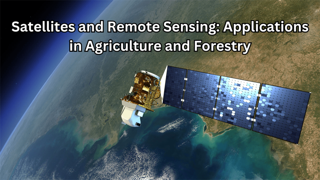
Remote sensing refers to the process of gathering information about objects or areas from a distance, typically using sensors on satellites or aircraft. Unlike traditional on-the-ground methods, remote sensing allows for the collection of data across vast areas with high accuracy and frequency. This technology encompasses a range of sensors, including optical, radar, and thermal, each capturing different types of data such as visible light, electromagnetic waves, and heat emissions. Satellites are the backbone of remote sensing. These orbiting platforms are equipped with advanced sensors that capture images and data across various wavelengths of the electromagnetic spectrum. Depending on their design and purpose, satellites can monitor anything from weather patterns and sea surface temperatures to crop health and forest cover. The data collected by these satellites is then processed and analyzed to provide actionable insights that can be applied in numerous fields, including agriculture and forestry.
Importance of Technology in Agriculture and Forestry
The integration of satellite and remote sensing technology in agriculture and forestry is a game-changer. In agriculture, this technology allows for precision farming, where inputs such as water, fertilizers, and pesticides can be applied more efficiently based on real-time data. Farmers can monitor crop health, estimate yields, and detect problems like pests or diseases early, thereby reducing waste and increasing productivity. This not only boosts profitability but also contributes to environmental sustainability by minimizing the overuse of resources. In forestry, remote sensing plays a crucial role in monitoring forest health, detecting deforestation, and managing resources sustainably. Forest managers can track changes in forest cover, assess the impact of climate change, and monitor biodiversity. This is particularly important in efforts to combat illegal logging and to protect vital ecosystems that are essential for carbon sequestration and biodiversity conservation.
Purpose and Scope of the Article
This article aims to provide a comprehensive overview of how satellites and remote sensing technologies are revolutionizing agriculture and forestry. By exploring the various applications, benefits, challenges, and future trends, the article will offer insights into the transformative potential of these technologies. Whether you are a farmer, forester, researcher, or policymaker, this article will equip you with the knowledge needed to understand and leverage satellite and remote sensing data in your field. From precision agriculture to sustainable forest management, the article will cover a broad spectrum of topics, illustrating how these cutting-edge technologies are shaping the future of agriculture and forestry.
Understanding Satellites and Remote Sensing
What is Remote Sensing?
Remote sensing is a technology that involves gathering information about objects or areas from a distance, typically using sensors on satellites or aircraft. This process allows for the collection of data across large areas without direct contact, making it an essential tool for monitoring and managing natural resources. By capturing data in various spectral bands, remote sensing provides detailed insights into the Earth’s surface and atmosphere, supporting applications in agriculture, forestry, environmental monitoring, and more.
Types of Satellites Used in Remote Sensing
Different types of satellites are utilized in remote sensing, each equipped with specific sensors designed to capture various types of data. The primary types of satellites include optical satellites, radar satellites, and thermal satellites. These satellites operate in various orbits and altitudes, providing a diverse range of data for numerous applications across different fields.
Optical Satellites
Optical satellites capture images of the Earth’s surface using visible, near-infrared, and shortwave infrared light. These satellites function similarly to digital cameras, collecting data by detecting the reflection of sunlight off the Earth’s surface. The images produced are highly detailed and are extensively used in applications like land use mapping, crop monitoring, and urban planning. Optical satellites are particularly valuable in agriculture, helping to assess crop health, soil conditions, and yield predictions.
Radar Satellites
Radar satellites use synthetic aperture radar (SAR) technology to capture images by transmitting microwave signals and measuring the reflected signals from the Earth’s surface. Unlike optical satellites, radar satellites can operate in all weather conditions, including during cloud cover and at night. This makes them crucial for monitoring areas frequently covered by clouds or during adverse weather. Radar satellites are widely used in forestry for detecting deforestation, mapping forest cover, and monitoring soil moisture in agriculture.
Thermal Satellites
Thermal satellites are equipped with sensors that detect infrared radiation emitted by the Earth’s surface, measuring temperature variations across different areas. These satellites provide data on heat emissions, making them useful for monitoring temperature changes, identifying heat stress in crops, and detecting wildfires. In agriculture, thermal satellites help manage irrigation by identifying areas of water stress, while in forestry, they are used for tracking forest fires and assessing urban heat islands in urban planning.
How Satellites Gather Data
Satellites gather data by capturing electromagnetic radiation reflected or emitted by the Earth’s surface and atmosphere. The sensors on these satellites detect specific wavelengths of light, which correspond to different types of information. The collected data is transmitted back to Earth, where it undergoes processing and analysis to generate useful insights for various applications, from agricultural monitoring to disaster management.
Passive vs. Active Sensing
Satellites gather data through either passive or active sensing methods. Passive sensors detect natural radiation emitted by the Earth’s surface or reflected sunlight, which is commonly used by optical and thermal satellites. Active sensors, such as those on radar satellites, emit their own signals (like microwaves) and measure the reflected signals, allowing for data collection regardless of lighting or weather conditions. Both methods play a crucial role in providing comprehensive data for remote sensing applications.
Data Processing and Analysis Techniques
Once satellite data is collected, it undergoes several stages of processing to transform raw information into usable insights. The processing pipeline includes data preprocessing, classification, image analysis, and interpretation. These steps involve correcting errors, categorizing data, applying image processing techniques, and drawing conclusions from the analyzed data. Advanced technologies like artificial intelligence and machine learning are increasingly integrated into these processes, enhancing the accuracy and efficiency of remote sensing in agriculture and forestry.
Applications in Agriculture
Crop Monitoring and Management
Crop monitoring and management have become significantly more precise and efficient with the advent of satellite technology. Satellites provide farmers with real-time data on various aspects of crop health, soil conditions, and environmental factors that influence agricultural productivity. This technology allows for continuous observation over large areas, enabling farmers to detect issues early and take timely action. Whether it’s assessing the impact of weather changes, identifying areas of water stress, or monitoring the spread of pests, satellite data empowers farmers to optimize their crop management practices, reduce waste, and enhance overall yield.
Satellite-Based Crop Health Assessment
Satellite-based crop health assessment involves using remote sensing technology to monitor the physiological state of crops throughout the growing season. Satellites equipped with optical sensors capture images in various spectral bands, which are then analyzed to determine the health and vigor of plants. For example, the Normalized Difference Vegetation Index (NDVI) is a commonly used indicator derived from satellite imagery that measures the density and health of vegetation. By analyzing NDVI and other vegetation indices, farmers can identify areas where crops may be under stress due to factors like nutrient deficiency, disease, or water scarcity. This information allows for targeted interventions, such as adjusting irrigation or applying fertilizers, to maintain optimal crop health.
Monitoring Crop Growth and Yield Estimation
Satellites play a crucial role in monitoring crop growth and estimating yields by providing continuous data on the development of crops over time. Through the analysis of satellite imagery, farmers can track the growth stages of their crops, measure biomass accumulation, and predict harvest times. Additionally, satellite data can be used to model and estimate crop yields based on factors such as plant health, soil moisture, and weather conditions. This capability is especially valuable for large-scale farming operations, where traditional on-the-ground monitoring may be impractical. By providing accurate and timely yield predictions, satellite technology helps farmers make informed decisions about harvest planning, marketing, and resource allocation, ultimately leading to increased efficiency and profitability.
Precision Agriculture
Precision agriculture is a farming management approach that uses technology, such as satellite data, to optimize field-level management regarding crop farming. The goal of precision agriculture is to ensure that crops and soil receive exactly what they need for optimal health and productivity. By utilizing data gathered from satellites, farmers can make more informed decisions about planting, watering, fertilizing, and harvesting. This approach not only enhances crop yields but also minimizes the environmental impact by reducing the overuse of inputs like water, fertilizers, and pesticides. Precision agriculture represents a significant shift from traditional farming methods, offering a more sustainable and efficient way to manage agricultural resources.
Variable Rate Application of Inputs
One of the key components of precision agriculture is the variable rate application (VRA) of inputs, which allows farmers to apply fertilizers, pesticides, and water at different rates across a field. Satellite data provides detailed information on the variability within a field, such as soil fertility, moisture levels, and crop health. This data is used to create application maps, guiding machinery to deliver the exact amount of inputs needed in specific areas, rather than applying a uniform rate across the entire field. By applying inputs more precisely, farmers can reduce waste, lower costs, and minimize the environmental impact of their operations, leading to a more sustainable farming practice.
Soil Moisture and Nutrient Monitoring
Monitoring soil moisture and nutrient levels is critical for maintaining healthy crops and optimizing agricultural productivity. Satellites equipped with remote sensing technology can detect variations in soil moisture and nutrient content across large areas. This data enables farmers to monitor the moisture levels in their fields in real-time, ensuring that crops receive the right amount of water at the right time. Similarly, nutrient monitoring allows farmers to identify areas where the soil may be deficient in essential nutrients, enabling targeted fertilization. By providing precise, up-to-date information on soil conditions, satellite technology helps farmers optimize their irrigation and fertilization practices, leading to healthier crops, improved yields, and more efficient use of resources.
Irrigation Management
Irrigation management is a critical aspect of modern agriculture, ensuring that crops receive the right amount of water at the right time to maximize growth and yield. With the help of satellite technology, farmers can now manage irrigation more effectively by accessing real-time data on soil moisture levels, weather patterns, and crop water needs. This data-driven approach allows for precise irrigation scheduling, reducing water waste and preventing over-irrigation, which can lead to issues such as waterlogging and nutrient runoff. By optimizing water use, satellite-assisted irrigation management not only improves crop health and productivity but also contributes to the sustainable use of water resources.
Monitoring Water Usage with Satellites
Satellites provide an invaluable tool for monitoring water usage in agricultural fields. Through remote sensing, satellites can detect variations in soil moisture and track how water is distributed and absorbed across different areas of a field. This information allows farmers to identify areas that are over- or under-watered and adjust their irrigation practices accordingly. Additionally, satellites can monitor water usage trends over time, helping farmers and water managers to assess the efficiency of irrigation systems and make necessary improvements. By providing a comprehensive view of water usage, satellites enable more efficient water management, reducing waste and conserving this vital resource.
Drought Detection and Response
Drought poses a significant threat to agriculture, leading to reduced crop yields and increased vulnerability to pests and diseases. Satellite technology plays a crucial role in detecting and responding to drought conditions by providing early warning signs of water stress in crops and soil. Satellites can monitor changes in vegetation health, soil moisture levels, and surface temperatures, all of which are indicators of drought. By analyzing this data, farmers can take proactive measures to mitigate the impact of drought, such as adjusting irrigation schedules, selecting drought-resistant crops, or implementing water conservation strategies. Early detection and timely response to drought conditions, facilitated by satellite technology, are essential for maintaining agricultural productivity and food security in the face of climate variability.
Pest and Disease Management
Pest and disease management is a crucial component of maintaining healthy crops and ensuring high agricultural yields. Traditionally, identifying and managing these threats has relied on manual inspections and localized treatments, which can be time-consuming and less effective on a large scale. However, with the advent of satellite technology, farmers now have access to advanced tools that allow for more efficient and widespread monitoring of pest and disease outbreaks. By analyzing satellite data, farmers can identify areas of concern early, implement targeted interventions, and reduce the spread of pests and diseases across their fields. This approach not only helps to protect crops but also minimizes the need for broad-spectrum pesticides, promoting a more sustainable and environmentally friendly approach to agriculture.
Early Detection of Pests and Diseases
Early detection is key to effective pest and disease management in agriculture. Satellites equipped with remote sensing technology can monitor vast agricultural areas and detect subtle changes in vegetation that may indicate the presence of pests or diseases. For example, variations in crop color, texture, or growth patterns captured by satellites can signal stress caused by infestations or infections. By identifying these issues early, farmers can take swift action to control the spread, whether through targeted pesticide application, biological control methods, or other management strategies. Early detection not only helps to minimize crop damage but also reduces the overall cost and environmental impact of pest and disease control measures.
Satellite-Based Surveillance Systems
Satellite-based surveillance systems provide a powerful tool for continuous monitoring of pest and disease threats in agriculture. These systems integrate satellite imagery with advanced data analytics to track the spread of pests and diseases across large geographic areas. By combining historical data, weather patterns, and real-time satellite observations, these systems can predict potential outbreaks and provide early warnings to farmers and agricultural authorities. This proactive approach enables more effective and coordinated pest and disease management efforts, helping to protect crops on a regional or even global scale. Satellite-based surveillance is particularly valuable in monitoring migratory pests, such as locusts, where timely intervention is critical to preventing widespread crop destruction.
Harvest Optimization
Harvest optimization involves the strategic planning and execution of crop harvesting to maximize yield, quality, and efficiency. By leveraging satellite technology, farmers can make data-driven decisions about when and where to harvest their crops, ensuring that they are harvested at their peak ripeness and nutritional value. Satellite imagery provides detailed insights into crop maturity, moisture levels, and environmental conditions, allowing farmers to coordinate their harvest operations effectively. This approach not only enhances the quality of the harvested produce but also reduces losses due to overripe or underripe crops, ultimately leading to increased profitability and sustainability in agricultural practices.
Predicting Optimal Harvest Times
Predicting the optimal harvest time is crucial for ensuring that crops are harvested when they are most nutritious and valuable. Satellites play a significant role in this process by continuously monitoring the growth and development of crops throughout the growing season. Using data such as plant vigor, moisture content, and temperature, satellites can provide accurate predictions of when crops will reach their peak maturity. These predictions enable farmers to plan their harvest operations with precision, ensuring that crops are collected at the right time to maximize yield and quality. By predicting optimal harvest times, satellite technology helps to improve overall farm efficiency and reduce post-harvest losses.
Monitoring Harvested Areas and Crop Residue
After the harvest, monitoring the remaining areas and crop residue is essential for planning subsequent farming activities, such as soil preparation and crop rotation. Satellite technology allows farmers to keep track of which areas have been harvested and assess the amount of crop residue left on the fields. This information is valuable for managing soil health, as crop residues can be a source of nutrients for the next planting season or may require removal to prevent pests and diseases. Additionally, monitoring harvested areas helps in the efficient allocation of resources, such as labor and equipment, for post-harvest activities. By providing a comprehensive view of the field after harvest, satellites assist farmers in maintaining the long-term sustainability of their agricultural operations.
Applications in Forestry
Forest Cover Mapping and Monitoring
Forest cover mapping and monitoring are essential tools for understanding the extent, composition, and health of forests around the world. Satellite technology plays a critical role in providing accurate, up-to-date maps of forested areas, allowing for continuous observation of changes over time. By capturing high-resolution images across different spectral bands, satellites can distinguish between various types of vegetation, track the growth or decline of forested areas, and assess the impact of natural events or human activities. This information is vital for managing forest resources, conserving biodiversity, and implementing sustainable land-use practices. With the ability to monitor vast and remote areas, satellite-based forest cover mapping ensures that changes in forest ecosystems are detected early, enabling timely intervention and policy-making.
Deforestation Detection and Forest Degradation
Deforestation and forest degradation pose significant threats to global biodiversity, carbon sequestration, and the livelihoods of millions of people. Satellite technology is a powerful tool for detecting deforestation and monitoring the degradation of forest ecosystems. By comparing satellite images over time, changes in forest cover can be identified, pinpointing areas where deforestation is occurring, whether due to logging, agricultural expansion, or other human activities. Satellites can also detect more subtle signs of forest degradation, such as changes in canopy density, which may indicate illegal logging or forest fires. This real-time monitoring capability is crucial for enforcing environmental regulations, protecting endangered habitats, and mitigating the impacts of deforestation on climate change.
Reforestation and Afforestation Monitoring
Reforestation and afforestation efforts are critical strategies for restoring degraded lands, sequestering carbon, and enhancing biodiversity. Satellite technology plays a key role in monitoring these initiatives by providing detailed information on the progress and effectiveness of planting activities. Satellites can track the growth of newly planted trees, assess the health and density of reforested areas, and ensure that afforestation projects are meeting their environmental goals. This data is essential for evaluating the success of reforestation and afforestation programs, as well as for making informed decisions about future land management and conservation strategies. By offering a comprehensive view of these efforts, satellite monitoring supports the global push towards restoring forests and combating climate change.
Biodiversity and Habitat Mapping
Biodiversity and habitat mapping are crucial for understanding the distribution of species and the ecosystems they inhabit. Satellite technology provides a powerful means of mapping these areas on a large scale, offering detailed insights into the spatial patterns of biodiversity. By capturing data across various spectral bands, satellites can identify different types of vegetation, land cover, and water bodies, which are key components of wildlife habitats. This information is essential for assessing the health and integrity of ecosystems, guiding conservation efforts, and planning land use in a way that supports the preservation of biodiversity. With the ability to monitor remote and inaccessible areas, satellite-based mapping ensures that diverse ecosystems are recognized and protected.
Identifying and Protecting Biodiversity Hotspots
Biodiversity hotspots are regions with exceptionally high levels of species diversity and endemism, often under significant threat from human activities. Identifying these hotspots is critical for prioritizing conservation efforts and protecting the most vulnerable ecosystems. Satellite technology enables the identification of biodiversity hotspots by mapping areas with high levels of species richness, unique habitats, and critical environmental conditions. Once identified, satellites can continuously monitor these areas for signs of environmental change, such as deforestation, habitat fragmentation, or climate-induced shifts. This real-time monitoring is essential for implementing timely conservation measures and ensuring that biodiversity hotspots remain intact. Protecting these areas is not only vital for preserving species diversity but also for maintaining the ecological services that support human well-being.
Monitoring Wildlife Habitats
Monitoring wildlife habitats is a key aspect of conserving biodiversity and ensuring the survival of endangered species. Satellite technology allows for the continuous observation of these habitats, providing data on changes in land cover, vegetation health, and environmental conditions. This information helps conservationists track the movement of wildlife populations, assess the availability of resources such as food and water, and detect potential threats to habitats, such as illegal encroachment or natural disasters. By monitoring wildlife habitats, satellites enable more effective management and protection strategies, ensuring that critical habitats are maintained and that species have the necessary conditions to thrive. This approach supports the long-term conservation of biodiversity and the sustainable management of natural resources.
Forest Health and Fire Monitoring
Forest health and fire monitoring are essential for maintaining the vitality and sustainability of forest ecosystems. Satellite technology provides a comprehensive view of forest conditions, allowing for the assessment of factors such as tree canopy density, leaf health, and overall forest cover. By analyzing satellite images, forest managers can detect early signs of distress, such as changes in vegetation color or density, which may indicate issues like drought, disease, or pest infestations. Additionally, satellites offer valuable insights into fire-prone areas by monitoring temperature variations and detecting hotspots. This information enables proactive management practices to address potential threats and ensure the long-term health of forest ecosystems.
Detecting Forest Diseases and Pests
Early detection of forest diseases and pests is crucial for preventing widespread damage and maintaining forest health. Satellites equipped with advanced sensors can detect subtle changes in vegetation patterns that may indicate the presence of diseases or pests. By analyzing spectral data, such as variations in leaf color or texture, satellites can identify stressed or infected areas before symptoms become widespread. This early detection allows forest managers to implement targeted interventions, such as selective treatments or containment measures, to address outbreaks quickly and effectively. Satellite-based monitoring enhances the ability to manage forest health by providing timely and accurate information on potential threats, reducing the risk of large-scale infestations or disease spread.
Satellite-Based Forest Fire Detection and Management
Satellite-based forest fire detection and management are critical for minimizing the impact of wildfires on ecosystems and communities. Satellites can monitor large forested areas in real-time, detecting heat signatures and smoke that indicate the presence of fires. Advanced sensors, such as thermal infrared detectors, provide early warnings of fire outbreaks by identifying temperature anomalies and potential ignition points. Once a fire is detected, satellites help track its spread and intensity, providing valuable information for coordinating firefighting efforts and resource allocation. This capability allows for rapid response and effective management of forest fires, reducing damage to forests, protecting wildlife, and safeguarding nearby communities. By integrating satellite data into fire management strategies, authorities can enhance their ability to prevent, detect, and respond to wildfires.
Carbon Sequestration and Climate Change
Carbon sequestration is the process by which carbon dioxide (CO2) is captured and stored in natural systems, such as forests, to mitigate climate change. Forests play a crucial role in this process by absorbing CO2 from the atmosphere during photosynthesis and storing it in biomass and soils. This natural carbon sink helps to offset greenhouse gas emissions and reduce the impact of climate change. Satellite technology enhances our understanding of carbon sequestration by providing detailed data on forest cover, biomass density, and changes in vegetation over time. By monitoring these factors, satellites help quantify the carbon storage capacity of forests and assess their contribution to climate change mitigation efforts.
Estimating Carbon Storage in Forests
Estimating carbon storage in forests involves calculating the amount of carbon held in vegetation and soils. Satellites contribute significantly to this process by providing high-resolution imagery and data on forest structure, tree height, canopy cover, and biomass. Using remote sensing techniques, researchers can estimate the volume of forest biomass and apply models to calculate the amount of carbon stored. This information is crucial for developing accurate carbon inventories, reporting to climate agreements, and assessing the effectiveness of forest management practices in sequestering carbon. Regular monitoring through satellites ensures that estimates of carbon storage are up-to-date and reflect changes due to factors such as deforestation, reforestation, and natural disturbances.
Monitoring the Impact of Climate Change on Forests
Climate change has profound effects on forest ecosystems, including shifts in species distribution, changes in growth patterns, and increased vulnerability to pests and diseases. Satellite technology provides a valuable tool for monitoring these impacts by offering real-time and historical data on forest health, vegetation cover, and environmental conditions. By analyzing satellite imagery, scientists can track changes in forest composition, detect signs of stress or decline, and assess the effects of altered climate conditions on forest ecosystems. This monitoring helps to identify areas at risk, evaluate the effectiveness of adaptation strategies, and inform policy decisions aimed at protecting forests in a changing climate. Satellites thus play a critical role in understanding and managing the impacts of climate change on forest environments.
Sustainable Forest Management
Sustainable forest management (SFM) aims to maintain and enhance the economic, social, and environmental values of forests while ensuring their long-term health and productivity. This approach involves managing forests in a way that balances the needs for timber production, biodiversity conservation, and ecosystem services. Satellite technology supports sustainable forest management by providing comprehensive data on forest cover, health, and changes over time. With real-time monitoring, forest managers can make informed decisions about land use, detect illegal logging activities, and implement conservation measures. By integrating satellite data into SFM practices, stakeholders can ensure that forests are managed responsibly and sustainably, supporting both current and future generations.
Planning and Monitoring Sustainable Logging
Effective planning and monitoring of sustainable logging practices are essential for minimizing the environmental impact of timber extraction. Satellite technology plays a crucial role in this process by providing detailed information on forest structure, distribution, and logging activities. By analyzing satellite imagery, forest managers can plan logging operations with precision, ensuring that only selected areas are harvested and that critical habitats are preserved. Additionally, satellite-based monitoring helps track compliance with logging plans and regulations, detect unauthorized activities, and assess the impact of logging on forest ecosystems. This approach ensures that logging practices are sustainable and that the forest’s ecological balance is maintained.
Forest Certification and Compliance Monitoring
Forest certification and compliance monitoring are key components of ensuring that forest management practices meet established environmental and sustainability standards. Certification programs, such as those from the Forest Stewardship Council (FSC) and the Program for the Endorsement of Forest Certification (PEFC), require rigorous adherence to sustainable practices. Satellites support these programs by providing independent verification of forest management practices and monitoring compliance with certification standards. Through satellite imagery, certifying bodies can assess forest conditions, verify logging activities, and track changes in forest cover. This objective oversight helps ensure that certified forests are managed according to best practices, supporting the credibility of certification programs and promoting sustainable forestry globally.
Challenges and Limitations
Technical Challenges
The use of satellite technology in agriculture and forestry presents several technical challenges that must be addressed to maximize its effectiveness. One major challenge is the integration of satellite data with other sources of information, such as ground-based measurements and historical records. This integration requires sophisticated algorithms and data fusion techniques to ensure consistency and accuracy across different data types. Additionally, the performance of satellite sensors can be affected by factors such as atmospheric conditions, sensor calibration, and the angle of observation, which can introduce errors or distortions in the data. Overcoming these technical challenges involves continuous advancements in sensor technology, data processing techniques, and calibration methods to enhance the reliability and utility of satellite-based information.
Resolution and Accuracy Issues
Resolution and accuracy are critical factors that impact the effectiveness of satellite-based monitoring in agriculture and forestry. Resolution refers to the level of detail that a satellite sensor can capture, with higher resolution providing more precise information but requiring more data storage and processing power. Accurate measurements are essential for applications such as crop monitoring, forest health assessment, and deforestation detection. However, limitations in sensor resolution can lead to challenges in distinguishing between different types of vegetation, detecting small changes, or monitoring fine-scale phenomena. Addressing these issues involves selecting the appropriate satellite sensors with suitable resolution and accuracy for specific applications and employing advanced image processing techniques to enhance data quality.
Data Processing and Interpretation Complexities
Data processing and interpretation are complex tasks that involve transforming raw satellite data into actionable insights. The vast amounts of data generated by satellites require robust processing systems and algorithms to handle tasks such as data calibration, noise reduction, and feature extraction. Interpreting this data involves analyzing various spectral bands, indices, and patterns to derive meaningful information related to crop health, forest cover, or environmental conditions. The complexity of data processing and interpretation is further compounded by the need to integrate satellite data with other sources and account for factors such as temporal changes and spatial variations. To address these complexities, researchers and practitioners rely on advanced software tools, machine learning algorithms, and expertise in remote sensing to ensure accurate and actionable results from satellite data.
Economic and Accessibility Challenges
Economic and accessibility challenges are significant barriers to the widespread adoption of satellite technology in agriculture and forestry. These challenges can impact the ability of various stakeholders to leverage satellite data effectively and integrate it into their practices.
Cost of Satellite Data and Equipment
The cost of satellite data and equipment is a major economic challenge. High-resolution satellite imagery and advanced sensors often come with substantial price tags, making them less accessible to small-scale farmers and smaller forestry operations. Additionally, the costs associated with maintaining and operating satellite systems, including data storage and processing infrastructure, can be prohibitively high. This financial barrier limits the ability of many stakeholders to afford and utilize cutting-edge satellite technology. To mitigate this issue, there are efforts to provide more affordable data options, develop cost-effective sensor technologies, and offer subsidized or open-access satellite data through various programs and initiatives.
Accessibility for Small-Scale Farmers and Foresters
Accessibility is another significant challenge, particularly for small-scale farmers and foresters who may lack the resources and technical expertise to utilize satellite data effectively. Small-scale operations often face difficulties in accessing high-quality satellite imagery and integrating it into their decision-making processes. The complexity of satellite data and the need for specialized software and training further exacerbate this issue. To improve accessibility, initiatives are underway to develop user-friendly platforms, offer training programs, and provide support services tailored to smaller operations. Additionally, partnerships between governments, NGOs, and technology providers aim to facilitate access to satellite data and tools for small-scale stakeholders, helping them to benefit from advancements in remote sensing technology.
Environmental and Ethical Concerns
The deployment and operation of satellite technology in agriculture and forestry raise various environmental and ethical concerns that need careful consideration. These concerns encompass the potential environmental impact of satellite infrastructure, as well as issues related to data privacy and security.
Satellite Debris and Environmental Impact
The accumulation of satellite debris, or space junk, is a growing environmental concern. As the number of satellites in orbit increases, so does the risk of collisions, which can create additional debris and exacerbate the problem. This debris poses a hazard not only to operational satellites but also to other space missions and the broader space environment. The environmental impact of satellite launches, including the carbon footprint of rocket launches and the potential for chemical pollution, also needs to be addressed. To mitigate these issues, space agencies and organizations are working on strategies for debris removal, designing satellites for end-of-life disposal, and developing sustainable launch practices to reduce the environmental footprint of space technology.
Privacy and Data Security Issues
Privacy and data security are critical ethical concerns in the use of satellite technology. Satellites collect vast amounts of data that can include sensitive information about agricultural practices, forest management activities, and land use. Ensuring that this data is handled securely and that privacy is maintained is essential to prevent unauthorized access and misuse. Data security measures must include encryption, access controls, and robust data management practices to protect sensitive information from potential breaches. Additionally, clear policies and regulations are needed to govern the use and sharing of satellite data to ensure that privacy rights are respected and that data is used ethically and transparently. Addressing these privacy and data security concerns is crucial for maintaining public trust and ensuring the responsible use of satellite technology.
Future Trends and Innovations
Advancements in Satellite Technology
Advancements in satellite technology are continually enhancing our ability to monitor and manage agricultural and forestry practices with greater precision and efficiency. Recent developments have focused on improving the capabilities of satellite sensors, increasing data resolution, and integrating advanced analytical tools to derive more actionable insights from satellite imagery. These advancements have expanded the potential applications of satellite technology, enabling more detailed observations of environmental changes, better management of natural resources, and more effective responses to global challenges.
Higher Resolution Imaging and Hyperspectral Sensors
Higher resolution imaging and hyperspectral sensors represent significant technological advancements in satellite capabilities. Improved resolution allows for more detailed and precise observations of the Earth’s surface, enabling the detection of finer features and changes in vegetation, land use, and environmental conditions. Hyperspectral sensors, which capture data across a wide range of wavelengths, provide detailed information on the chemical composition and health of vegetation, soil properties, and water quality. These sensors enhance the ability to identify specific plant species, monitor crop health, and detect subtle environmental changes, leading to more accurate and comprehensive analyses.
Integration of AI and Machine Learning in Data Analysis
The integration of artificial intelligence (AI) and machine learning in satellite data analysis is transforming the way we process and interpret satellite imagery. AI algorithms and machine learning models can analyze vast amounts of data more efficiently than traditional methods, identifying patterns, trends, and anomalies with greater accuracy. These technologies enable automated classification of land cover, prediction of crop yields, and detection of environmental changes. By leveraging AI and machine learning, researchers and practitioners can extract valuable insights from satellite data faster and more reliably, enhancing decision-making and improving the management of agricultural and forestry resources. The ongoing development of these technologies promises further advancements in the capabilities and applications of satellite-based monitoring.
Emerging Applications in Agriculture and Forestry
Emerging applications of satellite technology are revolutionizing how agriculture and forestry are managed. Innovations in satellite capabilities are enabling new approaches to monitoring and managing natural resources. These applications include precision agriculture, where satellites provide detailed data on crop health and soil conditions to optimize farming practices. In forestry, satellites are used to monitor forest health, track deforestation, and manage reforestation efforts. Emerging technologies also include the use of satellites for assessing the impacts of climate change, monitoring biodiversity, and managing water resources. These advancements are making it possible to address complex environmental challenges more effectively and sustainably.
Satellites for Urban Forestry and Agroforestry
Satellites are increasingly being used to enhance urban forestry and agroforestry practices. In urban areas, satellites help manage and monitor green spaces, track tree health, and plan urban greening initiatives. They provide valuable data on tree canopy coverage, assess the impact of urban development on green spaces, and support the planning of new urban forests. In agroforestry, satellites assist in managing mixed-use landscapes where agriculture and forestry intersect. They help monitor crop and tree health, evaluate land use changes, and support the integration of trees into agricultural systems for improved sustainability and productivity. By providing comprehensive spatial data, satellites enable better planning and management of both urban and rural green spaces.
Integration with IoT and Ground-Based Sensors
The integration of satellite technology with Internet of Things (IoT) devices and ground-based sensors is enhancing the precision and effectiveness of monitoring and management in agriculture and forestry. IoT devices, such as soil moisture sensors and weather stations, collect real-time data from the field, which can be combined with satellite imagery to provide a more complete picture of environmental conditions. This integration allows for more accurate assessments of soil health, crop growth, and forest conditions. By combining satellite data with ground-based measurements, practitioners can make more informed decisions, optimize resource use, and respond more effectively to changes in the environment. This synergy between satellites, IoT, and ground-based sensors is paving the way for more advanced and integrated approaches to managing natural resources.
Potential Impact of Future Innovations
Future innovations in satellite technology are poised to significantly impact agriculture and forestry, driving improvements in sustainability, efficiency, and resilience. Advancements in satellite sensors, data analytics, and integration with other technologies promise to enhance our ability to monitor and manage natural resources. Emerging innovations, such as more advanced hyperspectral sensors, higher resolution imaging, and real-time data processing, will provide even more detailed and accurate information. Additionally, the integration of artificial intelligence (AI) and machine learning will enable more sophisticated analyses and predictive capabilities. These innovations will help address key challenges such as climate change, resource depletion, and environmental degradation, ultimately leading to more effective and sustainable practices in agriculture and forestry.
Enhancing Sustainability and Resilience
The continued advancement of satellite technology will play a critical role in enhancing the sustainability and resilience of agricultural and forestry systems. By providing detailed, real-time data on environmental conditions, satellite technology enables better management practices that reduce resource use, minimize waste, and protect ecosystems. For example, precision agriculture supported by satellite data can optimize water and nutrient use, reducing runoff and soil degradation. In forestry, satellites can monitor forest health and detect early signs of stress, allowing for timely interventions that improve ecosystem resilience. Future innovations will further enhance these capabilities, enabling more adaptive and proactive approaches to managing natural resources in the face of changing environmental conditions and increasing pressures.
Revolutionizing Global Food Security and Forest Conservation
Future innovations in satellite technology have the potential to revolutionize global food security and forest conservation efforts. In agriculture, advanced satellite-based monitoring will improve crop management, enhance yield forecasting, and support precision farming practices that increase productivity while minimizing environmental impact. This will contribute to greater food security by enabling farmers to produce more food with fewer resources. In forest conservation, satellites will provide critical data for tracking deforestation, monitoring biodiversity, and managing reforestation projects. Enhanced capabilities for detecting illegal activities and assessing the impacts of climate change will support more effective conservation strategies and protect vital forest ecosystems. By leveraging these advancements, we can make significant strides towards achieving global food security and preserving the health and integrity of our forests.
Summary
Satellites and remote sensing technology and remote sensing have become indispensable tools in modern agriculture and forestry, offering unprecedented capabilities for monitoring and managing natural resources. These technologies provide detailed, real-time data that enhance our understanding of crop health, forest conditions, and environmental changes. Through advancements in resolution, sensor technology, and data analysis, satellites are transforming how we approach resource management, from precision agriculture to forest conservation. Future innovations promise to further expand these capabilities, offering new solutions for sustainability, resilience, and global food security.
Recap of Key Points
- Satellite Technology: Satellites offer high-resolution imaging and advanced sensors that provide valuable data for monitoring and managing agriculture and forestry. Innovations in imaging and hyperspectral sensors improve the precision of observations, while AI and machine learning enhance data analysis.
- Applications: Satellites are used for various applications, including crop monitoring, pest and disease management, irrigation, and forest health. They support sustainable practices by providing insights into resource use, detecting environmental changes, and guiding effective interventions.
- Challenges: Technical, economic, and accessibility challenges impact the adoption of satellite technology. Issues such as high costs, resolution limitations, and data processing complexities need to be addressed to maximize the benefits of remote sensing.
- Future Innovations: Emerging technologies and integration with IoT devices promise to enhance the capabilities of satellite monitoring. These innovations will contribute to greater sustainability, improved resource management, and more effective conservation efforts.
The Transformative Potential of Satellites and Remote Sensing
The transformative potential of satellites and remote sensing lies in their ability to provide comprehensive, real-time data that drives informed decision-making and effective management in agriculture and forestry. By offering detailed insights into environmental conditions and resource use, satellites enable more precise and sustainable practices. They play a crucial role in monitoring changes, optimizing resource use, and addressing global challenges such as climate change and food security. The continuous advancement of satellite technology holds the promise of further enhancing these capabilities, leading to significant improvements in how we manage and conserve natural resources.
Looking Ahead: The Future of Agriculture and Forestry
Looking ahead, the future of agriculture and forestry will be significantly shaped by advancements in satellite technology and remote sensing. Innovations in sensor technology, data integration, and analytical tools will provide even deeper insights into environmental conditions and resource management. The integration of AI, machine learning, and IoT devices will enable more sophisticated and adaptive approaches to managing crops, forests, and ecosystems. As these technologies continue to evolve, they will play a critical role in addressing the challenges of sustainability, resilience, and global food security, paving the way for a more sustainable and efficient future in agriculture and forestry.
FAQs
What are the main benefits of using satellites in agriculture?
Satellites provide numerous advantages in agriculture, including precise monitoring of crop health, soil conditions, and overall farm management. They enable enhanced productivity by optimizing planting times, irrigation, and nutrient management. Early detection of pests and diseases through satellite imagery allows for timely interventions, reducing potential damage. Additionally, satellites help in efficient resource use by guiding water and fertilizer applications, which lowers costs and minimizes environmental impact. They also support accurate yield forecasting, aiding in better planning and market strategies.
How do satellites help in monitoring forest health?
Satellites are instrumental in monitoring forest health by offering real-time observations of forest conditions, such as canopy cover and tree density. They assist in early detection of forest diseases and pests by identifying changes in vegetation patterns. Satellites track deforestation and assess the impact of land-use changes, contributing to forest conservation efforts. They also measure forest biomass and carbon storage, which supports climate change mitigation. Furthermore, satellites detect and monitor forest fires, facilitating effective management and response strategies.
What challenges do farmers and foresters face when using satellite technology?
Farmers and foresters face several challenges with satellite technology, including high costs of resolution imagery and equipment, which can be prohibitive for small-scale operations. Resolution limitations of some satellites may hinder the detection of fine-scale changes or features. Data processing and interpretation require complex and technical expertise, making it difficult for some users. Integrating satellite data with ground-based information and existing management systems can also be challenging. Additionally, the need for specialized knowledge and training to effectively utilize satellite technology can be a barrier.
How will future satellite innovations impact agriculture and forestry?
Future innovations in satellite technology are expected to greatly impact agriculture and forestry by enhancing resolution and imaging capabilities, leading to more detailed observations. Advancements in AI and machine learning will improve data analysis and predictive capabilities, offering more sophisticated insights. Better integration with IoT devices and ground-based sensors will provide a comprehensive view of environmental conditions. Innovations will support sustainability by optimizing resource use and improving conservation efforts. Additionally, emerging technologies may reduce costs and expand accessibility, benefiting a wider range of users.
Is remote sensing technology accessible to small-scale farmers and foresters?
Remote sensing technology presents accessibility challenges for small-scale farmers and foresters due to high costs and the complexity of data and equipment. Specialized software and expertise are often required to fully utilize satellite data, which may be beyond the reach of smaller operations. However, efforts are being made to address these issues by offering more affordable data options, developing user-friendly platforms, and providing training and support tailored to smaller-scale users. These initiatives aim to make remote sensing technology more accessible and beneficial for a broader audience in agriculture and forestry.