Table of Contents
Introduction
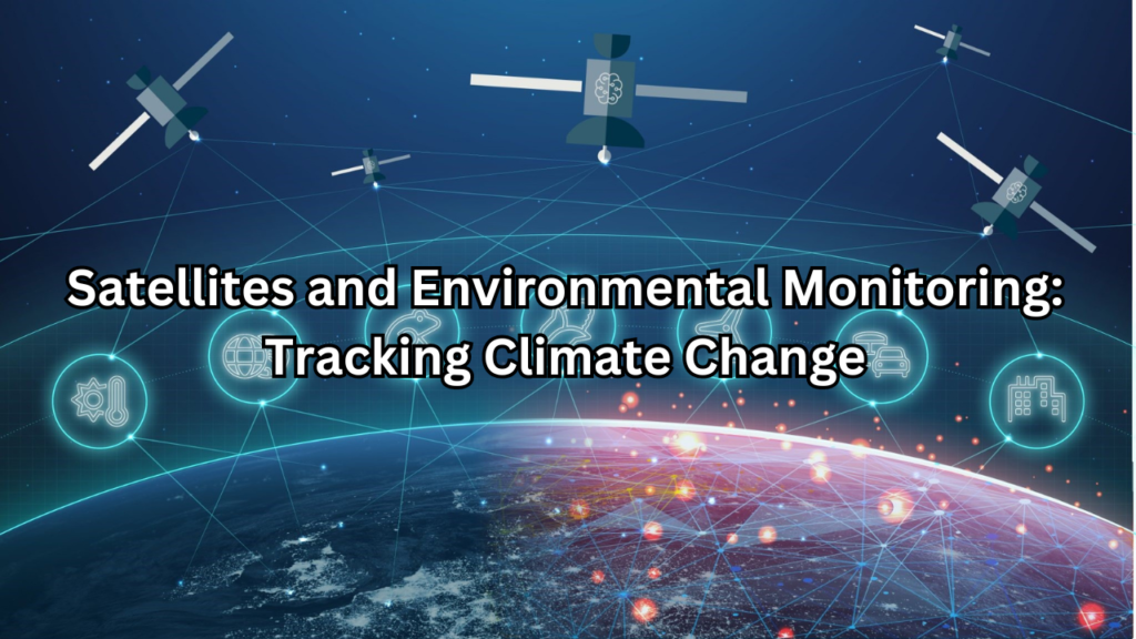
Satellites and environmental monitoring have become indispensable tools in the quest to understand and manage our planet’s environment. They provide a unique vantage point from space, allowing for comprehensive and continuous observation of Earth’s systems. This aerial perspective is crucial for tracking environmental changes, assessing natural disasters, and monitoring climate patterns with unprecedented accuracy and scope. Satellites equipped with remote sensing technology capture data on a wide range of environmental variables, including atmospheric composition, land use, ocean conditions, and more. This data is essential for scientists and policymakers to evaluate the health of our planet, understand the impacts of human activities, and predict future changes. As the effects of climate change become increasingly evident, the role of satellites in environmental monitoring grows even more critical. By offering real-time insights and long-term trends, satellites help us to identify and address environmental issues before they escalate. They enable more effective management of natural resources, support disaster response efforts, and inform international climate agreements.
Overview of Satellites and Environmental Monitoring
Satellites have revolutionized the way we monitor and understand our planet. They provide a bird’s-eye view of Earth, offering invaluable data on various environmental factors. Through remote sensing technology, satellites can capture images and measurements from space, covering vast areas with precision and consistency. This capability is crucial for tracking environmental changes, assessing natural disasters, and monitoring climate patterns. The integration of satellite data into environmental science has enabled scientists to detect trends and anomalies that might otherwise go unnoticed, leading to more informed decisions and policies.
Importance of Monitoring Climate Change
Monitoring climate change is essential for several reasons. First, it allows us to track and understand the impacts of global warming, such as rising temperatures, melting ice caps, and shifting weather patterns. This knowledge is critical for predicting future climate scenarios and preparing for potential consequences. Second, climate monitoring helps in assessing the effectiveness of mitigation strategies and adapting to changing conditions. Accurate data is necessary for formulating effective policies and strategies to combat climate change. Lastly, understanding climate dynamics aids in safeguarding ecosystems, protecting biodiversity, and ensuring the resilience of natural and human systems.
Historical Context: From Early Weather Satellites to Modern Environmental Satellites
The journey of Satellites and environmental monitoring began in the early 1960s with the launch of the first weather satellites. These early satellites, such as TIROS (Television Infrared Observation Satellite), were primarily designed to observe and predict weather patterns. They marked a significant milestone by providing real-time data on atmospheric conditions, which was previously unavailable. As technology advanced, so did the capabilities of environmental satellites. In the 1970s, the launch of the Landsat program represented a breakthrough in Earth observation, offering detailed imagery of the Earth’s surface and enabling the study of land use changes and environmental conditions. This era also saw the introduction of geostationary satellites, which provided continuous, real-time monitoring of weather systems and climate phenomena.
The Role of Satellites in Climate Change Monitoring
Weather Satellites
Weather satellites are designed primarily to observe and predict atmospheric conditions. They provide real-time data on weather patterns, including temperature, humidity, cloud cover, and precipitation. These satellites are crucial for weather forecasting and climate research. They orbit the Earth in geostationary orbits, allowing them to continuously monitor the same region, which is essential for tracking storm systems, weather fronts, and long-term climate trends. Notable examples include the GOES (Geostationary Operational Environmental Satellites) series and the Meteosat satellites operated by the European Space Agency (ESA).
Earth Observation Satellites
Earth observation satellites focus on monitoring and analyzing the Earth’s surface and subsurface. They capture high-resolution images and data on land use, vegetation, urban development, and natural resources. These satellites are pivotal for environmental management, disaster response, and resource assessment. They orbit the Earth in polar orbits, passing over different regions with each orbit, which allows them to provide global coverage. Prominent examples are the Landsat satellites, which have been providing detailed imagery of the Earth’s surface for decades, and the Copernicus Sentinel satellites, which offer extensive data on various environmental parameters.
Specialized Climate Satellites
Specialized climate satellites are designed to monitor specific aspects of the climate system. They focus on collecting data related to greenhouse gases, ocean temperatures, ice cover, and other critical climate indicators. These satellites provide insights into long-term climate trends and help track changes in atmospheric composition and Earth’s energy balance. Examples include the NASA Aura satellite, which measures atmospheric composition, and the ESA CryoSat-2, which monitors polar ice thickness.
Key Technologies in Satellite Monitoring
Remote Sensing
Remote sensing is the technology used by satellites to collect data about the Earth’s surface without physical contact. It involves capturing electromagnetic radiation reflected or emitted by objects and converting this information into digital data. Remote sensing encompasses various types of sensors, including optical, thermal, and microwave sensors, each providing different types of data. This technology is fundamental for creating detailed images and maps of the Earth, assessing environmental changes, and monitoring natural disasters.
Spectroradiometers
Spectroradiometers are instruments that measure the intensity of electromagnetic radiation across different wavelengths. They are used in satellites to analyze the spectral properties of Earth’s surface and atmosphere. By measuring how different materials absorb and reflect light at various wavelengths, spectroradiometers can provide detailed information on land cover, vegetation health, and atmospheric composition. This data is crucial for understanding ecological changes and monitoring climate variables.
Radar and Lidar Systems
Radar and Lidar systems are advanced technologies used to measure distance and detect objects on Earth’s surface. Radar (Radio Detection and Ranging) systems use radio waves to create images of the Earth’s surface, even through clouds and darkness. They are particularly useful for monitoring surface topography, vegetation, and changes due to natural events such as floods or landslides. Lidar (Light Detection and Ranging) systems use laser light to measure distances and create high-resolution 3D maps of the Earth’s surface. Lidar is effective for analyzing forest canopies, measuring ice thickness, and assessing terrain elevation. Both technologies are essential for detailed environmental monitoring and mapping.
Satellite Data and Climate Change Indicators
Measuring Atmospheric Composition
Carbon Dioxide Levels
Satellites play a critical role in measuring atmospheric carbon dioxide (CO₂) levels, a key greenhouse gas driving climate change. Instruments aboard satellites can detect and quantify CO₂ concentrations by analyzing the absorption of infrared radiation as it passes through the Earth’s atmosphere. The data collected helps scientists understand spatial and temporal variations in CO₂ levels, assess sources and sinks of carbon, and evaluate the effectiveness of climate policies aimed at reducing greenhouse gas emissions. Notable satellites for measuring CO₂ include NASA’s Orbiting Carbon Observatory-2 (OCO-2) and the European Space Agency’s (ESA) Sentinel-5P.
Methane Concentrations
Methane (CH₄) is another potent greenhouse gas whose levels are closely monitored by satellites. Methane has a much higher global warming potential than CO₂, making its measurement crucial for understanding and mitigating climate change. Satellites equipped with specialized sensors can detect methane concentrations through its absorption of infrared light. These measurements help identify major methane sources, such as natural gas facilities, wetlands, and livestock, and track changes in atmospheric methane over time. The NASA’s MethaneSAT and ESA’s Sentinel-5P are key satellites for methane monitoring.
Monitoring Ocean Parameters
Sea Surface Temperatures
Sea surface temperature (SST) is a critical parameter for studying ocean health and climate change. Satellites measure SST by detecting the thermal radiation emitted from the ocean surface. This data is essential for understanding ocean currents, weather patterns, and marine ecosystems. Changes in SST can indicate shifts in climate, influence weather events like hurricanes, and affect marine biodiversity. Satellites such as the NOAA’s Advanced Very High Resolution Radiometer (AVHRR) and ESA’s Sentinel-3 provide valuable SST data.
Ocean Color and Algal Blooms
Monitoring ocean color is crucial for assessing the health of marine environments and detecting algal blooms. Satellites use remote sensing to analyze the color of the ocean, which reflects the presence of phytoplankton and other substances. Changes in ocean color can indicate the occurrence of harmful algal blooms, which can impact marine life and human health. Instruments such as NASA’s MODIS (Moderate Resolution Imaging Spectroradiometer) and ESA’s Sentinel-3 OLCI (Ocean and Land Colour Instrument) provide detailed data on ocean color and help track algal bloom events.
Tracking Land Changes
Deforestation and Reforestation
Satellites are vital tools for monitoring land use changes, particularly deforestation and reforestation. By capturing high-resolution imagery over time, satellites can track changes in forest cover, identify illegal logging activities, and assess reforestation efforts. These observations are crucial for understanding the impacts of land-use changes on biodiversity, carbon sequestration, and local climates. Key satellites for tracking deforestation and reforestation include NASA’s Landsat series and ESA’s Copernicus Sentinel-2.
Urban Heat Islands
Urban heat islands (UHIs) are areas within cities that experience higher temperatures than their rural surroundings due to human activities and infrastructure. Satellites measure land surface temperatures to identify UHIs and analyze their extent and intensity. By understanding UHIs, cities can implement strategies to mitigate heat effects, such as increasing green spaces or improving building materials. Instruments like NASA’s MODIS and ESA’s Sentinel-3 help monitor urban heat islands and support efforts to manage urban environments more sustainably.
Case Studies: Satellites in Action
The Role of NASA’s Earth Observing System
NASA’s Earth Observing System (EOS) is a comprehensive satellite program designed to provide critical data for understanding and managing Earth’s environment. Launched in the late 1990s, EOS comprises a series of satellites equipped with advanced instruments that monitor various aspects of the Earth’s systems, including atmosphere, land, and oceans. EOS satellites, such as the Terra and Aqua satellites, are equipped with instruments like MODIS (Moderate Resolution Imaging Spectroradiometer) and CERES (Clouds and the Earth’s Radiant Energy System). These instruments collect data on land cover, sea surface temperatures, cloud properties, and atmospheric composition. The data from EOS is instrumental in studying climate change, tracking natural disasters, and assessing environmental health. The program’s long-term data record supports climate modeling and helps scientists and policymakers make informed decisions regarding environmental protection and management.
ESA’s Copernicus Program
The Copernicus Program, managed by the European Space Agency (ESA) in collaboration with the European Commission, is one of the most comprehensive Earth observation programs in the world. Launched in 2014, Copernicus aims to provide high-quality, accessible data on various environmental and security-related issues. The program includes a fleet of Sentinel satellites, each designed for specific monitoring tasks. For instance, Sentinel-1 uses radar imaging to monitor land surface movements and detect natural hazards, while Sentinel-2 provides high-resolution optical imagery for tracking land cover and vegetation changes. Sentinel-3 focuses on sea surface temperatures and ocean color, essential for climate and marine environment studies. The data collected by Copernicus supports a wide range of applications, including disaster management, urban planning, and environmental protection, making it a vital resource for both scientific research and practical applications.
Japan’s GOSAT for Greenhouse Gases Monitoring
The Greenhouse gases Observing Satellite (GOSAT), also known as Ibuki, is a Japanese satellite dedicated to monitoring greenhouse gases in the Earth’s atmosphere. Launched in 2009, GOSAT provides critical data on the concentrations of carbon dioxide (CO₂) and methane (CH₄), two of the most significant greenhouse gases contributing to climate change. GOSAT uses a high-resolution spectrometer to measure the absorption of infrared radiation by greenhouse gases. This data helps scientists track the sources and sinks of CO₂ and CH₄, assess their impact on global warming, and evaluate the effectiveness of climate mitigation strategies. The satellite’s observations are crucial for understanding regional and global carbon cycles, supporting climate modeling, and informing international climate agreements.
India’s RISAT for Agricultural Monitoring
The Radar Imaging Satellite (RISAT) series, developed by the Indian Space Research Organisation (ISRO), is designed to provide all-weather, day-and-night radar imaging for a variety of applications, including agricultural monitoring. Launched in 2009, RISAT-1 and its successors offer valuable data for assessing crop health, monitoring soil moisture, and managing agricultural resources. RISAT satellites use synthetic aperture radar (SAR) technology to capture high-resolution images of the Earth’s surface, regardless of weather conditions or lighting. This capability is particularly useful for tracking changes in crop conditions, detecting pest infestations, and evaluating the effects of irrigation and rainfall. The data from RISAT supports precision agriculture practices, improves food security, and enhances the management of agricultural resources in India and beyond.
Challenges in Satellites and Environmental Monitoring
Data Accuracy and Calibration
Ensuring the accuracy of satellite data is crucial for reliable environmental monitoring. Calibration processes adjust satellite measurements to correct for errors caused by sensor degradation or environmental conditions. This involves comparing satellite data with ground-based observations to maintain precision. Agencies like NASA and ESA conduct rigorous calibration procedures and continuously update satellite instruments to ensure the data accurately reflects Earth’s conditions. Without proper calibration, satellite data may lead to incorrect conclusions about environmental changes or the effectiveness of climate mitigation strategies.
Coverage and Resolution Limitations
Satellites face limitations in both coverage and resolution. Coverage refers to the extent of the Earth’s surface a satellite can observe, while resolution denotes the detail of the images or measurements provided. Geostationary satellites offer continuous coverage of the same region but with limited spatial resolution, while polar-orbiting satellites provide global coverage with less frequent revisits to specific locations. High-resolution satellites capture detailed images but cover smaller areas, whereas lower-resolution satellites cover broader regions with less detail. Advances in technology continue to improve both coverage and resolution, but trade-offs remain.
Data Management and Processing
Managing and processing the vast amounts of satellite data involves several steps. Raw data transmitted from satellites is first received by ground stations, where it undergoes calibration and correction for atmospheric effects. The processed data is then stored in databases, managed for easy access, and analyzed using various techniques. Effective data management systems are essential for handling large datasets, ensuring data integrity, and providing tools for efficient analysis. Proper data processing transforms raw satellite information into actionable insights for scientific research and operational monitoring.
International Collaboration and Data Sharing
International collaboration and data sharing are essential for advancing satellite-based environmental monitoring. Joint missions and programs, such as the Copernicus Program and the Global Earth Observation System of Systems (GEOSS), involve multiple countries working together to pool resources and expertise. Data sharing agreements and global databases ensure that valuable satellite data is accessible to researchers and policymakers worldwide. Standardization and harmonization of data formats and protocols facilitate the integration and comparison of data from different sources. Through these collaborative efforts, the global community enhances its ability to monitor and address environmental challenges.
Innovations and Future Directions
Advances in Satellite Technology
Advances in satellite technology have significantly enhanced our ability to monitor and understand environmental changes. Innovations include improved sensors, better data processing capabilities, and more efficient communication systems. These advancements allow for more detailed observations, increased frequency of data collection, and enhanced accuracy in measurements. Modern satellites are equipped with advanced imaging technologies, such as high-resolution optical and radar sensors, which provide detailed information about the Earth’s surface and atmosphere. Additionally, new propulsion systems and satellite architectures enable more flexible and efficient missions, expanding the scope and capabilities of satellite-based environmental monitoring.
High-Resolution Imaging
High-resolution imaging technology has revolutionized environmental monitoring by providing detailed and accurate views of the Earth’s surface. Satellites equipped with high-resolution sensors can capture images with fine detail, revealing changes in land use, vegetation, and urban development. This capability is crucial for applications such as tracking deforestation, monitoring agricultural practices, and assessing natural disasters. High-resolution imagery also supports precise mapping and analysis, facilitating better decision-making and planning. Recent advancements in imaging technology continue to push the boundaries of resolution, offering even more detailed insights into environmental conditions.
Miniaturization and Nanosatellites
The miniaturization of satellite technology has led to the development of nanosatellites, which are small, lightweight satellites that offer cost-effective solutions for various space missions. Nanosatellites, or CubeSats, are equipped with sensors and instruments similar to those in larger satellites but at a fraction of the size and cost. These small satellites provide valuable data for environmental monitoring, including atmospheric measurements, earth observations, and technology demonstrations. Their low cost and rapid development cycle make them ideal for deploying constellations of satellites that can offer more frequent and comprehensive coverage of the Earth’s surface.
AI and Machine Learning in Satellite Data Analysis
Artificial Intelligence (AI) and machine learning are transforming satellite data analysis by enabling more efficient and accurate processing of vast amounts of data. AI algorithms can automatically detect patterns, anomalies, and trends in satellite imagery, facilitating tasks such as land cover classification, disaster detection, and climate modeling. Machine learning models can improve over time as they are exposed to more data, enhancing their ability to interpret complex environmental phenomena. These technologies accelerate data analysis, reduce manual effort, and provide deeper insights into environmental changes, making them essential tools for modern satellite-based monitoring and research.
Upcoming Satellite Missions Focused on Climate Change
Several upcoming satellite missions are specifically designed to address and monitor climate change. These missions aim to provide critical data on various aspects of the climate system, including greenhouse gas concentrations, sea level rise, and polar ice dynamics. For instance, NASA’s Landsat Next mission will continue the legacy of the Landsat program with enhanced capabilities for observing land surface changes. The European Space Agency’s (ESA) Sentinel-6 mission will monitor sea level rise with high precision. Additionally, the Global Climate Observing System (GCOS) is planning new missions to improve climate data coverage and support international climate agreements. These missions will contribute valuable information for understanding and mitigating the impacts of climate change on a global scale.
Impact of Satellite Monitoring on Climate Policy
Informing International Climate Agreements
Satellites play a crucial role in informing international climate agreements by providing objective, accurate, and comprehensive data on climate change. They offer detailed measurements of greenhouse gas concentrations, temperature changes, sea level rise, and other critical climate indicators. This data supports the development of evidence-based policies and helps track progress towards international climate goals, such as those outlined in the Paris Agreement. By providing reliable information on the state of the climate, satellites enable countries to negotiate more effectively, set realistic targets, and monitor compliance with agreed-upon measures. The data collected also helps in assessing the effectiveness of mitigation and adaptation strategies, ensuring that international climate agreements are grounded in solid scientific evidence.
Supporting National Climate Action Plans
National climate action plans benefit significantly from satellite data, which provides essential insights for developing and implementing effective climate policies. Satellites offer high-resolution observations and long-term data on various environmental parameters, including carbon emissions, land use changes, and extreme weather events. This information helps governments assess their current climate impacts, identify areas for improvement, and design targeted strategies to reduce emissions and enhance resilience. Satellite data supports the monitoring and evaluation of national climate initiatives, ensuring that policies are adapted based on real-time information and evolving conditions. By integrating satellite observations into national planning, countries can enhance the effectiveness of their climate action plans and achieve their environmental goals more efficiently.
Enhancing Public Awareness and Education
Satellites also play a vital role in enhancing public awareness and education about climate change and environmental issues. They provide compelling visual evidence of environmental changes, such as shrinking ice caps, deforestation, and urban expansion, which can be used to educate and engage the public. By making satellite imagery and data accessible through various platforms, such as online tools and educational programs, individuals and communities can better understand the impact of their actions on the environment. Public outreach initiatives that leverage satellite data help raise awareness about climate change, promote sustainable practices, and encourage informed decision-making. Educational institutions use satellite data to teach students about Earth sciences, environmental monitoring, and the importance of space technology in addressing global challenges.
Conclusion
Satellites and Environmental Monitoring have become indispensable tools in monitoring and addressing climate change, offering unparalleled capabilities in observing and analyzing environmental conditions from space. Through their advanced technologies, satellites provide critical data that informs international climate agreements, supports national climate action plans, and enhances public awareness. They enable precise measurements of greenhouse gases, track changes in land and sea, and monitor the impacts of human activities on the environment. As technology continues to advance, satellites will play an increasingly vital role in enhancing our understanding of climate dynamics and guiding efforts to protect and sustain our planet for future generations.
Summary of Satellites’ Role in Climate Change Monitoring
Satellites are crucial for climate change monitoring, providing detailed and continuous observations of the Earth’s atmosphere, land, and oceans. They measure key climate variables, such as greenhouse gas concentrations, sea surface temperatures, and land cover changes, offering insights that are essential for understanding and mitigating climate change. Advanced satellite missions, such as those from NASA’s Earth Observing System and ESA’s Copernicus Program, deliver valuable data that informs international climate agreements and supports national climate strategies. By integrating high-resolution imagery and advanced technologies, satellites enable accurate assessments of climate impacts and trends, facilitating more effective climate action.
The Future of Satellites in Environmental Protection
The future of satellites in environmental protection promises further advancements and expanded capabilities. Emerging technologies, such as next-generation sensors, miniaturized satellites, and AI-driven data analysis, will enhance the precision and scope of environmental monitoring. Upcoming satellite missions are set to provide even more detailed data on climate change, including improved measurements of greenhouse gases, enhanced tracking of sea level rise, and better monitoring of deforestation. As international collaboration and data sharing continue to grow, satellites will increasingly contribute to global efforts to address climate challenges. The integration of these technologies will not only advance scientific understanding but also support more effective and timely responses to environmental issues, ultimately strengthening our ability to protect the planet.
FAQs
What are the primary types of satellites used in environmental monitoring?
The primary types of satellites used in environmental monitoring include weather satellites, Earth observation satellites, and specialized climate satellites. Weather satellites, such as those operated by NOAA, monitor atmospheric conditions, weather patterns, and natural disasters. Earth observation satellites, like the ESA’s Sentinel series and NASA’s Landsat satellites, provide detailed imagery of the Earth’s surface for tracking land use changes, vegetation, and water bodies. Specialized climate satellites, such as NASA’s OCO-2 for carbon dioxide and ESA’s Sentinel-5P for air quality, focus on specific aspects of climate and atmospheric composition.
How do satellites measure greenhouse gases?
Satellites measure greenhouse gases by detecting and analyzing the absorption of specific wavelengths of infrared light as it passes through the Earth’s atmosphere. Instruments on board the satellites, such as spectrometers, capture the amount of light absorbed by gases like carbon dioxide (CO₂) and methane (CH₄). By comparing these measurements with known absorption characteristics, satellites can quantify the concentration of these gases. This data is crucial for understanding their distribution, sources, and impacts on global warming.
What are the main challenges faced by satellite-based climate monitoring?
Satellite-based climate monitoring faces several challenges, including data accuracy and calibration, coverage and resolution limitations, and managing vast amounts of data. Ensuring accurate calibration of satellite instruments is crucial for reliable measurements, but can be complex and costly. Coverage limitations arise from the fixed orbits of satellites, which may affect the frequency of observations for specific regions. Resolution limitations impact the level of detail captured, with high-resolution satellites covering smaller areas and lower-resolution ones covering larger regions. Additionally, managing and processing the large volumes of data generated by satellites requires robust infrastructure and advanced analytical techniques.
How does satellite data contribute to climate policy?
Satellite data contributes to climate policy by providing objective, high-resolution information on environmental changes and climate indicators. This data supports the development of evidence-based policies and helps track progress towards climate goals. For instance, satellite observations of greenhouse gas concentrations and land use changes inform international climate agreements and national action plans. By offering detailed insights into the state of the climate, satellites help policymakers set realistic targets, monitor compliance, and assess the effectiveness of climate mitigation and adaptation strategies.
What are some notable satellite missions focused on environmental monitoring?
Notable satellite missions focused on environmental monitoring include NASA’s Earth Observing System (EOS), which includes satellites like Terra and Aqua for observing land, ocean, and atmospheric conditions. ESA’s Copernicus Program features Sentinel satellites such as Sentinel-1 for radar imaging and Sentinel-2 for optical imagery. Japan’s GOSAT (Greenhouse gases Observing Satellite) specializes in monitoring greenhouse gas concentrations. India’s RISAT (Radar Imaging Satellite) provides radar imagery for agricultural monitoring. Each of these missions plays a critical role in advancing our understanding of environmental changes and supporting effective climate management.