Table of Contents
Introduction
In an era where natural disasters are increasingly frequent and severe, the ability to predict, monitor, and respond effectively is crucial. Satellites have become indispensable in modern satellites aid in disaster management, offering unique capabilities that enhance early warning systems, real-time monitoring, and post-disaster coordination. Their role in safeguarding lives and minimizing damage has made satellite technology a cornerstone of disaster management strategies worldwide.
Understanding the Role of Satellites Aid in Disaster Management
Satellites aid in disaster management by providing comprehensive, real-time data that enables early detection and informed decision-making. Unlike traditional ground-based systems, satellites offer a global perspective, continuously monitoring the Earth’s atmosphere, oceans, and land. This vantage point allows for early detection of extreme weather events, seismic activities, and other natural hazards, significantly improving response times and reducing potential impacts. Additionally, satellites ensure uninterrupted communication during disasters, allowing for effective coordination of relief efforts even in remote or devastated areas.
Overview of Disaster Management Phases and Satellite Involvement
Disaster management is typically divided into four phases: mitigation, preparedness, response, and recovery. Satellites play a critical role in each phase, enhancing the effectiveness and efficiency of disaster management efforts. During the mitigation phase, satellites monitor environmental changes and potential hazards, helping to reduce the risk of future disasters. In the preparedness phase, satellites provide crucial data for early warning systems, enabling timely evacuations and other protective measures. During the response phase, satellites offer real-time damage assessment and ensure communication resilience, guiding rescue operations and resource allocation. Finally, in the recovery phase, satellites monitor the progress of rebuilding efforts, supporting long-term recovery and environmental restoration.
Early Warning Systems
How Satellites Monitor Weather Patterns and Predict Natural Disasters
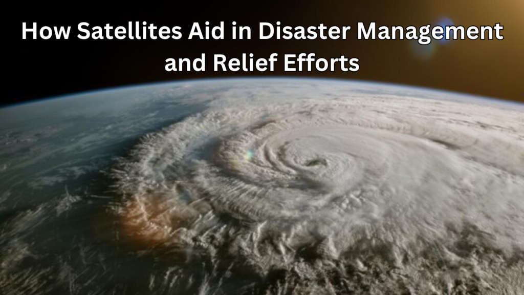
Satellites play a crucial role in monitoring weather patterns and predicting natural disasters, providing a comprehensive view of the Earth’s atmosphere and surface. By continuously capturing data on temperature, humidity, wind speeds, and cloud cover, satellites enable meteorologists to track the development of severe weather events such as hurricanes, typhoons, and thunderstorms. This data is essential for creating accurate weather models and forecasts, allowing authorities to issue timely warnings and prepare for potential disasters. Additionally, satellites monitor long-term climatic trends, such as the El Niño and La Niña phenomena, which can influence global weather patterns and increase the likelihood of extreme weather events.
Satellite-Based Tsunami Warning Systems
Satellite-based tsunami warning systems are vital for early detection and mitigation of the devastating impacts of tsunamis. These systems rely on a combination of satellite altimetry, which measures sea surface height, and ground-based sensors, such as seismometers and tide gauges. When an undersea earthquake or volcanic eruption occurs, satellites detect the resulting changes in sea level and transmit this data to tsunami warning centers. This information is used to model the potential path and impact of the tsunami, allowing authorities to issue warnings and evacuate vulnerable coastal areas. Satellite-based systems are particularly valuable in remote regions where ground-based infrastructure may be limited, ensuring that warnings are disseminated quickly and effectively to at-risk populations.
Role of Satellites in Earthquake Detection and Prediction
While predicting the exact timing of earthquakes remains a challenge, satellites contribute significantly to the detection and analysis of seismic activity. Satellites equipped with synthetic aperture radar (SAR) and global positioning system (GPS) technology monitor the Earth’s crust for signs of stress and deformation, which can indicate the potential for an earthquake. By analyzing this data, scientists can identify fault lines and areas of increased seismic risk. In the aftermath of an earthquake, satellites provide rapid damage assessment by capturing high-resolution images of affected areas, helping to prioritize rescue and recovery efforts. Although satellite technology cannot yet predict earthquakes with precision, ongoing research and advancements in satellite-based monitoring hold promise for improving early warning capabilities.
Satellites in Volcanic Eruption Forecasting
Satellites are invaluable tools for forecasting volcanic eruptions, providing real-time data on volcanic activity that is critical for early warning and disaster preparedness. Satellites equipped with thermal sensors detect heat anomalies on the Earth’s surface, which can indicate magma movement beneath a volcano. Additionally, satellites monitor gas emissions, such as sulfur dioxide, which often increase prior to an eruption. By tracking these indicators, scientists can assess the likelihood of an eruption and issue warnings to nearby communities. In the event of an eruption, satellites also monitor the spread of ash clouds, which can disrupt air travel and pose health risks. The ability of satellites to continuously monitor remote and inaccessible volcanoes makes them essential for global volcanic hazard assessment and risk management.
Real-Time Disaster Monitoring
The Importance of Real-Time Satellite Data During Disasters
Real-time satellite data is crucial during disasters, providing immediate insights that are essential for effective response and decision-making. When disasters strike, every second counts, and the ability to access up-to-date information can make a significant difference in saving lives and minimizing damage. Satellites provide continuous monitoring of affected areas, capturing critical data on weather conditions, environmental changes, and the extent of damage. This information is transmitted to disaster management teams, enabling them to assess the situation accurately, allocate resources efficiently, and coordinate relief efforts. Real-time satellite data also supports communication networks, ensuring that responders remain connected, even when terrestrial infrastructure is compromised. Overall, the timely availability of satellite data enhances the speed, accuracy, and effectiveness of disaster response operations.
Satellite Imaging for Flood and Storm Tracking
Satellite imaging plays a vital role in tracking floods and storms, providing detailed and wide-area coverage that is essential for monitoring these dynamic and destructive events. During floods, satellites equipped with synthetic aperture radar (SAR) can penetrate cloud cover and darkness, capturing high-resolution images of inundated areas. These images allow authorities to map flood extents, assess damage, and prioritize evacuation and rescue efforts. In the case of storms, satellites monitor the development and movement of weather systems, tracking parameters such as cloud formations, wind speeds, and precipitation. This data is used to predict the path and intensity of storms, enabling early warnings and the implementation of protective measures. Satellite imaging is particularly valuable in regions where ground-based observations are limited, providing a comprehensive view that enhances situational awareness and disaster preparedness.
Using Satellites to Monitor Wildfires
Satellites are indispensable in monitoring wildfires, offering real-time data that is critical for detecting, tracking, and managing these rapidly spreading hazards. Equipped with thermal sensors, satellites can detect the heat signatures of fires, even in remote and inaccessible areas. This capability allows for the early detection of wildfires, enabling quick response efforts to contain them before they escalate. Once a wildfire is detected, satellites provide continuous monitoring of its progression, capturing data on fire intensity, direction, and spread. This information is crucial for coordinating firefighting efforts, deploying resources, and protecting communities at risk. Additionally, satellites track the environmental impact of wildfires, such as smoke plumes and air quality, which can have far-reaching health and ecological consequences. The ability of satellites to provide near-real-time updates makes them an essential tool in wildfire management and mitigation.
The Role of Satellites in Monitoring Landslides and Avalanches
Satellites play a key role in monitoring landslides and avalanches, providing data that is essential for assessing risks and issuing timely warnings. Landslides and avalanches are often triggered by factors such as heavy rainfall, snowmelt, or seismic activity, all of which can be monitored from space. Satellites equipped with optical and radar sensors detect changes in land surface conditions, such as soil movement, ground deformation, and snow accumulation, which may indicate an impending landslide or avalanche. By analyzing these indicators, scientists can assess the stability of slopes and identify areas at risk. In the event of a landslide or avalanche, satellites provide rapid damage assessment by capturing high-resolution images of the affected areas, aiding in search and rescue operations. The ability of satellites to monitor vast and remote regions makes them an invaluable tool in mitigating the risks associated with landslides and avalanches.
Damage Assessment and Relief Coordination
Post-Disaster Damage Assessment Using Satellite Imagery
Satellite imagery is a powerful tool for post-disaster damage assessment, providing a rapid and comprehensive overview of the affected areas. In the immediate aftermath of a disaster, ground-based assessments can be challenging due to accessibility issues and the scale of destruction. Satellites overcome these limitations by capturing high-resolution images from space technology, which are used to identify and quantify damage to infrastructure, homes, and natural environments. This imagery allows disaster response teams to assess the extent of the impact, prioritize areas in need of urgent assistance, and allocate resources effectively. Moreover, satellite imagery can be compared with pre-disaster data to determine the magnitude of the damage, facilitating accurate reporting and decision-making during critical response phases.
Coordinating Relief Efforts with Satellite Communication
Satellite communication is essential for coordinating relief efforts during disasters, especially when terrestrial communication networks are compromised. In disaster-stricken areas, traditional communication infrastructure, such as cell towers and internet services, may be damaged or overwhelmed, hindering the ability of response teams to coordinate effectively. Satellites provide a reliable and resilient alternative, ensuring continuous communication between emergency responders, government agencies, and humanitarian organizations. Through satellite phones, data links, and satellite internet, responders can share critical information, request resources, and synchronize their efforts in real time. This capability is particularly crucial in remote or isolated regions where other forms of communication are unavailable. By enabling seamless communication, satellites play a vital role in enhancing the efficiency and effectiveness of disaster relief operations.
Satellites in Mapping Affected Areas for Rescue Operations
Mapping affected areas is a critical aspect of disaster response, and satellites provide the detailed, up-to-date maps needed for effective rescue operations. When disasters occur, the landscape can change rapidly, with roads becoming impassable, buildings collapsing, and natural barriers forming. Satellite imagery offers an accurate and current view of these changes, helping rescue teams navigate the terrain and reach those in need. High-resolution maps generated from satellite data highlight key areas, such as the location of survivors, safe zones, and potential hazards, guiding rescue operations and ensuring that efforts are focused where they are most needed. Additionally, satellites can monitor the progress of rescue missions, providing continuous updates that allow teams to adjust their strategies as conditions evolve. The ability to map affected areas quickly and accurately makes satellites an indispensable tool in disaster response.
Utilizing Satellite Data for Infrastructure Recovery Planning
Infrastructure recovery is a complex and long-term process, and satellite data plays a crucial role in planning and managing these efforts. After a disaster, it is essential to assess the condition of infrastructure such as roads, bridges, utilities, and public buildings to determine what repairs or reconstructions are needed. Satellite imagery provides a comprehensive overview of the affected infrastructure, highlighting areas of severe damage and those that require immediate attention. Additionally, satellites can monitor ongoing recovery efforts, tracking the progress of construction and the restoration of services over time. This data is invaluable for planners and engineers, enabling them to prioritize projects, allocate resources efficiently, and ensure that recovery efforts are aligned with broader community needs and resilience goals. By providing accurate, up-to-date information, satellites support the rebuilding of infrastructure that is safer, more resilient, and better suited to withstand future disasters.
Communication and Connectivity
Ensuring Communication Resilience Through Satellite Networks
In the face of disasters, maintaining communication is essential for coordinating relief efforts and ensuring public safety. Satellite networks provide a resilient and reliable communication infrastructure that remains operational even when terrestrial systems fail. Traditional communication networks, such as cellular towers and landlines, are often vulnerable to damage during natural disasters, leading to widespread outages. Satellites, however, operate independently of ground-based infrastructure, offering uninterrupted service regardless of local conditions. By providing a backbone for emergency communications, satellite networks ensure that disaster response teams can maintain contact with each other, share vital information, and coordinate their actions effectively. This resilience is crucial for enabling a swift and organized response, particularly in the chaotic aftermath of a disaster.
How Satellites Provide Connectivity in Remote and Affected Areas
In remote and disaster-affected areas, where traditional communication infrastructure may be sparse or non-existent, satellites offer a critical lifeline by providing connectivity. These areas often lack the necessary infrastructure for reliable internet or phone services, which can significantly hinder disaster response and recovery efforts. Satellites bridge this gap by delivering high-speed internet, voice communication, and data services directly to these hard-to-reach locations. Satellite-based communication systems can be rapidly deployed, ensuring that responders, government agencies, and humanitarian organizations have the connectivity they need to coordinate relief efforts. Additionally, satellites enable affected communities to communicate with the outside world, access vital information, and request assistance, which is crucial for survival and recovery.
The Role of Satellite Phones in Disaster Relief Efforts
Satellite phones play a pivotal role in disaster relief efforts, providing reliable communication in situations where conventional networks are down or unavailable. Unlike mobile phones, which rely on local cell towers, satellite phones connect directly to orbiting satellites, ensuring that they can operate in any location, regardless of the state of the ground infrastructure. This makes satellite phones an invaluable tool for emergency responders, allowing them to stay in touch with command centers, coordinate field operations, and communicate with other teams, even in the most remote or devastated areas. Additionally, satellite phones are often used to establish emergency communication links for affected populations, enabling them to reach out for help, receive updates, and stay connected with loved ones. Their portability, reliability, and global coverage make satellite phones a cornerstone of effective disaster communication and coordination.
Environmental Impact and Recovery
Assessing Environmental Damage with Satellite Technology
Satellite technology is crucial for assessing environmental damage following natural disasters, providing detailed and wide-ranging data that ground-based assessments alone may not capture. Satellites equipped with optical and radar sensors can quickly and accurately map the extent of environmental damage, such as deforestation, soil erosion, and water contamination. By capturing high-resolution imagery before and after a disaster, satellites enable scientists and environmentalists to evaluate the impact on ecosystems, track changes in land use, and identify areas of severe degradation. This information is essential for understanding the full scope of the disaster’s effects, guiding immediate response efforts, and developing strategies for environmental protection and restoration.
Supporting Long-Term Environmental Recovery with Satellite Data
Long-term environmental recovery efforts benefit significantly from satellite data, which provides ongoing monitoring and evaluation of recovery progress. After a disaster, restoring affected environments and ecosystems can be a complex and prolonged process. Satellites offer continuous, high-resolution observations that track changes over time, allowing for the assessment of recovery efforts, such as reforestation and wetland restoration. By analyzing satellite data, environmental agencies can monitor vegetation regrowth, soil health, and water quality, ensuring that recovery initiatives are effective and adjusting strategies as needed. This long-term monitoring capability helps to ensure that ecosystems are restored to their natural state and that any emerging issues are addressed promptly.
Monitoring Reforestation and Habitat Restoration Post-Disaster
Monitoring reforestation and habitat restoration efforts post-disaster is essential for ensuring that ecosystems recover effectively and sustainably. Satellites provide valuable tools for tracking the progress of these initiatives, offering detailed observations of changes in vegetation cover, forest density, and habitat conditions. By analyzing satellite imagery, environmental organizations can assess the success of reforestation projects, identify areas where additional planting may be needed, and evaluate the impact of restoration efforts on local wildlife habitats. This capability is particularly important in regions that are difficult to access on the ground, where satellite data can offer a comprehensive view of recovery activities. Continuous satellite monitoring supports adaptive management practices, ensuring that restoration efforts contribute to long-term ecological stability and resilience.
Technological Advancements and Future Trends
Advances in Satellite Technology for Improved Disaster Response
Advances in satellite technology have significantly enhanced disaster response capabilities, providing more accurate, timely, and comprehensive data. Modern satellites are equipped with advanced sensors, such as high-resolution optical cameras, synthetic aperture radar (SAR), and thermal imaging, which enable detailed monitoring of disaster events. Innovations in satellite technology include increased data transmission speeds, improved imaging resolutions, and enhanced onboard processing capabilities, allowing for faster and more precise data collection and analysis. Additionally, advancements in satellite constellations, which involve deploying multiple satellites in coordinated orbits, provide continuous and real-time coverage of disaster areas. These technological improvements facilitate more effective early warning systems, better damage assessment, and more efficient coordination of relief efforts, ultimately leading to quicker and more informed responses to disasters.
The Future of AI-Driven Satellite Data in Disaster Management
The integration of artificial intelligence (AI) with satellite data is poised to transform disaster management, offering unprecedented levels of analysis and prediction capabilities. AI algorithms can process vast amounts of satellite data to identify patterns, detect anomalies, and predict the progression of disasters with greater accuracy. For instance, machine learning models can analyze historical and real-time data to forecast weather events, assess damage, and optimize resource allocation. AI-driven satellite data also supports automated image analysis, enabling rapid detection of affected areas and prioritization of response efforts. Looking ahead, advancements in AI technology are expected to enhance the precision of disaster predictions, improve the efficiency of response operations, and provide actionable insights for mitigating the impacts of future disasters.
Emerging Trends: Small Satellites and Their Role in Disaster Relief
Small satellites, or CubeSats, are emerging as a significant trend in disaster relief due to their cost-effectiveness, flexibility, and rapid deployment capabilities. These compact satellites can be launched in large numbers, creating constellations that provide detailed, high-frequency observations of disaster-affected areas. Small satellites are particularly valuable for monitoring dynamic disaster events, such as wildfires or floods, as they offer frequent updates and can be rapidly repositioned to focus on areas of interest. Additionally, their lower cost allows for more widespread use, enabling comprehensive coverage and improved data accessibility. The proliferation of small satellites enhances disaster response by providing more granular data, supporting early warning systems, and facilitating real-time communication with ground-based teams. As technology advances, small satellites are expected to play an increasingly prominent role in disaster management and relief efforts.
Summary
Satellites Aid in Disaster Management, offering vital support across all phases of disaster response and recovery. From monitoring weather patterns and predicting natural disasters to assessing damage and coordinating relief efforts, satellite technology provides a comprehensive and real-time perspective that enhances the effectiveness and efficiency of disaster management strategies. The ability of satellites to deliver high-resolution imagery, maintain communication resilience, and offer continuous monitoring capabilities has revolutionized how we prepare for, respond to, and recover from disasters. Their role in mapping affected areas, supporting long-term environmental recovery, and facilitating global connectivity underscores their critical importance in mitigating the impacts of natural disasters.
Recap of the Critical Role Satellites Play in Disaster Management
Satellites play a crucial role in disaster management by providing essential data and communication capabilities that are critical for effective response and recovery. They offer real-time monitoring of weather patterns, track the progression of storms and floods, and enable early detection of wildfires and other hazards. During disasters, satellites ensure communication resilience, facilitating coordination among responders and affected communities. They also assist in post-disaster damage assessment, support environmental recovery efforts, and monitor infrastructure restoration. The ability of satellites to provide comprehensive and timely information enhances decision-making, improves resource allocation, and ultimately helps to save lives and reduce the impact of disasters.
The Future Outlook of Satellites in Enhancing Global Disaster Response
The future of satellites in disaster management holds promising advancements that will further enhance global disaster response capabilities. Innovations in satellite technology, such as AI integration, increased satellite constellations, and the development of small satellites, are expected to improve the accuracy and timeliness of disaster predictions and assessments. AI-driven analysis will provide deeper insights into disaster patterns and impacts, while small satellites will offer more frequent and detailed observations. As satellite technology continues to evolve, it will increasingly support global disaster response efforts by providing even more precise data, facilitating better coordination, and enhancing preparedness for future events. The ongoing advancements in satellite capabilities will play a pivotal role in building more resilient communities and improving our ability to manage and respond to disasters on a global scale.
FAQs
What Are the Key Advantages of Using Satellites in Disaster Management?
Satellites offer several key advantages in disaster management, including comprehensive coverage and real-time data. They provide a global perspective, allowing for the monitoring of large areas and the detection of disasters as they unfold. Their ability to operate independently of ground-based infrastructure ensures reliable communication and data collection even when traditional systems fail. Satellites also offer high-resolution imagery for accurate damage assessment, support early warning systems, and facilitate effective coordination of relief efforts. Additionally, their continuous monitoring capabilities help in tracking the progress of recovery and environmental restoration.
How Do Satellites Differ from Traditional Disaster Management Tools?
Satellites differ from traditional disaster management tools in several ways. Unlike ground-based tools, which are often limited by local infrastructure and access, satellites provide a broad, global perspective and operate regardless of terrestrial conditions. They can capture real-time data from remote and inaccessible areas, offering detailed imagery and information that ground-based tools may not provide. While traditional tools rely on localized observations and manual data collection, satellites offer automated, high-frequency monitoring and analysis. This capability enhances early detection, damage assessment, and coordination during disasters.
What Challenges Do Satellites Face in Disaster Monitoring?
Despite their advantages, satellites face several challenges in disaster monitoring. One major challenge is the resolution and quality of data, which can be affected by atmospheric conditions such as cloud cover or smoke. The high cost of satellite launches and maintenance can also limit the number of satellites available for disaster monitoring. Additionally, the vast amount of data generated can be overwhelming, requiring sophisticated processing and analysis tools to extract actionable insights. There can also be limitations in the timeliness of data delivery, depending on satellite revisit times and communication latency.
Can Satellite Data Be Used by Local Authorities and NGOs?
Yes, satellite data can be used by local authorities and non-governmental organizations (NGOs). Many satellite data providers offer access to imagery and information through online platforms and data-sharing agreements. This accessibility enables local authorities and NGOs to incorporate satellite data into their disaster management efforts, such as assessing damage, planning response strategies, and coordinating relief activities. By leveraging satellite data, these organizations can enhance their situational awareness, make more informed decisions, and improve the effectiveness of their response and recovery efforts.
What Are the Costs Associated with Satellite Aid in Disaster Management?
The costs associated with satellite-based disaster management include several components. These can include the expenses of satellite launches, maintenance, and operations, which are typically high. Additionally, there are costs related to data acquisition, processing, and analysis, as well as the infrastructure needed to support satellite communications and data dissemination. While these costs can be significant, the benefits provided by satellite technology—such as improved accuracy, efficiency, and timeliness—often outweigh the financial investment. Increasing advancements and the proliferation of small satellites are expected to reduce costs over time and make satellite-based disaster management more accessible.