Table of Contents
Introduction
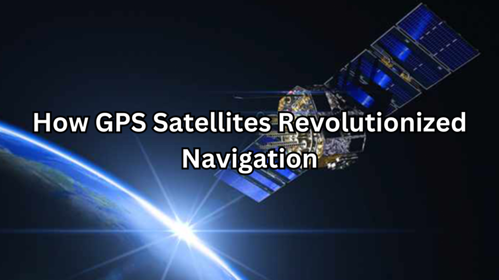
GPS Satellites, Navigating the world has been a fundamental human need for centuries, evolving from primitive methods to highly sophisticated technologies. This article explores how Global Positioning System (GPS) satellites have transformed navigation, making it more accurate, accessible, and integral to modern life. We will delve into the historical context of navigation, the development of GPS technology, and its profound impact on various aspects of society today.
Brief Overview of GPS Satellites
Ancient Navigation Techniques
Human navigation began with observing natural landmarks and celestial bodies. Early sailors used the stars to guide their journeys, while land navigators relied on landmarks and rudimentary maps. Ancient cultures, such as the Polynesians, excelled in oceanic navigation using sophisticated techniques like star charts and wave patterns.
The Age of Exploration
The Age of Exploration marked a significant leap in navigation with the development of tools such as the compass and sextant. These innovations enabled explorers like Columbus and Magellan to traverse vast oceans with greater accuracy. The creation of more detailed maps further improved navigation, laying the groundwork for modern cartography.
The Rise of Electronic Navigation
The 20th century saw the advent of electronic navigation systems, including radar and early satellite systems. These technologies allowed for real-time tracking and more precise positioning, revolutionizing how we navigate land, sea, and air.
The Advent of GPS Technology
Development and Launch
The concept of GPS emerged from the need for a reliable and accurate global navigation system. The U.S. Department of Defense initiated the development of GPS in the 1970s to enhance military operations. The first GPS satellite was launched in 1978, marking the beginning of a new era in navigation technology.
How GPS Works
Space technology operates through a constellation of satellites that orbit the Earth. These satellites transmit signals to GPS receivers on the ground. By calculating the time it takes for these signals to travel from multiple satellites, the receiver can determine its precise location. This system relies on the principles of triangulation, where the position is pinpointed by measuring distances from several satellite sources.
Evolution and Improvements
Since its inception, GPS technology has undergone numerous upgrades. Initially restricted for military use, GPS became available for civilian applications in the 1980s. Advances in satellite technology, signal processing, and integration with other navigation systems have continually enhanced GPS’s accuracy and functionality.
Importance of GPS in Modern Society
Everyday Convenience
GPS technology has become an integral part of daily life, from personal navigation in cars and smartphones to location-based services. It simplifies travel planning, enables real-time traffic updates, and helps users find nearby services and attractions.
Economic Impact
GPS plays a crucial role in various industries, including transportation, logistics, and agriculture. It enables efficient fleet management, enhances supply chain operations, and supports precision farming techniques. This technological advancement has driven economic growth and increased productivity across multiple sectors.
Safety and Security
In emergency situations, GPS is invaluable for locating and responding to incidents quickly. It aids in search and rescue operations, disaster response, and public safety measures. The ability to accurately pinpoint locations enhances overall safety and helps coordinate effective responses to crises.
Scientific and Environmental Monitoring
GPS technology supports scientific research and environmental monitoring by providing precise data on Earth’s movements, climate change, and natural disasters. It is used in geodesy to study tectonic shifts and in climate science to track changes in sea levels and other environmental parameters.
The Origins of GPS
Early Navigation Systems
Navigation has been a crucial aspect of human civilization, evolving from simple methods of observing natural landmarks and celestial bodies to more complex systems. Early navigators used the sun, moon, and stars to guide their journeys, with tools like the astrolabe and sextant helping to measure angles and determine positions. These early systems laid the groundwork for more advanced navigation technologies.
Development of Satellite-Based Navigation
The idea of satellite-based navigation emerged as technology advanced, driven by the need for more accurate and reliable global positioning systems. In the 1960s, the concept of using satellites for navigation was developed, leading to various experimental systems. The U.S. Department of Defense played a key role in this development, recognizing the potential of satellites to provide precise and continuous location data worldwide.
The Launch of the First GPS Satellite
The first practical implementation of GPS began with the launch of the initial GPS satellites. In 1978, the United States launched the first experimental GPS satellite, which was part of the Navstar system. This marked the beginning of a new era in navigation, as the satellite began transmitting signals that would eventually form the basis of the Global Positioning System.
How GPS Works
Basic Principles of GPS Technology
GPS technology relies on a network of satellites that orbit the Earth and transmit signals to receivers on the ground. These signals include information about the satellite’s position and the time the signal was sent. By receiving signals from multiple satellites, a GPS receiver can calculate its precise location based on the time it took for the signals to reach it. This process utilizes the principles of triangulation to determine position accurately.
The Role of Satellites in GPS
GPS operates through a constellation of satellites, each equipped with atomic clocks that provide highly accurate time measurements. These satellites orbit the Earth in precise paths, ensuring global coverage. Each satellite continuously broadcasts signals containing its position and the current time, which are essential for the GPS receiver to determine the user’s location.
Signal Transmission and Reception
GPS signals are transmitted from satellites to receivers using radio waves. These signals travel at the speed of light and are affected by various factors such as atmospheric conditions. GPS receivers capture these signals from multiple satellites, measure the time it took for each signal to arrive, and use this information to calculate the distance from each satellite. This distance data is then used to determine the receiver’s precise location.
Triangulation and Position Calculation
Triangulation is a fundamental technique used in GPS technology to calculate precise locations. By measuring the distance from at least three satellites, a GPS receiver can determine its position through intersecting spheres created by the distance measurements. The point where these spheres intersect indicates the receiver’s location. This process is refined by additional satellites to improve accuracy and reliability, providing users with precise positional data.
Components of the GPS System
Space Segment: GPS Satellites
The space segment of the GPS system consists of a constellation of satellites that orbit the Earth. These satellites are equipped with highly accurate atomic clocks and broadcast signals that provide essential data for location determination. The GPS constellation is designed to ensure continuous and reliable coverage of the entire globe, with each satellite transmitting information about its position and the time the signal was sent.
Control Segment: Ground Stations
The control segment of the GPS system is responsible for managing and monitoring the satellites. This segment includes a network of ground stations that track the satellites’ positions, monitor their health, and adjust their orbits as needed. The control segment ensures that the satellites remain in their designated orbits and that the system operates with high accuracy and reliability.
User Segment: GPS Receivers
The user segment of the GPS system consists of GPS receivers used by individuals and organizations to obtain location information. These receivers capture signals from multiple satellites, process the data, and calculate precise positioning information. GPS receivers are found in various applications, including smartphones, vehicles, and specialized navigation equipment.
GPS Satellite Constellation
Number and Types of Satellites
The GPS satellite constellation typically consists of at least 24 satellites, distributed across six orbital planes to provide global coverage. These satellites are divided into different types based on their functionality, including standard GPS satellites and specialized satellites for augmentations and enhancements. The constellation ensures that multiple satellites are always visible from any point on the Earth’s surface.
Orbital Mechanics and Satellite Coverage
The satellites in the GPS constellation orbit the Earth in Medium Earth Orbit (MEO) at an altitude of approximately 20,200 kilometers (12,550 miles). Their orbits are carefully calculated to ensure that they provide continuous and overlapping coverage of the Earth’s surface. The precise arrangement of the satellites allows for accurate positioning and navigation, regardless of the user’s location.
Ensuring Global Coverage
To ensure global coverage, the GPS constellation is designed with a specific number of satellites and orbital configurations. The satellites are positioned to maintain line-of-sight visibility from any location on Earth, allowing GPS receivers to access signals from multiple satellites simultaneously. This design ensures that users can obtain accurate and reliable location information anywhere on the globe, even in remote or challenging environments.
Technological Innovations in GPS
Advances in Satellite Technology
Recent advancements in satellite technology have significantly improved the performance of the GPS system. Modern GPS satellites are equipped with more sophisticated atomic clocks, enhanced signal processing capabilities, and advanced communication technologies. These innovations have led to improvements in the accuracy and reliability of GPS signals, enabling more precise location determination and better performance in various conditions.
Enhanced Signal Accuracy and Reliability
Technological advancements have also enhanced the accuracy and reliability of GPS signals. Improvements in signal processing algorithms, error correction techniques, and increased signal power have reduced errors and increased the precision of GPS positioning. These enhancements have made GPS more reliable, even in challenging environments such as urban canyons or dense foliage.
Integration with Other Navigation Systems
GPS technology has been integrated with other navigation systems to provide more comprehensive and accurate positioning information. This integration includes combining GPS with Global Navigation Satellite Systems (GNSS) such as GLONASS (Russia), Galileo (EU), and BeiDou (China). By utilizing multiple satellite systems, users benefit from enhanced accuracy, improved coverage, and greater reliability.
Applications of GPS
Navigation for Personal Use
GPS technology is widely used for personal navigation, providing users with convenient and accurate directions for everyday activities. This includes automotive navigation systems that offer turn-by-turn directions, real-time traffic updates, and points of interest. GPS has become an essential tool for drivers, hikers, and travelers, simplifying route planning and navigation.
Automotive Navigation Systems
Automotive navigation systems have become a standard feature in modern vehicles. These systems use GPS technology to provide drivers with detailed maps, real-time traffic information, and route optimization. Enhanced with features such as voice guidance and live traffic updates, automotive navigation systems help drivers reach their destinations efficiently and safely.
Smartphones and Portable Devices
GPS technology is embedded in smartphones and portable devices, enabling a wide range of location-based services. Applications include navigation apps, location sharing, geotagging photos, and finding nearby businesses. The integration of GPS into smartphones has revolutionized how people interact with their surroundings, making location-based services easily accessible.
Commercial and Industrial Uses
GPS technology plays a crucial role in various commercial and industrial applications. In aviation and maritime navigation, GPS provides accurate positioning and routing information for safe and efficient travel. In fleet management and logistics, GPS enables real-time tracking of vehicles and cargo, optimizing routes and improving operational efficiency.
Aviation and Maritime Navigation
In aviation and maritime industries, GPS is essential for accurate navigation and safety. It provides pilots and ship captains with precise location data, helping them navigate complex airways and sea routes. GPS enhances situational awareness, improves flight and voyage planning, and supports safety measures in both air and sea travel.
Fleet Management and Logistics
GPS technology is widely used in fleet management and logistics to track and manage vehicles and cargo. It allows companies to monitor the location and status of their fleets in real-time, optimize routes, and improve delivery efficiency. GPS-based solutions help reduce operational costs, enhance customer service, and streamline supply chain management.
Military Applications
Strategic and Tactical Operations
In the military, GPS technology is crucial for strategic and tactical operations. It provides accurate positioning and navigation data for military units, enabling precise coordination and effective mission planning. GPS enhances situational awareness, supports battlefield navigation, and improves the overall efficiency of military operations.
Precision-Guided Munitions
GPS technology plays a vital role in precision-guided munitions, which are designed to hit specific targets with high accuracy. By integrating GPS guidance systems into munitions, military forces can achieve greater precision in targeting and reduce collateral damage. This advancement has significantly enhanced the effectiveness of military operations and precision strike capabilities.
GPS and Geolocation Services
Role in Mapping and Surveying
GPS technology has transformed mapping and surveying by providing highly accurate geospatial data. Surveyors use GPS to create precise maps and perform land surveys with unprecedented accuracy. This technology enables detailed topographic maps, cadastral surveys, and infrastructure planning, supporting urban development and environmental management.
Geocaching and Recreational Uses
Geocaching is a popular recreational activity that relies on GPS technology. Participants use GPS coordinates to find hidden caches or containers placed by other geocachers. This outdoor treasure hunt combines technology with adventure, encouraging exploration and physical activity while utilizing GPS for navigation.
Location-Based Services in Mobile Apps
Location-based services (LBS) in mobile apps leverage GPS to provide users with relevant information based on their geographic location. Apps utilize GPS to offer services such as navigation, local business searches, real-time traffic updates, and location-based promotions. This integration enhances user experience by delivering personalized and context-aware content.
Impact on Various Industries
Transportation and Logistics
GPS technology has revolutionized transportation and logistics by enabling real-time tracking and efficient route planning. Fleet management systems use GPS to monitor vehicle locations, optimize delivery routes, and manage traffic conditions. This improves operational efficiency, reduces costs, and enhances customer satisfaction by providing accurate delivery estimates.
Agriculture: Precision Farming
In agriculture, GPS technology supports precision farming by enabling accurate field mapping and automated machinery. Farmers use GPS to optimize planting patterns, monitor crop health, and apply fertilizers and pesticides with precision. This results in increased crop yields, reduced resource usage, and improved sustainability in agricultural practices.
Construction and Engineering
GPS technology plays a crucial role in construction and engineering projects by providing precise location data for site planning and execution. It assists in tasks such as site surveying, grading, and excavation. GPS also supports the alignment of construction machinery and monitoring of project progress, ensuring accuracy and efficiency in building projects.
Emergency Services and Disaster Management
In emergency services and disaster management, GPS technology enhances response capabilities by providing accurate location information for coordination and resource deployment. It helps emergency responders navigate to incidents quickly, manage evacuation plans, and coordinate relief efforts during natural disasters. GPS enables effective crisis management, improving overall safety and response times.
Enhancements and Augmentations
Differential GPS (DGPS)
Differential GPS (DGPS) enhances the accuracy of standard GPS by using a network of fixed ground-based reference stations. These stations receive GPS signals and compare them with known locations to calculate correction factors. The corrections are then transmitted to nearby GPS receivers, improving positioning accuracy to within a few meters. DGPS is widely used in applications requiring higher precision, such as maritime navigation and surveying.
Wide Area Augmentation System (WAAS)
The Wide Area Augmentation System (WAAS) is a satellite-based augmentation system that improves GPS accuracy across a large geographic area. WAAS uses a network of ground-based reference stations and geostationary satellites to provide real-time corrections to GPS signals. This system enhances the accuracy of GPS to within a few meters and is especially useful for aviation and other applications requiring high precision.
Real-Time Kinematic (RTK) Positioning
Real-Time Kinematic (RTK) positioning is a technique that provides highly accurate location information using GPS and a reference station. RTK relies on the data from a base station, which is usually located at a known position, to correct the signals received by a rover station. This method achieves centimeter-level accuracy and is commonly used in precision agriculture, construction, and surveying.
Challenges and Limitations
Signal Interference and Jamming
GPS signals are susceptible to interference and jamming, which can degrade the quality of positioning data. Interference can come from various sources, including electronic devices and environmental factors. Jamming involves deliberately disrupting GPS signals, which can affect navigation and safety. To mitigate these issues, advanced signal processing techniques and backup systems are employed to maintain reliability.
Dependency on Satellites
The accuracy and reliability of GPS depend on the proper functioning of the satellite constellation. Any malfunction or degradation of satellite performance can impact the quality of GPS services. Additionally, GPS signals can be obstructed by physical structures or atmospheric conditions, leading to reduced accuracy or loss of signal.
Privacy and Security Concerns
The widespread use of GPS technology raises privacy and security concerns. GPS data can be used to track individuals’ movements and locations, leading to potential privacy breaches. Additionally, the potential for GPS spoofing and cyberattacks poses security risks. Ensuring robust security measures and privacy protections is essential to address these concerns and safeguard users’ information.
The Future of GPS
Next-Generation GPS Satellites
The future of GPS includes the development and deployment of next-generation satellites that offer enhanced capabilities and improved performance. These new satellites will feature advanced technology, such as better atomic clocks, increased signal power, and greater resistance to interference. They will continue to provide accurate and reliable positioning services while supporting new applications and services.
Integration with New Technologies
The integration of GPS with emerging technologies is expected to drive further advancements in navigation systems. This includes combining GPS with technologies like Internet of Things (IoT), artificial intelligence (AI), and autonomous systems. Such integration will enhance the capabilities of GPS and enable new applications, such as smart cities and autonomous vehicles.
Emerging Trends in Navigation Systems
Emerging trends in navigation systems include the development of hybrid navigation solutions that combine GPS with other positioning technologies, such as inertial navigation systems (INS) and visual odometry. These hybrid systems aim to provide more accurate and reliable positioning in challenging environments. Additionally, advancements in satellite-based navigation and the proliferation of new global navigation satellite systems (GNSS) will continue to shape the future of navigation and positioning technologies.
Summary
GPS technology has fundamentally reshaped the way we navigate and interact with our environment. Originating from early navigation methods, the development of GPS began with the launch of experimental satellites in the late 1970s and has since evolved into a global system with widespread applications. The GPS system comprises three main segments: the space segment (GPS satellites), the control segment (ground stations), and the user segment (GPS receivers). Technological enhancements such as Differential GPS (DGPS), the Wide Area Augmentation System (WAAS), and Real-Time Kinematic (RTK) positioning have significantly improved the accuracy and reliability of GPS data.
Recap of Key Points
GPS technology has fundamentally transformed navigation by providing accurate, reliable, and accessible positioning data. From its origins in early navigation systems to the launch of the first GPS satellites, the development of GPS has led to significant advancements in both technology and applications. Key components of the GPS system include the space segment with GPS satellites, the control segment with ground stations, and the user segment with GPS receivers. Enhancements such as Differential GPS (DGPS), Wide Area Augmentation System (WAAS), and Real-Time Kinematic (RTK) positioning have further improved accuracy and reliability. Despite challenges like signal interference, dependency on satellites, and privacy concerns, GPS continues to play a crucial role in various industries, including transportation, agriculture, construction, and emergency services.
The Transformative Power of GPS
GPS technology has revolutionized how we navigate and manage various aspects of our lives. Its impact extends across multiple domains, from personal navigation and mobile applications to commercial uses in transportation and logistics. By providing precise location data, GPS has enhanced efficiency, safety, and convenience in everyday activities. It has also supported critical applications in emergency services, agriculture, and military operations, demonstrating its versatility and importance in modern society.
Future Prospects and Innovations
Looking ahead, the future of GPS holds exciting prospects with the development of next-generation satellites and integration with emerging technologies. Innovations such as improved satellite capabilities, hybrid navigation solutions, and advancements in global navigation satellite systems (GNSS) will continue to enhance GPS performance and expand its applications. As technology evolves, GPS will remain a key component in shaping the future of navigation and positioning, driving advancements in smart cities, autonomous systems, and beyond.
FAQs
What is GPS and how does it work?
GPS, or Global Positioning System, is a satellite-based navigation system that provides accurate location and time information anywhere on Earth. It works by using a network of satellites orbiting the Earth that transmit signals to GPS receivers. The receiver calculates its position by measuring the time it takes for signals from multiple satellites to reach it and using this information to determine the distance from each satellite. By intersecting these distances, the receiver can pinpoint its exact location.
How many GPS satellites are there?
The GPS constellation typically consists of at least 24 satellites. These satellites are distributed across six orbital planes to ensure global coverage and provide continuous and reliable positioning information. The constellation is designed to ensure that at least four satellites are visible from any point on Earth, which is essential for accurate positioning.
What are the main uses of GPS today?
GPS is used in a wide range of applications, including:
- Personal Navigation: Providing directions for driving, walking, and hiking through navigation apps and devices.
- Automotive Systems: Enhancing vehicle navigation and real-time traffic management.
- Agriculture: Supporting precision farming techniques for optimized crop management.
- Construction and Engineering: Assisting in site surveying, equipment positioning, and project planning.
- Aviation and Maritime Navigation: Ensuring safe and efficient travel in air and sea routes.
- Emergency Services: Aiding in the coordination of response efforts and location tracking during emergencies.
How accurate is GPS?
The accuracy of GPS can vary depending on the type of system and environmental conditions. Standard GPS accuracy is typically within 5 to 10 meters. However, with enhancements such as Differential GPS (DGPS) and Real-Time Kinematic (RTK) positioning, accuracy can improve to within a few centimeters. Factors such as atmospheric conditions, signal interference, and the quality of the GPS receiver can impact accuracy.
What are the potential vulnerabilities of GPS?
GPS faces several potential vulnerabilities, including:
- Signal Interference: GPS signals can be disrupted by electronic devices or environmental factors, reducing accuracy.
- Jamming: Deliberate interference can block or degrade GPS signals, affecting navigation and safety.
- Spoofing: GPS signals can be artificially generated to mislead users, posing risks for security and safety.
- Dependency on Satellites: The system relies on the functioning of satellites, and any malfunction or degradation can impact service quality.
- Privacy Concerns: The ability to track and record location data raises privacy issues, especially with widespread use in personal devices.